System and method for using time-distance characteristics in acquisition, processing, and imaging of t-CSEM data

a technology of time-distance characteristics and time-distance characteristics, applied in the field of geophysical exploration for hydrocarbons, can solve the problems of ineffectiveness, significant drawbacks, and abrupt termination of electric current, and achieve the effects of strong attenuation, high dispersion, and easy processing and imag

US20060203613A1Inactive Publication Date: 2006-09-14BP CORP NORTH AMERICA INC
8 Cites 113 Cited by

Patent Information

Authority / Receiving Office
US · United States
Current Assignee / Owner
Publication Date
2006-09-14
Estimated Expiration
Not applicable · inactive patent

Smart Images

  • Figure 1
    Figure 1
  • Figure 2
    Figure 2
  • Figure 3
    Figure 3
Patent Text Reader

Abstract

There is provided herein a system and method of acquiring, processing, and imaging transient Controlled Source ElectroMagnetic (t-CSEM) data in ways that are similar to those used for seismic data. In particular, the instant invention exploits the time-distance characteristics of t-CSEM data to permit the design and execution of t-CSEM surveys for optimal subsequent processing and imaging. The instant invention illustrates how to correct t-CSEM data traces for attenuation and dispersion, so that their characteristics are more like those of seismic data and can be processed using algorithms familiar to the seismic processor. The resulting t-CSEM images, particularly if combined with corresponding seismic images, may be used to infer the location of hydrocarbon reservoirs.
Need to check novelty before this filing date? Find Prior Art

Description

RELATED APPLICATION

[0001] This application claims the benefit of U.S. Provisional Patent Application Ser. No. 60 / 654,378 filed on Feb. 18, 2005, the disclosure of which is incorporated by reference as if fully set out at this point.TECHNICAL FIELD

[0002] This invention relates to the general subject of geophysical exploration for hydrocarbons and, in particular, to methods for collecting and analyzing time-domain controlled source electromagnetic earth survey data. BACKGROUND OF THE INVENTION Electro-Magnetic Exploration Methods

[0003] Measurements of resistivities of subsurface Earth formations have long been used, among other purposes, for differentiating rock layers that contain hydrocarbons from other, non-oil bearing rock layers. For example, records of resistivity with respect to depth in a wellbore (called “resistivity well logs”) have been routinely used for many years to identify hydrocarbon producing intervals within a well bore drilled through Earth formations. However, ...

Examples

Embodiment Construction

[0043] While this invention is susceptible of being embodied in many different forms, there is shown in the drawings, and will herein be described hereinafter in detail, some specific embodiments of the instant invention. It should be understood, however, that the present disclosure is to be considered an exemplification of the principles of the invention and is not intended to limit the invention to the specific embodiments or algorithms so described.

General Environment of the Invention

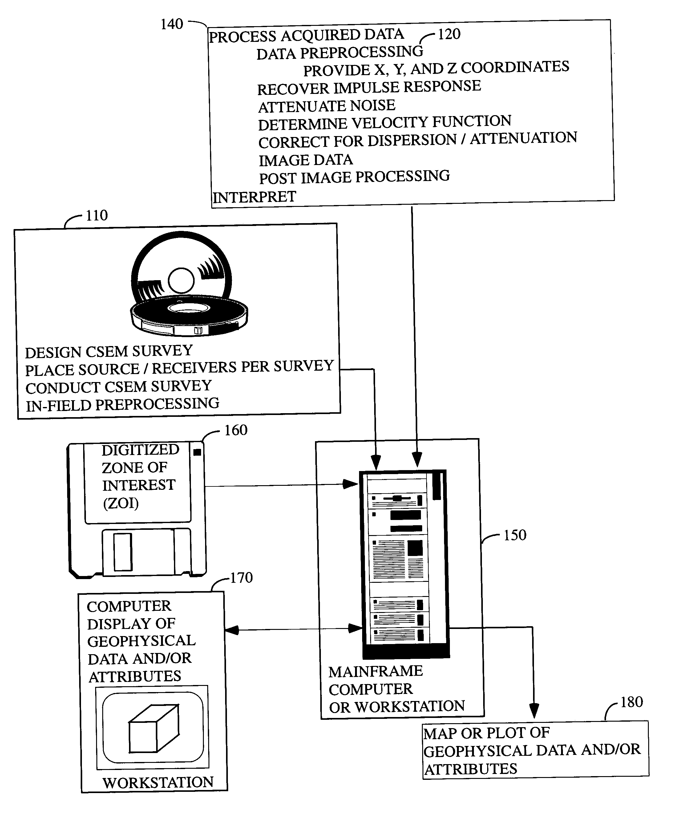
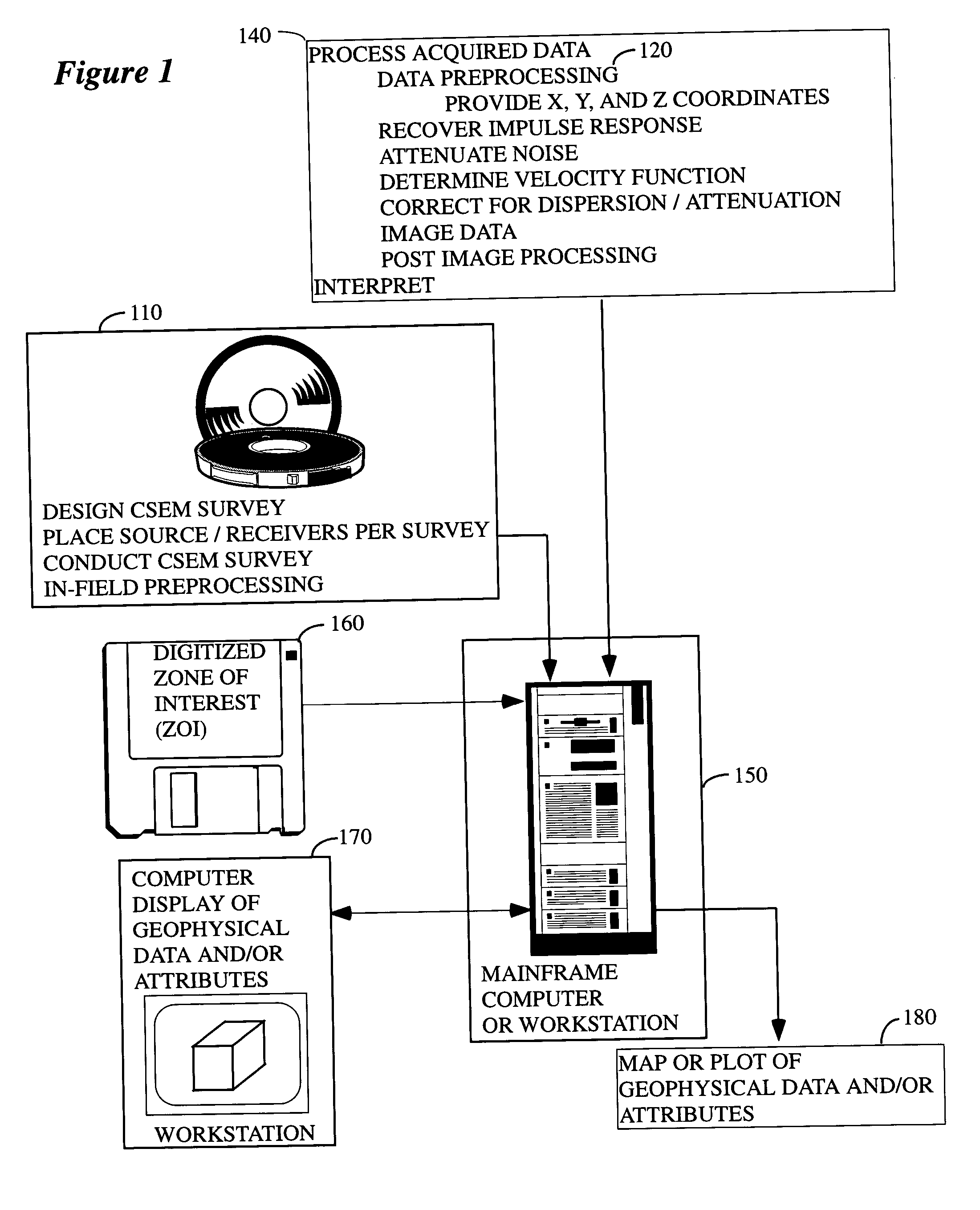
[0044]FIG. 1 illustrates a general environment in which the instant invention would typically be used. Following survey-design principles described below, t-CSEM data are collected in the field 110 (while the preferred embodiment is in the marine context, it is not restricted to such and can include land, and borehole, and combined applications) over or alongside a subsurface target of potential economic importance for the exploration and exploitation of hydrocarbon resources, and are typically sen...