Method of sedimentologic interpretation by estimation of various chronological scenarios of sedimentary layers deposition

Active Publication Date: 2006-11-02
INST FR DU PETROLE
View PDF6 Cites 16 Cited by
  • Summary
  • Abstract
  • Description
  • Claims
  • Application Information

AI Technical Summary

Benefits of technology

[0027] the chronological scenarios can be interpreted by defining zones of low and of high rate of sedimentation by means of an attribute D

Problems solved by technology

Thus, the current architecture of the layers shown by seismic imagery can reach a high degree of complexity which makes the task very delicate when trying to reconstruct the geologic history undergone thereby.
Interpretation is often very delicate and it entirely depends on the interpreter's sedimentologic expertise.
There are few tools allowing to assist in this task, which all the more complex as a seismic image often shows several hundred layers.
It can be noted that t

Method used


Image

  • Method of sedimentologic interpretation by estimation of various chronological scenarios of sedimentary layers deposition
  • Method of sedimentologic interpretation by estimation of various chronological scenarios of sedimentary layers deposition
  • Method of sedimentologic interpretation by estimation of various chronological scenarios of sedimentary layers deposition

Examples


Embodiment Construction

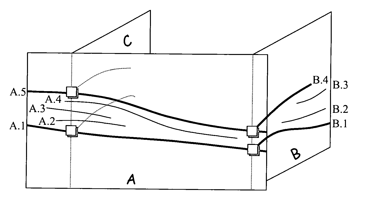
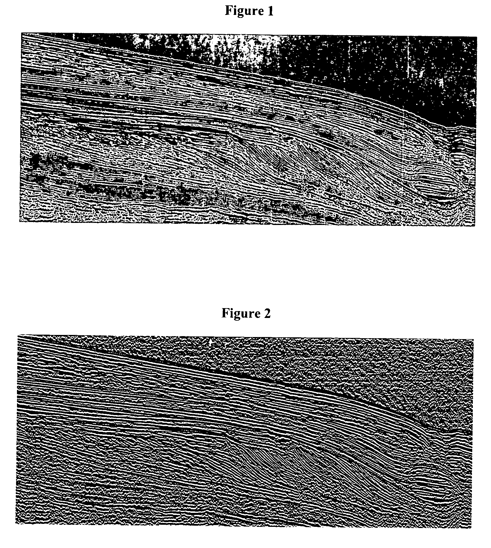
[0058] The method according to the invention applies to a seismic image. A seismic image is, horizontally, a spatial representation and, vertically, a temporal representation of the amplitudes of the acoustic signals recorded. These amplitudes generally correlate from one trace to the next, which is translated on the pixels making up the seismic image into lineations, that is sub-horizontal lines, more or less rectilinear, thick and continuous. These lineations represent the interfaces between sedimentary layers. Various color scales are conventionally used to represent these amplitude variations in an image. A two-dimensional seismic image represents a vertical seismic section of the subsoil by means of a continuous (levels of grey for example) or non-continuous color scale.

[0059] The aim of the method according to the invention is to automatically extract, by image processing, pertinent information for sedimentologic interpretation in order to reconstruct the depositional conditi...


PUM


Abstract

A method having application for the development of oil reservoirs for automatically extracting from a seismic image pertinent information for sedimentologic interpretation in order to reconstruct the depositional conditions under which sedimentary layers have formed, by means of estimations of realistic chronological scenarios of sedimentary layers deposition. The method comprises iterative estimation of a first and of a second chronological scenario of the deposition of sedimentary layers, assuming that each reflector settles at the earliest, respectively at the latest possible moment during the sedimentary depositional process. A chronological level number is assigned to a group of initial reflectors. Then a chronological level number incremented by one, respectively decremented by one, is assigned to the reflectors made up from pixels located above, respectively below the initial reflectors and above, respectively below no other reflector. An interpretation of these two chronological scenarios is eventually carried out so as to reconstruct the depositional conditions of the sedimentary layers.

Description

BACKGROUND OF THE INVENTION [0001] 1. Field of the Invention [0002] The present invention relates to a method for extracting automatically pertinent information for sedimentologic interpretation, in order to reconstruct the depositional conditions under which sedimentary layers have formed. [0003] 2. Description of the Prior Art [0004] Sedimentology reconstructs environments wherein the various rocks samples of which are studied have formed. The subsoil has of piles of sedimentary layers that have settled in sub-horizontal position. The nature of the rocks that make up these layers can vary from one layer to the next, notably depending on the water depth under which the sediment has settled. These layers have a limited lateral extension because the sedimentation process does not affect the whole of the earth's surface at a given time of the geologic history. [0005] Stratigraphy is that branch of geology that studies the order in which the rock layers that make up the earth's crust h...

Claims


Application Information

Patent Timeline
IPC IPC(8): G06F19/00
CPCG01V2210/661G01V1/282G01V1/301
Inventor CACAS, MARIE-CHRISTINE
Owner INST FR DU PETROLE
Why Eureka
Try Eureka