
Street side maps and paths

a street map and street technology, applied in the field of street side maps and paths, can solve the problems of not being able to easily convey the global relationships between various features resident in orthographic projection maps, such as the relationship between distance, direction, orientation,

Active Publication Date: 2007-04-05
MICROSOFT TECH LICENSING LLC
View PDF41 Cites 169 Cited by
  • Summary
  • Abstract
  • Description
  • Claims
  • Application Information

AI Technical Summary

Benefits of technology

[0010] The following presents a simplified summary of the claimed subject matter in order to provide a basic understanding of some aspects of the claimed subject matter. This summary is not an extensive overview of the claimed subject matter. It is intended to neither identify

Problems solved by technology

However, when the purpose of the map is to assist travel, certain other information, such as, e.g., political information may not be of much use.
Thus, incorporating this information may detract from utility of the map.
However, while street-side images are very effective at supplying local detail information such as color, shape, size, etc., they do not readily convey the global relationships between various features resident in orthographic projection maps, such as relationships between distance, direction, orientation, etc.
Accordingly, current approaches to street-side imagery / mapping have many limitations.
As such, many difficulties arise.
For example, it is often difficult to orient the displayed, local images with the global, orthographic projection map.
Often, this can lead to confusion for the user.
Similarly, as well as trouble in obtaining the global orientation, there also exists trouble obtaining the global position when browsing the local images.
For instance, a user might want take a particular path because the local images show it has, e.g. more shade, more shops or the like, but may not be able to readily identify which side of the street those images portray.
Additionally, the first-person images provide only localized information based upon a selected position, which makes searching or exploration very expensive / inefficient in terms of time and image queries.
However, if the user does not know the exact location, but rather only knows the general whereabouts of a particular feature on the global map, then searching and / or exploring for that particular feature can be a very lengthy process.
Hence, there is no convenient way to print the full information necessary for a larger area such as an a city block, a neighborhood or an entire city.

Method used


Image

  • Street side maps and paths
  • Street side maps and paths
  • Street side maps and paths

Examples


Embodiment Construction

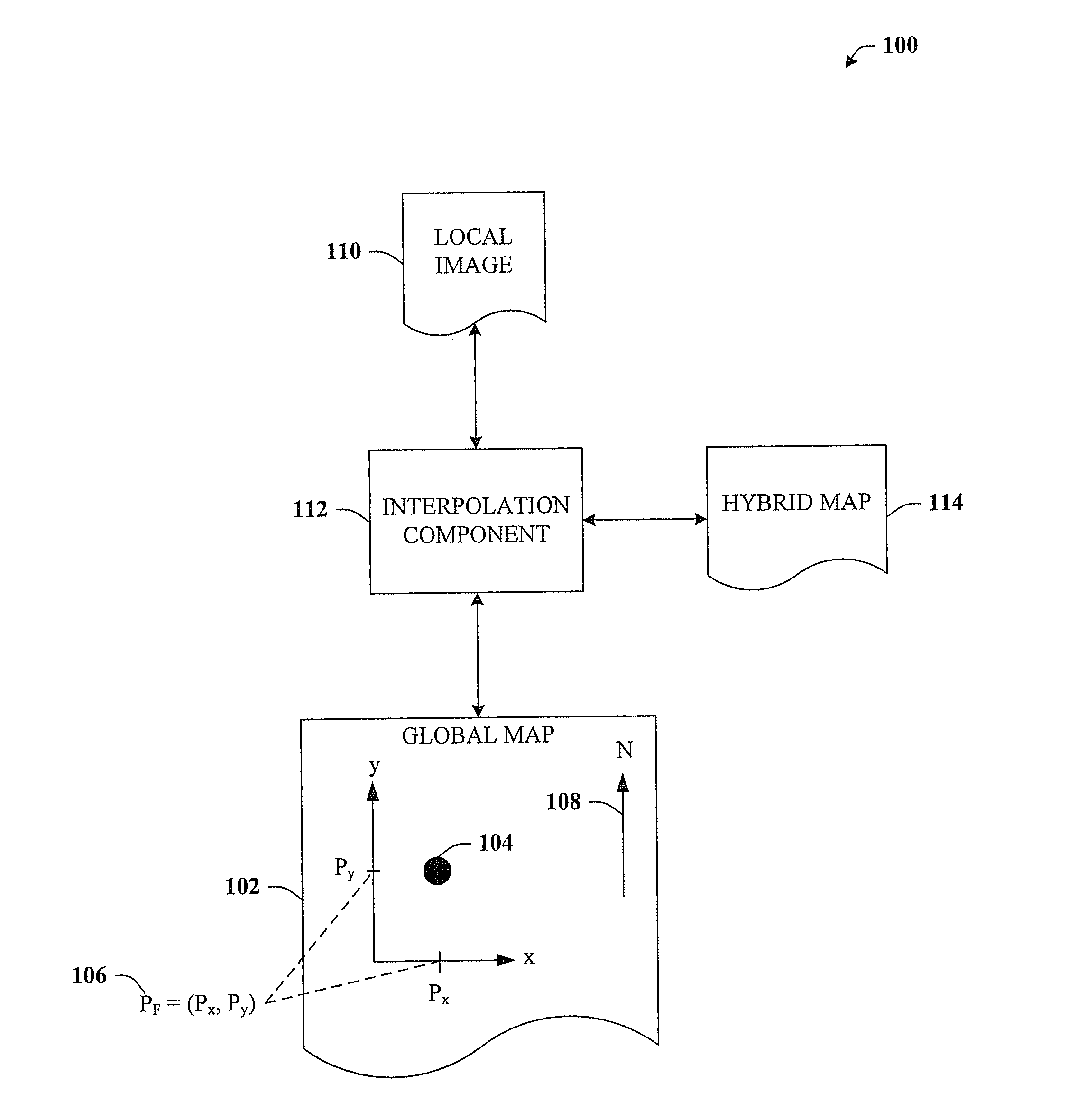
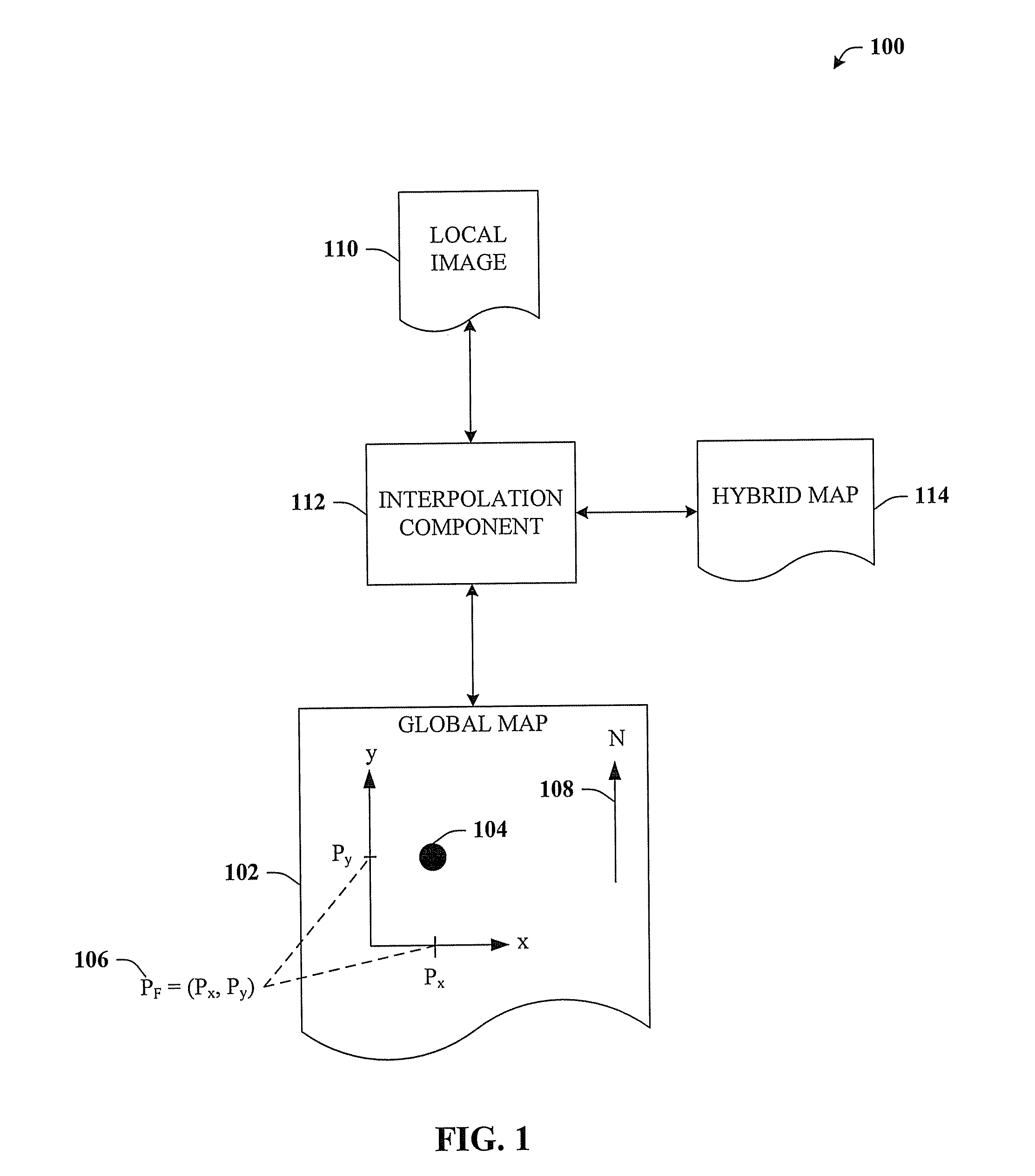
[0034] The claimed subject matter is now described with reference to the drawings, wherein like reference numerals are used to refer to like elements throughout. In the following description, for purposes of explanation, numerous specific details are set forth in order to provide a thorough understanding of the claimed subject matter. It may be evident, however, that the claimed subject matter may be practiced without these specific details. In other instances, well-known structures and devices are shown in block diagram form in order to facilitate describing the claimed subject matter.

[0035] As used in this application, the terms “component” and “system” are intended to refer to a computer-related entity, either hardware, a combination of hardware and software, software, or software in execution. For example, a component may be, but is not limited to being, a process running on a processor, a processor, an object, an executable, a thread of execution, a program, and / or a computer....


PUM


Abstract

The claimed subject matter relates to a computer-implemented architecture that can generate a map. The map can be a hybrid between an orthographic projection map and street-side images, thus including useful aspects from both types of representations. For example, an orthographic projection map is very effective at presenting global relationships among the features of the map, but not effective at presenting local detail. In contrast, street-side images show excellent detail, but do not convey the global information of an orthographic projection map. The hybrid map can thus provide a richer set of information than conventional maps, and can also display objects / features of the hybrid map in multiple perspectives simultaneously on a single representation that is printable.

Description

CROSS-REFERENCE TO RELATED APPLICATIONS [0001] This application is a continuation-in-part of co-pending U.S. patent application Ser. No. 11 / 323,241, entitled “PHOTOGRAPHING BIG THINGS” filed on Dec. 30, 2005, which claims priority to U.S. Provisional Application Ser. No. 60 / 723,576, filed Oct. 4, 2005, entitled “PHOTOGRAPHING BIG THINGS.” This application is also related to co-pending U.S. patent application Ser. No. ______ (MSFTP1451US), entitled “A USER INTERFACE FOR VIEWING STREET SIDE IMAGERY” and to co-pending U.S. patent application Ser. No. ______ (MSFTP1390US), entitled “INDEXING AND CACHING STRATEGY FOR LOCAL QUERIES”. The entireties of these applications are incorporated herein by reference.BACKGROUND OF THE INVENTION [0002] Maps have been in existence for many thousands of years and employed for a variety of purposes relating to travel, logistics, planning, etc. One type of map is a general purpose map, which typically provides an orthographic projection of a surface (e.g...

Claims


Application Information

Patent Timeline
IPC IPC(8): G06K9/00
CPCG06T3/4038
Inventor OFEK, EYAL
Owner MICROSOFT TECH LICENSING LLC
Learn More