

Methods and systems for mobile navigational applications using global navigation satellite systems
a global navigation satellite and mobile navigation technology, applied in satellite radio beaconing, measurement devices, instruments, etc., can solve problems such as safety compromise, gps alone, and without any other augmentation, and achieve the effect of improving the availability of integrity functions
- Summary
- Abstract
- Description
- Claims
- Application Information
AI Technical Summary
Benefits of technology
Problems solved by technology
Method used
Image

Examples
first embodiment
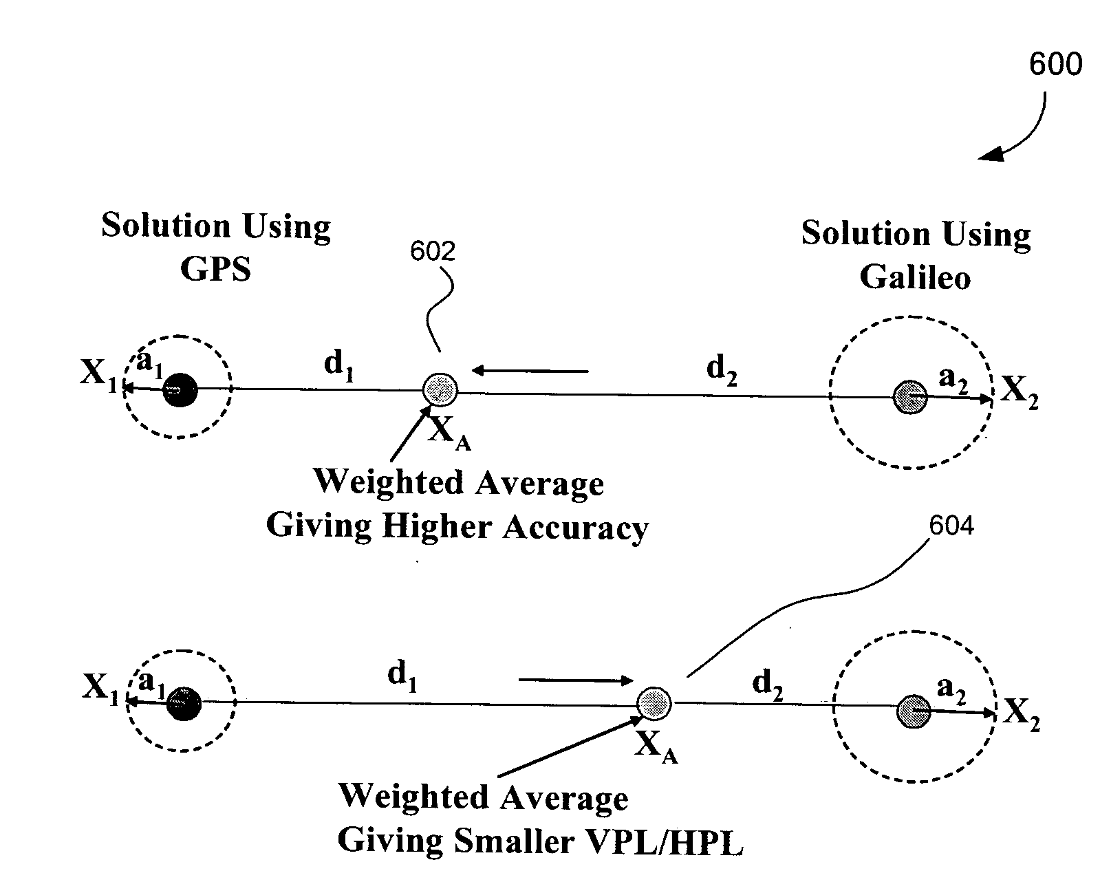
[0038]the present invention enhances the capability to use RAIM for both horizontal and vertical guidance during instrument approach, for example. For example, the OWAS-2 RAIM method of the present invention enables both GPS and Galileo to provide an extended capability to detect multiple satellite signal faults in either constellation. More specifically, the present invention brings together the best features of previous versions of RAIM methods and implements these methods in the position domain.
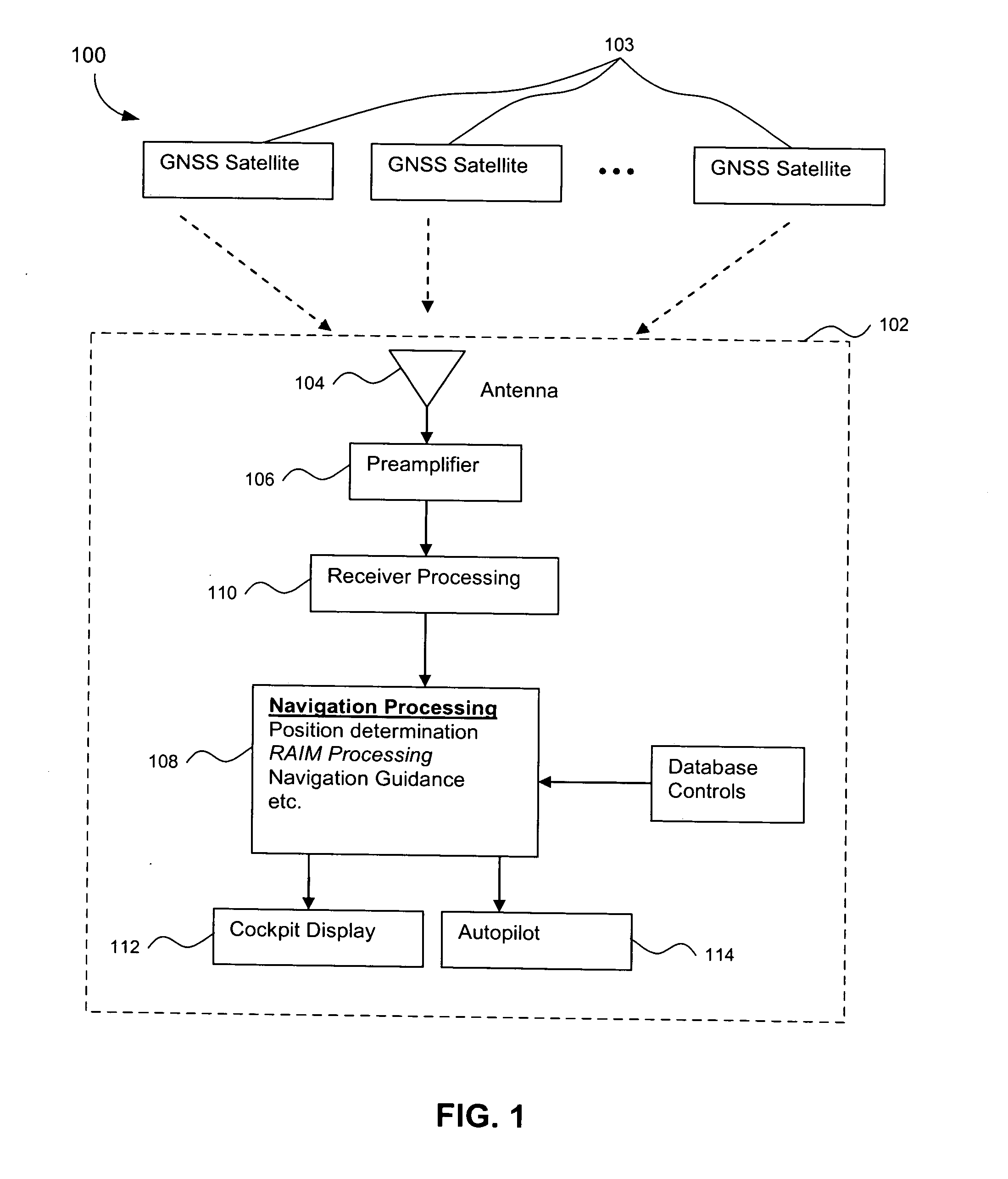
[0039]FIG. 1 is a top-level functional block diagram of a GNSS receiver wherein a RAIM system can be implemented in accordance with the present invention 100. A GNSS user receiver 102 receives ranging signals from GNSS satellites 103 in view through an antenna 104. The GNSS user receiver 102 includes traditional receiver system components such as the antenna 104 and a preamplifier 106, etc., which are all well known to those of skill in the art. The GNSS receiver 102 for aviation also incl...
second embodiment
[0045]For applications of the present invention (OWAS-1), user equipment desirably determines the same sets of parameters as with OWAS-2, but for the example of air navigation in NPA, terminal, and en route phases of flight, the parameters are determined only with respect to the horizontal position. The pilot has to take an appropriate action according to a given operational procedure where the pilot is alerted with either a “no RAIM” or a “fault detection” message. As stated earlier, for applications in which OWAS-1 is used, only up to a single satellite fault is assumed at any given time. With this assumption and with comparatively large alert limits for en route through NPA phases of flight, availability of the FDE function associated with OWAS-1 is typically high such that it would be worthwhile to execute the FDE function.
[0046]The first embodiment of the present invention can be used for the vertically guided approaches. The performance of this invention can be measured by the...
PUM
 Abstract
Description
Claims
Application Information