Distance estimation method for a moving object having a constrained vertical path profile

a technology of distance estimation and moving objects, applied in the field of navigation of moving objects, can solve the problems of not allowing the crew of an aircraft to know, and ignoring any possibility

Inactive Publication Date: 2008-06-26
THALES SA
View PDF1 Cites 30 Cited by
  • Summary
  • Abstract
  • Description
  • Claims
  • Application Information

AI Technical Summary

Benefits of technology

[0015]Advantageously, when the moving object is an aircraft having a vertical flight profile to be respected, defining the evolution in its instantaneous altitude, the predictable values of the instantaneous altitudes that the aircraft would have by reaching the target point via the listed paths while respecting the imposed vertical flight profile are assoc

Problems solved by technology

However, this map of the risks of collision with the environment, although showing the essential vertical and lateral avoidance manoeuvres to be carried out, does not allow the crew of an aircraft to know if, taking into account an avoidance manoeuvre and the flight performance of the aircraft, the next required point of passage of its flight plan or its destination terrain remains accessible to it.
However, this map of the weather risks, although showing the essential vertical and lateral avoidance manoeuvres to be carried out, also does not allow the crew of an aircraft to know if, taking into account an avoidance manoeuv

Method used


Image

  • Distance estimation method for a moving object having a constrained vertical path profile
  • Distance estimation method for a moving object having a constrained vertical path profile
  • Distance estimation method for a moving object having a constrained vertical path profile

Examples


Embodiment Construction

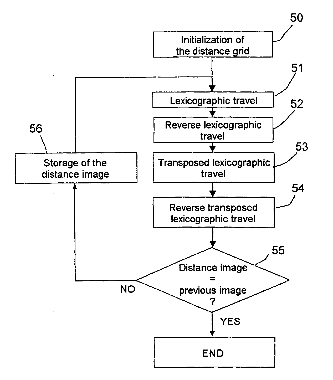
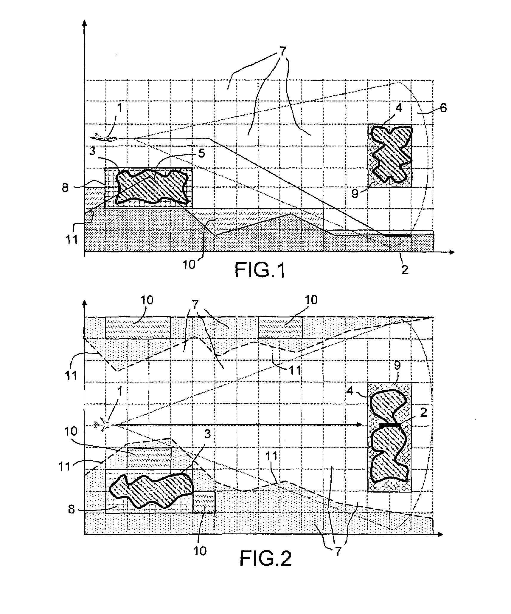
[0042]FIGS. 1 and 2 illustrate, in vertical section (FIG. 1) and in horizontal section (FIG. 2), a scenario in which an aircraft 1 is preparing to land in bad weather on a runway 2 surrounded by reliefs. The aircraft 1 is fitted with a weather radar and with a TAWS system for preventing collisions with the terrain, which displays, in the cockpit, a scrolling navigation map like the horizontal sectional view in FIG. 2, indicating, on a representation 11 of the relief taken from a terrain elevation database, the weather disturbances 3, 4 occurring in its vicinity and also the ground obstacles 5 that are dangerous for its navigation.

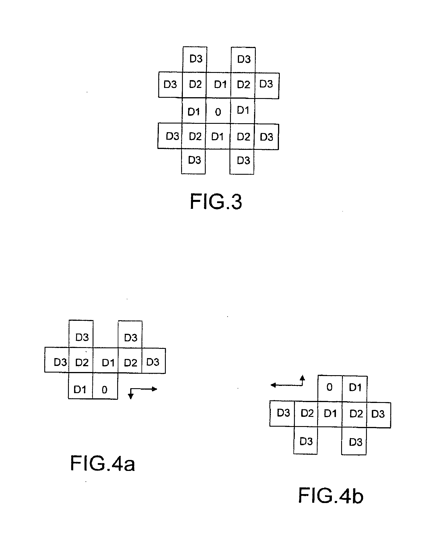
[0043]The weather radar of the aircraft takes moisture density measurements in the space 6 located in front of the aircraft, which it probes by sampling elementary volumes identified relative to the aircraft and then relative to geographical coordinates (latitude, longitude and altitude) corresponding to a mesh of elementary cubes 7 of the space through whi...


PUM


Abstract

This method makes it possible to plot, from a terrain elevation database, a map of the distances of the points accessible to a moving object subject to constraints (inaccessible reliefs, unnegotiable obstacles, weather disturbances, path with an imposed vertical profile, etc.), the distances being measured only along paths that are practical for the moving object. It employs a chamfer distance transform applied to the image consisting of the projection on the horizontal plane of a 3D representation of the flying space of the moving object, which is likened to a mesh of elementary cubes associated with specific negotiation danger levels. It lists the typical paths without exceeding an acceptable danger threshold, going from a target point, the distance of which is to be estimated, to a source point, the origin of the distance measurements, and likens the distance of the target point to the length of the shortest practicable path or paths.

Description

RELATED APPLICATIONS[0001]The present application is based on, and claims priority from, French Application Number 06 11208, filed Dec. 21, 2006, the disclosure of which is hereby incorporated by reference herein in its entirety.FIELD OF THE INVENTION[0002]The invention relates to the navigation of a moving object, the path of which is subject to vertical profile constraints, in a flying space having locally various danger levels. The moving object may be an aircraft, for example one limited in terms of rate of ascent, the limit possibly being negative, varying above reliefs and / or obstacles on the ground in a zone affected by local weather disturbances close to or above its flight altitude.BACKGROUND OF THE INVENTION[0003]Various systems have been developed for warning the crew of an aircraft of a risk of collision with the ground. Some of these, such as terrain awareness and warning systems (TAWS), make a short-term path prediction for the aircraft on the basis of flight informati...

Claims


Application Information

Patent Timeline
IPC IPC(8): G01C21/00
CPCG01C21/00G01S13/953G01S13/94G01S7/06G01S13/935Y02A90/10
Inventor BITAR, ELIASGAMET, PIERREMARTY, NICOLAS
Owner THALES SA
Why Eureka
Try Eureka