
Method and system utilizing online analytical processing (OLAP) for making predictions about business locations

Active Publication Date: 2008-08-28
SAAMA TECH
View PDF1 Cites 42 Cited by
  • Summary
  • Abstract
  • Description
  • Claims
  • Application Information

AI Technical Summary

Benefits of technology

[0013]Machine learning and human input enables the automatic generation of the composite indicators that are most useful for making predictions. These composite indicators are complex mathematical functions of the original input data and are relied upon for optimal location decision-making. Appropriate dimensionality reduction techniques are also described to reduce the time and computing resources required for analyzing large amounts of data. The composite indicators can also be pre-selected.
[0019]The system includes a processing unit with a precomputation engine to perform, in accordance with one aspect of the invention, aggregations for at least 95% of all permutations of the variables for a given snapshot of data. Using 20 variables, for example, would require a number or precomputations that could exceed 1 million, or more. These precomputation would need to be available and updated with each new snapshot of data. The precomputations could be easily parallelized on a large multiprocessor machine to reduce the number of serial computations. It can be appreciated that the precomputation scheme here, while optimal for certain data sets and computing environments, may be varied in accordance with the needs of a user. For example, precomputation schemes computing much less than 95% of all permutations can be used in accordance with the present invention.
[0023]The step of analyzing includes creating a data matrix having a dimensionality and the method further comprises the step of reducing the dimensionality of the data matrix to ease mathematical complexity. In one embodiment, the dimensionality is reduced by assigning relevancy scores to the data, selecting meaningful data based on the relevancy score and utilizing only the meaningful data.

Problems solved by technology

Choosing an optimal location may be a critical issue for numerous businesses including businesses involved in retail, manufacturing, franchising, and housing.
There are a number of drawbacks to relying on traditional methods of business location selection.
Second, even with carefully articulated methods, human bias can introduce uncertainty and problems surrounding location selection.
Third, since volumes of data is available, the process of analyzing data and choosing optimal locations based on the available data can be arduous and time consuming, which limits a decision-maker's ability to choose numerous optimal business locations within a short period.
Sometimes the conclusions resulting from human efforts to analyze heterogeneous data is presented in a format where relationships between various pieces of data can be missed, resulting in less than optimal decision making.
Although a wealth of data is presented in a user-friendly format, the data does not make any predictions.
Normally, the resolution and quality of data are issues to be addressed.
Heterogeneity of data sources may also be a problem.

Method used


Image

  • Method and system utilizing online analytical processing (OLAP) for making predictions about business locations
  • Method and system utilizing online analytical processing (OLAP) for making predictions about business locations
  • Method and system utilizing online analytical processing (OLAP) for making predictions about business locations

Examples


Embodiment Construction

[0042]On Line Analytical Processing (OLAP) is an approach for providing answers to analytical queries that are multidimensional in nature. The OLAP is part of the broader category business intelligence, which also includes Extract Transform Load (ETL), relational reporting and data mining. The OLAP is used by the present invention to enable analysis of traffic patterns, at various times, to facilitate business location selection.

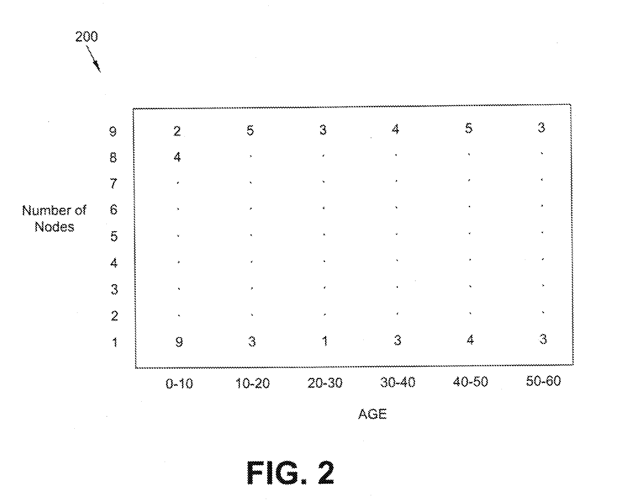
[0043]Databases configured for OLAP employ a multidimensional data model, or a MultiDimensional DataBase (MDDB), allowing for complex analytical and ad-hoc queries with a rapid execution time. An alternative and more descriptive term to describe the concept of OLAP may be Fast Analysis of Shared Multidimensional Information (FASMI). These borrow aspects of navigational databases and hierarchical databases that are speedier than their relational kin.

[0044]The output of an OLAP query may be displayed in a matrix format. The dimensions form the row and column o...


PUM


Abstract

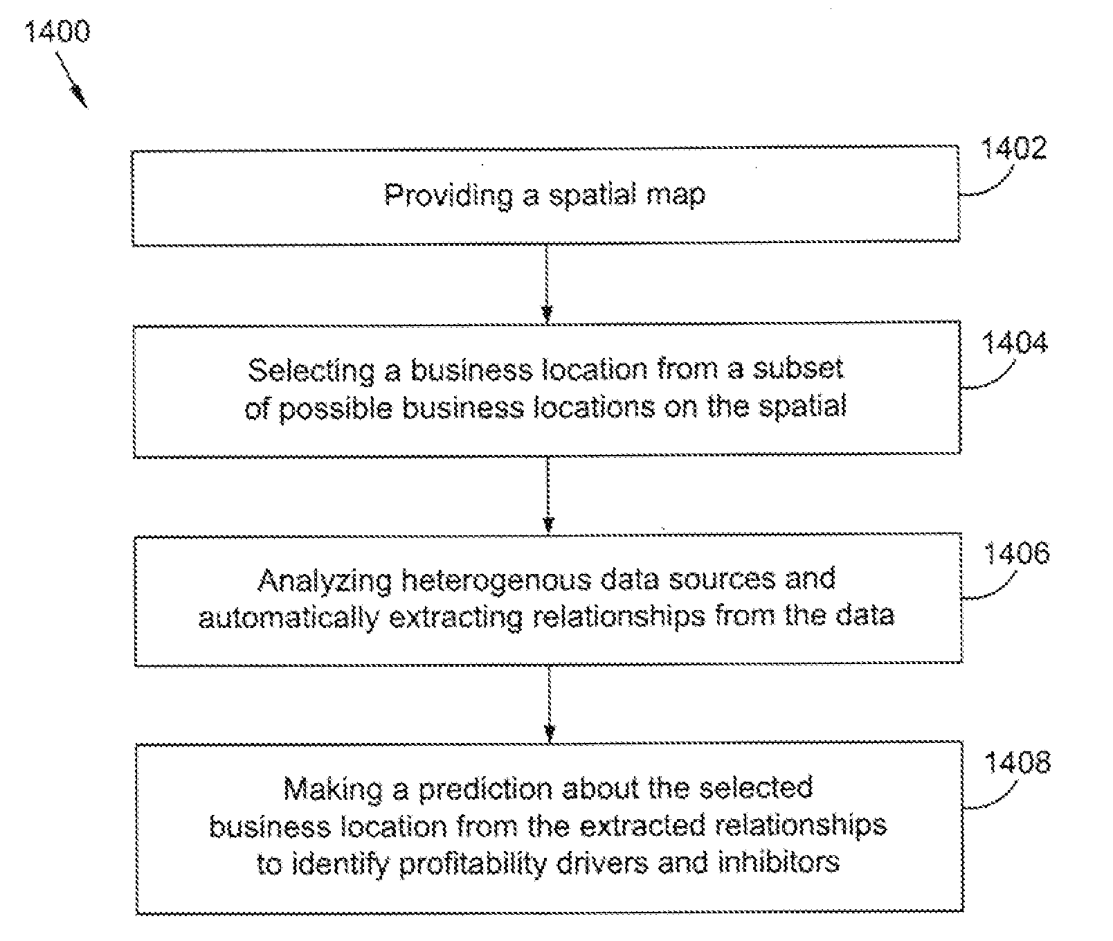
A method and system that utilizes OLAP and supporting data structures for making predictions about business locations. The method includes providing a spatial map and analyzing heterogeneous data having a spatial component to find utilizable data. Relationships are automatically extracted from the utilizable data by employing machine learning. The step of automatically extracting relationships includes generating a composite indicator, which correlates spatial data with unstructured data. The extracted relationships are presented on a spatial map to make a prediction about at least one business location. Preferably, the predictions are presented as a rank-ordered list on the spatial map and a heat map overlays the spatial map to indicate predictions about particular regions.

Description

PRIORITY CLAIM[0001]This application is a continuation-in-part of U.S. patent application Ser. No. 11 / 710,093, filed on Feb. 23, 2007.FIELD OF THE INVENTION[0002]The present invention relates to systems and methods for making predictions about business locations.BACKGROUND OF THE INVENTION[0003]Choosing an optimal location may be a critical issue for numerous businesses including businesses involved in retail, manufacturing, franchising, and housing. Numerous factors may contribute to the choice of the eventual location of a business. These factors include, traffic flow, parking, real estate availability, cost, appearance, customer demographics and spending patterns, location of competitors, location of anchor businesses (i.e., businesses that attract customers that would be suitable for one's own business), barriers to traffic flow, and zoning. Currently, most companies use human insight and experience to combine these heterogeneous factors into a prediction regarding optimal busin...

Claims


Application Information

Patent Timeline
IPC IPC(8): G06Q99/00G06F17/00
CPCG06Q10/04G06Q30/0205G06Q10/06375
Inventor SRIVASTAVA, ASHOK N.
Owner SAAMA TECH
Learn More