Geographic XML database management system

a database management system and geographic information technology, applied in the field of geographic information database management system, can solve the problem that the conversion into a certain file format alone is not sufficient to facilitate the use of shape files, and achieve the effect of efficient storage and retrieval of geographic information

Inactive Publication Date: 2009-05-14
SOFTWARE AG
View PDF4 Cites 9 Cited by
  • Summary
  • Abstract
  • Description
  • Claims
  • Application Information

AI Technical Summary

Benefits of technology

[0009]The invention is based on the recognition that an XML database system can be used to efficiently store and retrieve geographic information, if the XML documents, into which the geospatial data documents are converted, adhere to an XML schema, which defines that the geospatial information and the related attributes are stored together in a single node. As a result, an XQuery search can be performed base...

Problems solved by technology

However, conversion into a certain file format alon...

Method used


Image

  • Geographic XML database management system
  • Geographic XML database management system
  • Geographic XML database management system

Examples


Embodiment Construction

[0017]In the following, exemplary embodiments of the method of the present invention are described. It will be understood that the functionality described below can be implemented in a number of alternative ways, for example in a management system for a single XML database, in a distributed arrangement of a plurality of XML databases, with an integral storage or an external storage, etc. The database management system could be tightly integrated with the database itself or be provided separately. None of such implementation details is essential for the present invention.

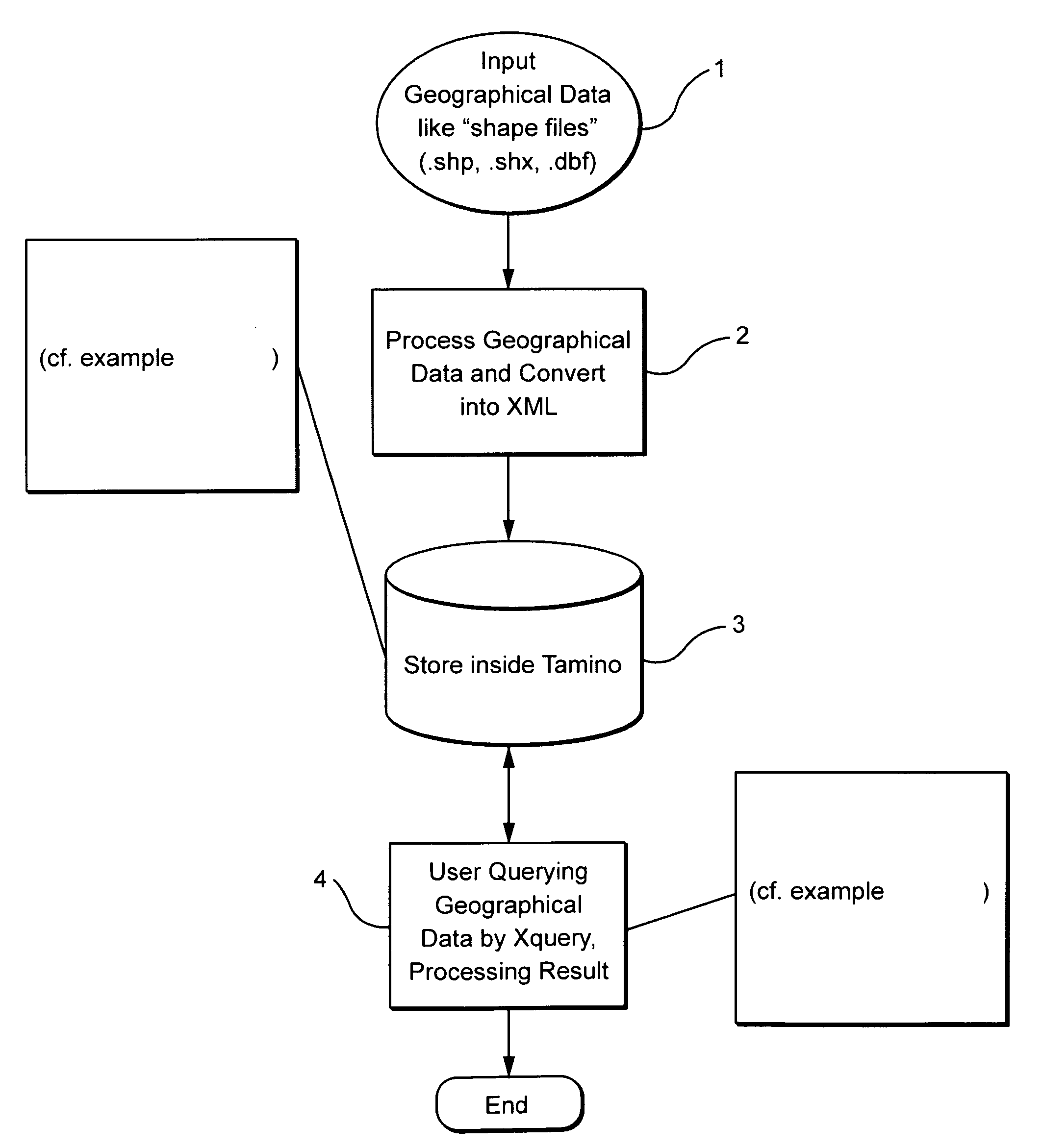
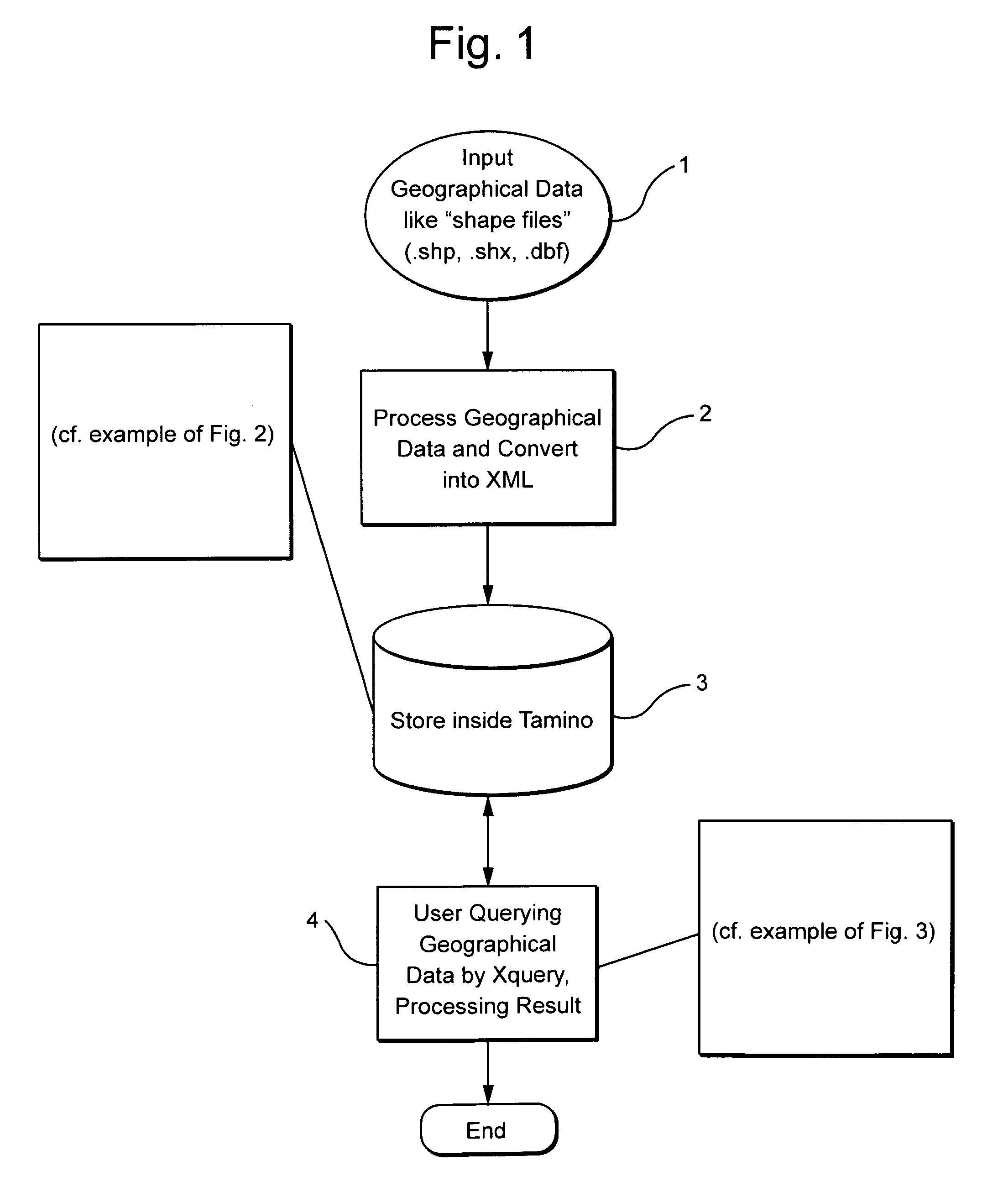
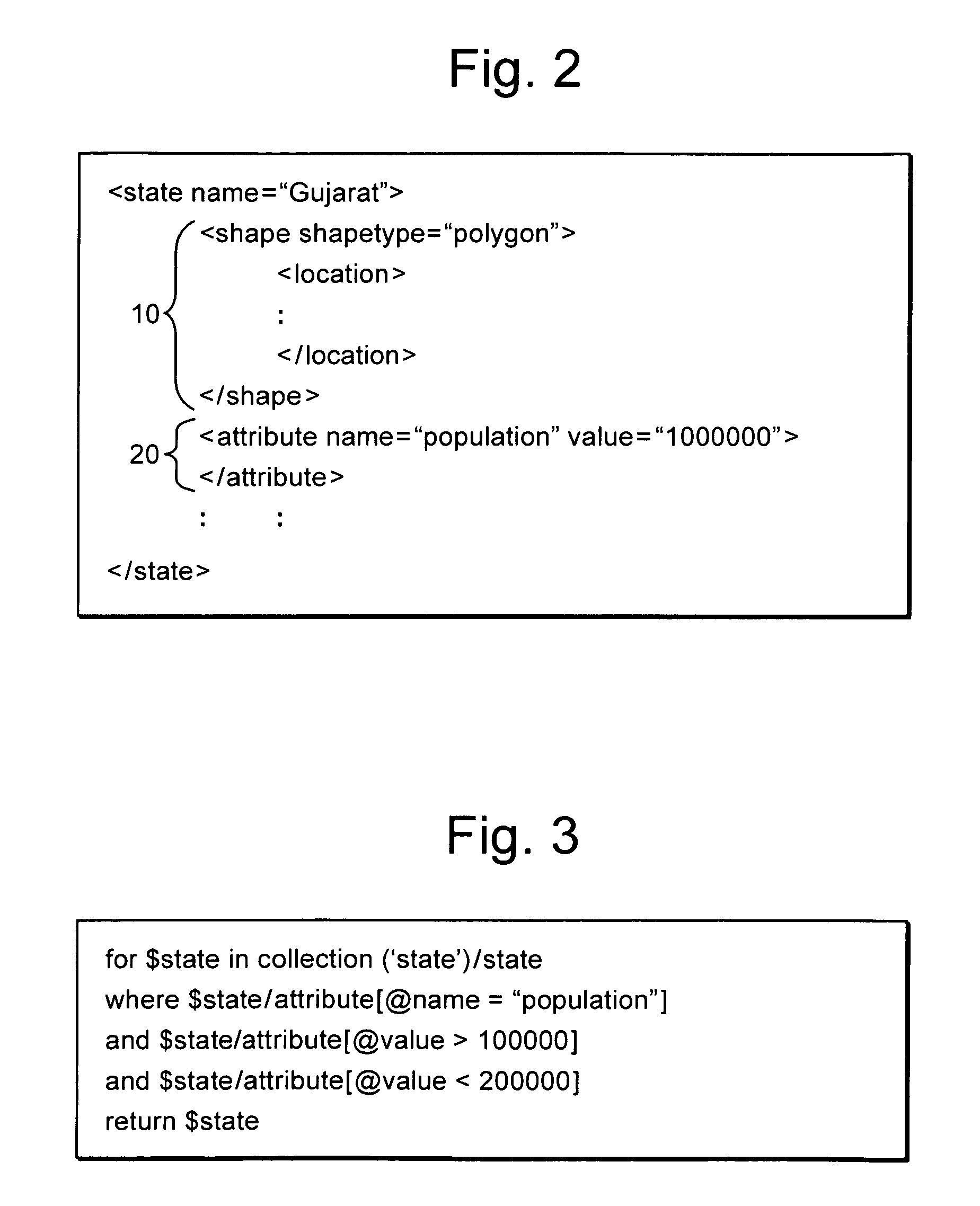
[0018]FIG. 1 presents a schematic flowchart describing exemplary steps of the process for storing geospatial data in a XML database and for retrieving the stored data using XQuery. As shown in step 1, the data may be provided as input in a variety of file formats such as shape files having the extensions .shp, .shx and .dbf . Other suitable file formats are also conceivable as input.

[0019]In step 2, the geographical ...


PUM


Abstract

The present invention relates to an XML database management system for providing geographic information. In one embodiment, the XML database management system comprises a loader capable to convert (1) a geospatial data document, in particular a shape file, into an XML document in accordance with a predefined XML schema, wherein the predefined XML schema defines geospatial data (10) and attributes (20) to be stored in a single XML node, and an XQuery capability enabling a user to retrieve (4) the XML document based on one or more of its attributes (20).

Description

1. TECHNICAL FIELD[0001]The present invention relates to an XML database management system and a database for providing geographic information.2. THE PRIOR ART[0002]Geographical data have an increasing importance for a number of technical applications. For example, the planning of infrastructure networks such as streets, railways, water pipes and power grids always involve questions of geography. More and more, information technology is used to make geographical data available in a form, which by far exceeds the capabilities of a simple map. Geographic information systems (GIS) allow linking information attributes to location data, for example people to addresses, buildings to parcels, or streets within a network. The available geographic information is provided in several layers allowing a separate processing of the data but also a complete view showing relations between the various layers.[0003]A common data format to store geographic information is a so-called shape file which ha...

Claims


Application Information

Patent Timeline
IPC IPC(8): G06F7/06G06F17/30
CPCG06F17/30923G06F17/30241G06F16/29G06F16/83
Inventor VALA, KEVAL B.
Owner SOFTWARE AG
Why Eureka
Try Eureka