

Wireless communication terminals and methods that display relative direction and distance therebetween responsive to acceleration data
a technology of wireless communication terminals and acceleration data, applied in the field of wireless communication, can solve the problems of difficult or impossible acquisition of gps signals that may be easily acquired in the open, complex algorithms used to acquire gps signals and determine positions therefrom, and achieve the effect of increasing the accuracy of relative direction and distance data
- Summary
- Abstract
- Description
- Claims
- Application Information
AI Technical Summary
Benefits of technology
Problems solved by technology
Method used
Image

Examples
Embodiment Construction
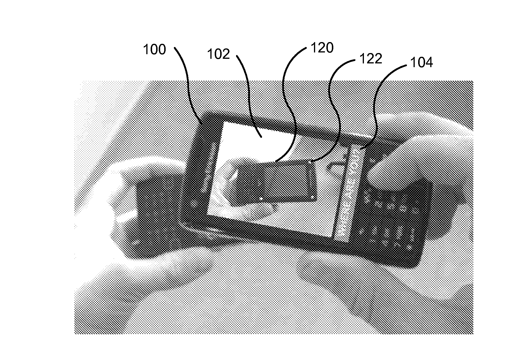
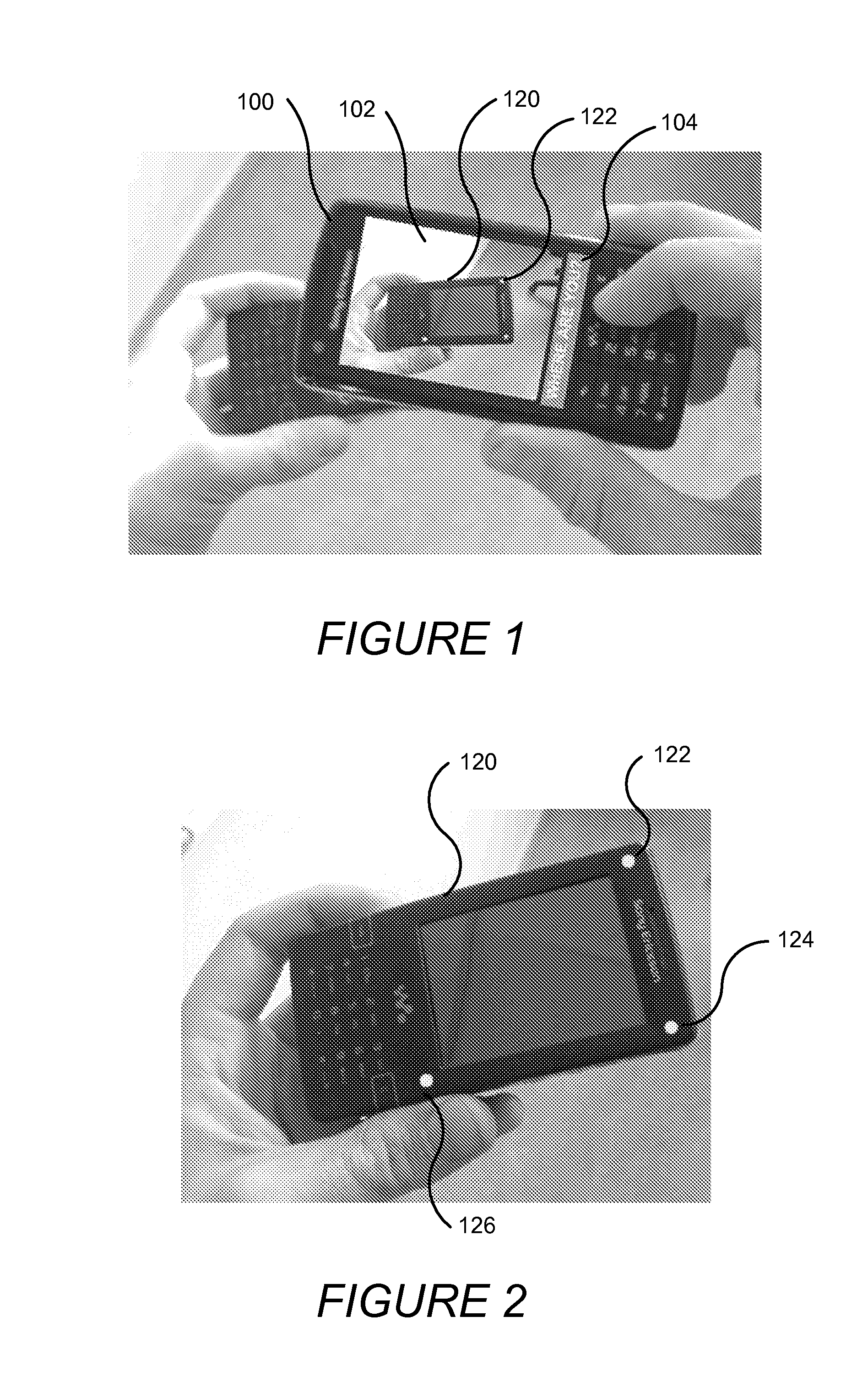
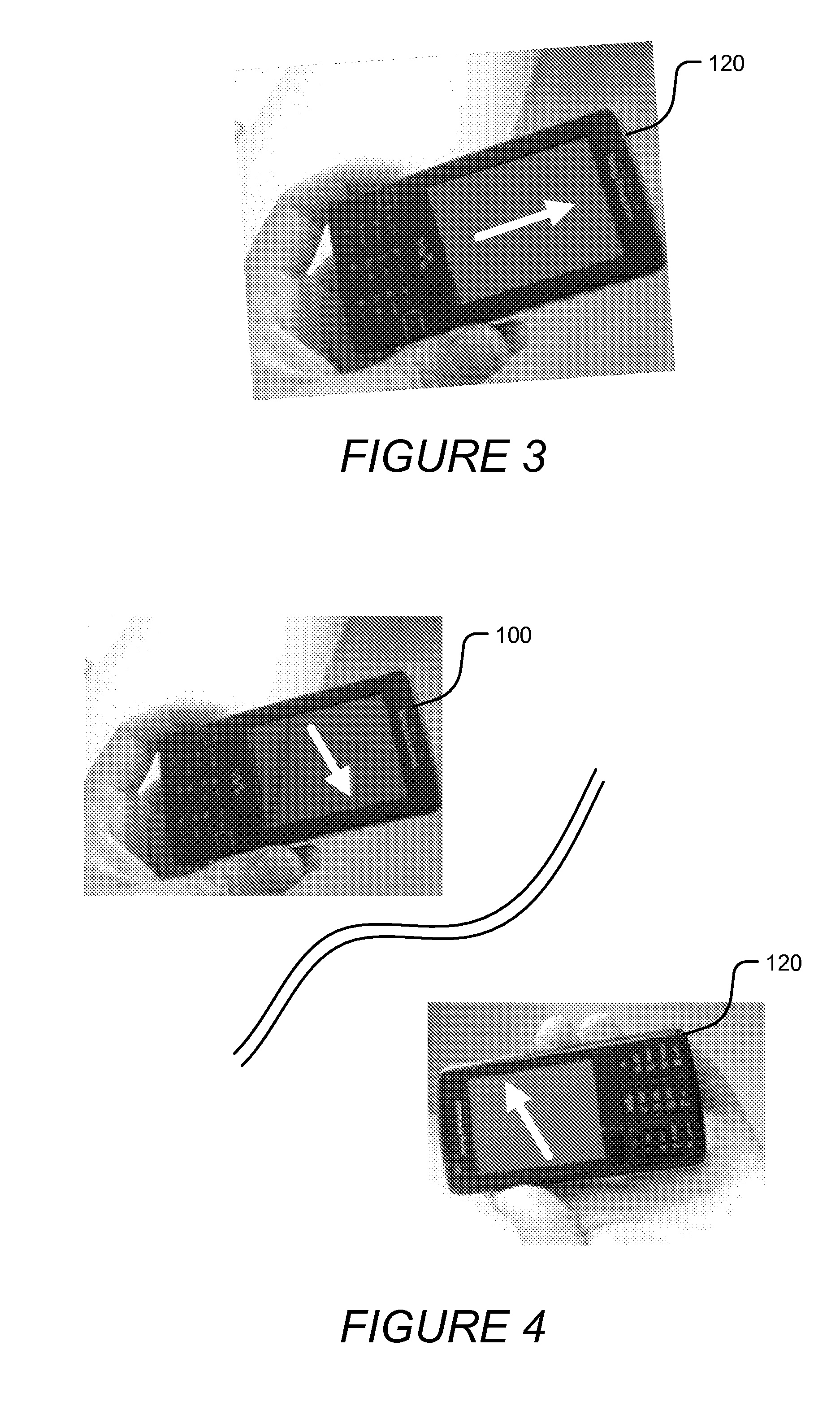
[0035]Various embodiments of the present invention will now be described more fully hereinafter with reference to the accompanying drawings. However, this invention should not be construed as limited to the embodiments set forth herein. Rather, these embodiments are provided so that this disclosure will be thorough and complete, and will convey the scope of the invention to those skilled in the art.
[0036]It will be understood that, as used herein, the term “comprising” or “comprises” is open-ended, and includes one or more stated elements, steps and / or functions without precluding one or more unstated elements, steps and / or functions. As used herein, the singular forms “a”, “an” and “the” are intended to include the plural forms as well, unless the context clearly indicates otherwise. The term “and / or” and “ / ” includes any and all combinations of one or more of the associated listed items. In the drawings, the size and relative sizes of regions may be exaggerated for clarity. Like n...
PUM
 Abstract
Description
Claims
Application Information