

Method and apparatus for combining a first partition from a first digital map database and a second partition from a second digital map database
- Summary
- Abstract
- Description
- Claims
- Application Information
AI Technical Summary
Benefits of technology
Problems solved by technology
Method used
Image

Examples
first embodiment
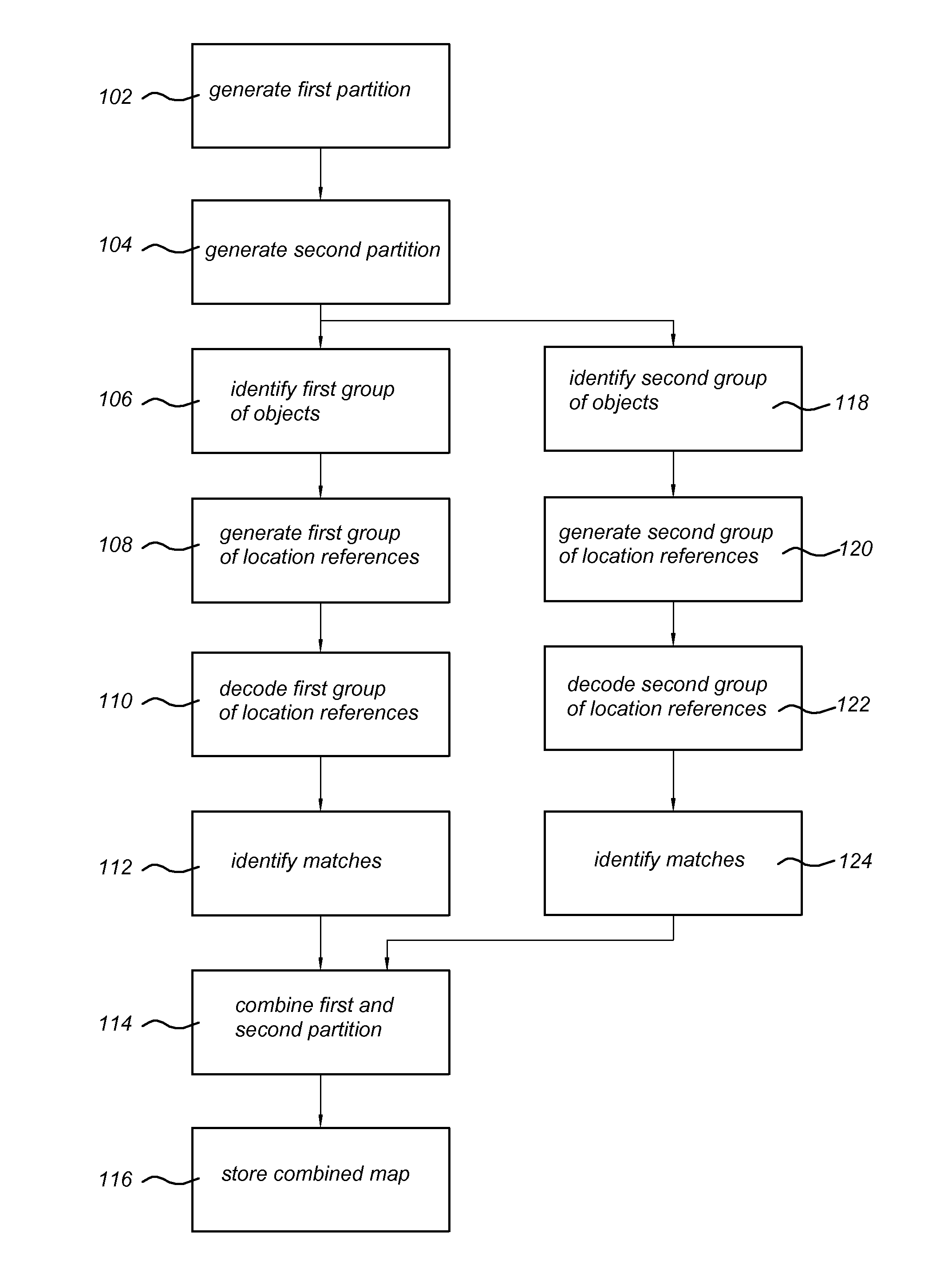
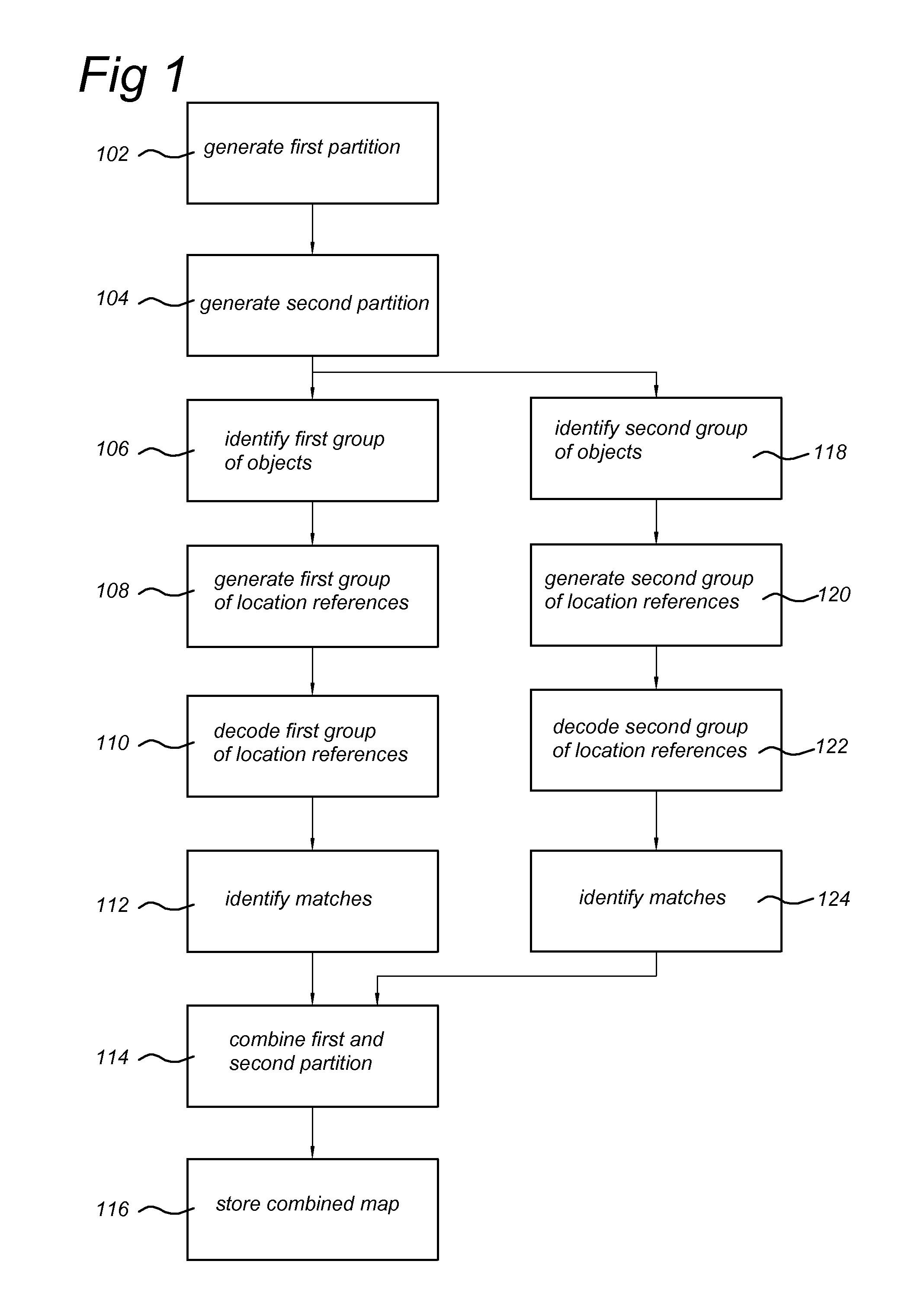
[0056]In action 114, the position in the combined map is the middle between the position of an object in the first digital map database and the position of said object in the second digital map database. This corresponds to averaging the positions of the object in both databases. In this embodiment only the positions of matched objects have to be calculated. The topology of the two partitions will be coupled by for example adding to a record of matched object in the first database a pointer to the record of the corresponding matched object from the second database as known to a person skilled in the art. The other objects in the digital map databases will have their original position in the coordinate reference system.
[0057]Instead of averaging the positions of a road crossing the partition line, the road segment corresponding to said position could be determined in both databases. Subsequently, an end of said segment present in the first partition is topologically connected by mean...
third embodiment
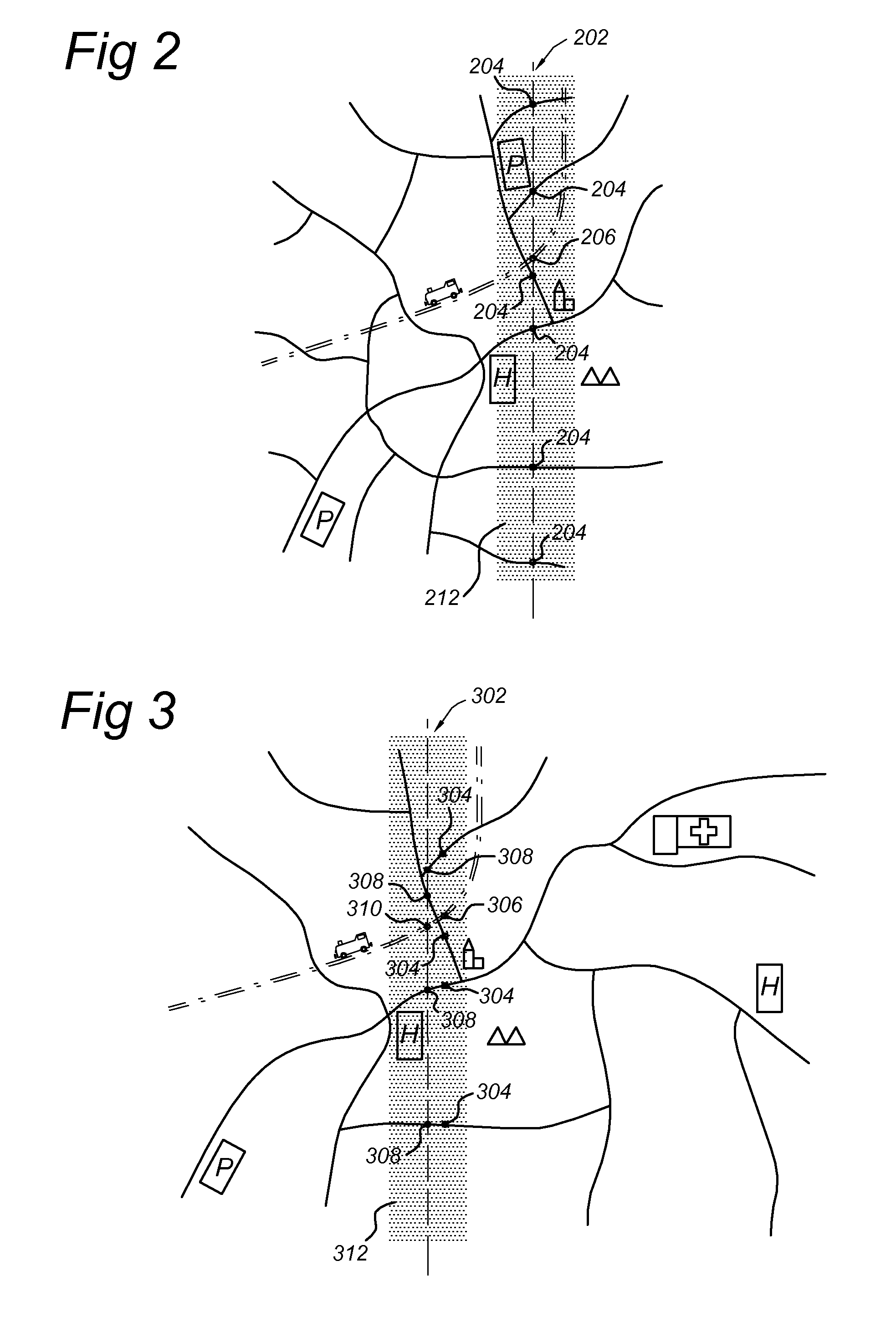
[0060]In action 114, rubber sheeting is performed by means of the objects associated with the topological connections to obtain a combined digital map. In cartography, rubber-sheeting refers to the process by which a layer is distorted to allow it to be seamlessly joined to an adjacent geographic layer of matching imagery, such as satellite imagery (most commonly vector cartographic data) which are digital maps. This is sometimes referred to as image-to-vector conflation. Often this has to be done when layers created from adjacent map sheets are joined together. Rubber-sheeting is necessary because the imagery and the vector data will rarely match up correctly due to various reasons, such as the angle that the image was taken at, the curvature of the surface of the earth, minor movements in the imaging platform (such as a satellite or aircraft), and other errors in the imagery. There are other methods known to one skilled in the art of transforming the geometry to smooth the geometr...
PUM
 Abstract
Description
Claims
Application Information