Method for generating map data

a map and data technology, applied in surveying, navigation, instruments, etc., can solve the problems of insufficient gps signal reception in buildings, inability to determine internal features or layouts, and inability to obtain satellite or aerial views. the effect of reducing the bandwidth required

Inactive Publication Date: 2013-11-07
TOMTOM BELGIUM
View PDF3 Cites 116 Cited by
  • Summary
  • Abstract
  • Description
  • Claims
  • Application Information

AI Technical Summary

Benefits of technology

[0026]The method may comprise providing the location related data from the at least one mobile device to a server. The method may comprise retrieving the map data from the server using the mobile devices. The method may be performed on the remote server. However, it will be appreciated that the method may additionally or alternatively be performed on the mobile device. For example, although navigational data as determined by the at least one non-GPS sensor may be sent directly to the server, it may be advantageous to determine estimated location data from the navigational data and / or determine aggregated location data on the mobile device before communicating the estimated location data and / or aggregated location data to the server. In this way, for example, navigational data from the non-GPS sensors such as direction, distance, number of steps, speed, pressure and the like, may be processed on the device, and referenced to GPS location data from the GPS sensor, in order to determine estimated locations from the navigational data obtained from the non-GPS sensors. Optionally the estimated locations may be sent to the server, rather than the navigational data from the non-GPS sensors. The estimated location data may be aggregated with other estimated location data collected by the mobile device and used to form aggregated location data, such as an aggregated route trace, before communicating data with the server. By converting raw sensor data such as number of steps or direction into estimated locations on the device, then device specific issues such as the format of the non-GPS sensor data and user specific issues such as providing an average step length for a user in order to determine distance travelled from a number of steps recorded by a pedometer, may be more easily addressed. By performing the above processing on the device, aggregated data that is sent to the server may be less data intensive than raw sensor or estimated location data and / or may reduce the bandwidth required.

Problems solved by technology

However, GPS signals may be attenuated by walls, floors and other building structures.
As a result, GPS signal reception in buildings is often insufficient to allow accurate determination of positions.
Furthermore, satellite or aerial views do not generally allow internal features or layout to be determined.
Historical mapping data may not cover building interiors and buildings and their interiors may change over time.
However, these non-GPS sensors are often less accurate than sensors that use GPS based systems.
Furthermore, determining internal positions of features and routes within buildings may be time consuming and / or access to some buildings or areas of buildings may be restricted.

Method used


Image

  • Method for generating map data
  • Method for generating map data
  • Method for generating map data

Examples


Embodiment Construction

[0057]Throughout the following description identical reference numerals will be used to identify like parts.

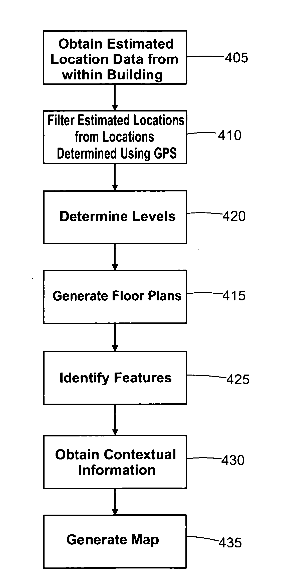
[0058]As indicated above, many traditional techniques used in the collection of mapping data such as those relying solely on GPS based systems may be ineffective inside buildings and enclosed spaces.

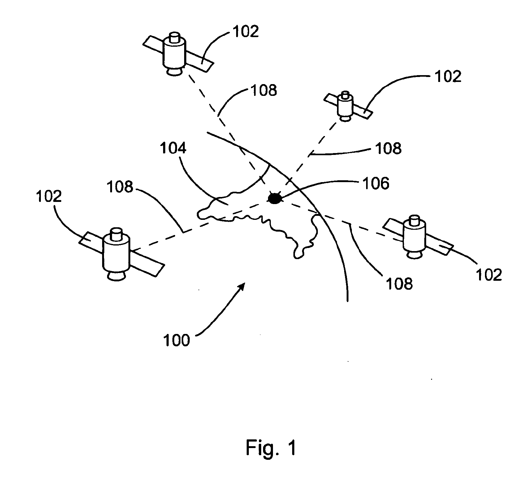
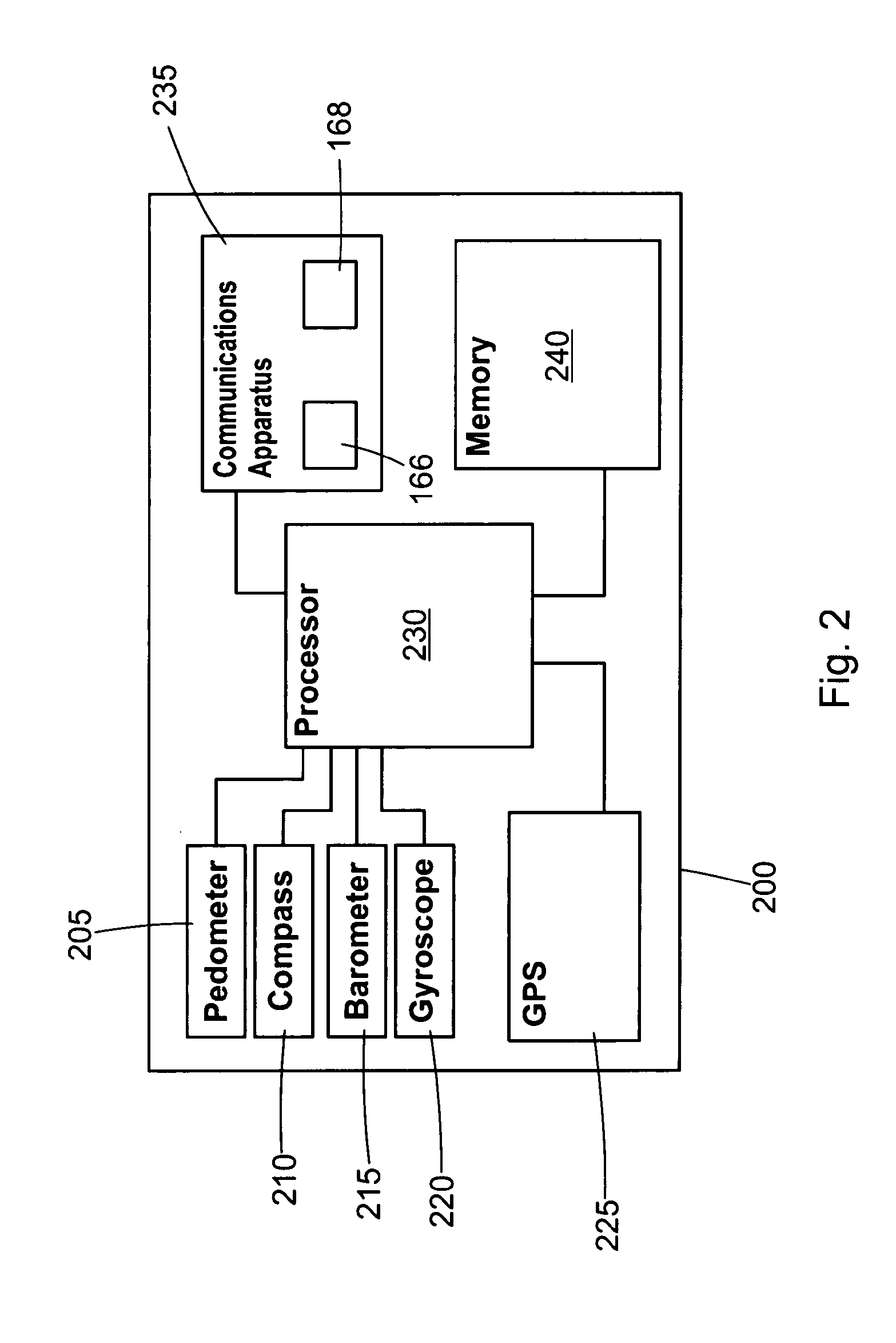
[0059]FIG. 2 shows a mobile device 200 that comprises non-GPS sensors 205, 210, 215, 220 that are operable to obtain navigational data and / or at least partial estimates of location. For example, the mobile device 200 may be equipped or equipable with one or more sensors such as pedometers 205, compasses 210, pressure sensors 215 such as barometers, gyroscopes 220, inclinometers and the like. The mobile device 200 is also equipped or equipable with a GPS sensor 225 for use when sufficient signal 108 from GPS satellites 102 is available. The GPS 225 and / or non-GPS 205, 210, 215, 220 sensors may optionally be built into the mobile device 200 or may be connected to the mobile device 20...


PUM


Abstract

A method and system for generating map data is disclosed, wherein the map data represents the inside of a building and/or an enclosed and/or covered area. Location related data is firstly generated by a plurality of mobile devices using at least one non-GPS navigation sensor and at least one GPS sensor, preferably in each mobile device. The location related data is then aggregated and map data determined from the aggregated data.

Description

FIELD OF THE INVENTION[0001]The present invention relates to a method for generating map data, particularly a method for generating indoor map data from devices having GPS and non-GPS sensors.BACKGROUND TO THE INVENTION[0002]Techniques for generating maps have benefited from advances in technology. In particular, the Global Positioning System (GPS) of FIG. 1 and the similar systems may be used to determine continuous position, velocity, time, and in some instances direction information for an unlimited number of users. Formerly known as NAVSTAR, the GPS incorporates a plurality of satellites which orbit the earth in extremely precise orbits. Based on these precise orbits, GPS satellites can relay their location to any number of receiving units.[0003]The GPS system is implemented when a device, specially equipped to receive GPS data, begins scanning radio frequencies for GPS satellite signals. Upon receiving a radio signal from a GPS satellite, the device determines the precise locat...

Claims


Application Information

Patent Timeline
Patent Type & Authority Applications(United States)
IPC IPC(8): G01C21/20
CPCG01C21/206G01C21/28G01C21/383G01C21/3848G01C21/3841
Inventor VANDE VELDE, LINDECLARYSSE, PASCAL
Owner TOMTOM BELGIUM
Why Eureka
Try Eureka