

Simultaneous multi-event universal kriging methods for spatio-temporal data analysis and mapping
- Summary
- Abstract
- Description
- Claims
- Application Information
AI Technical Summary
Benefits of technology
Problems solved by technology
Method used
Image

Examples
first embodiment
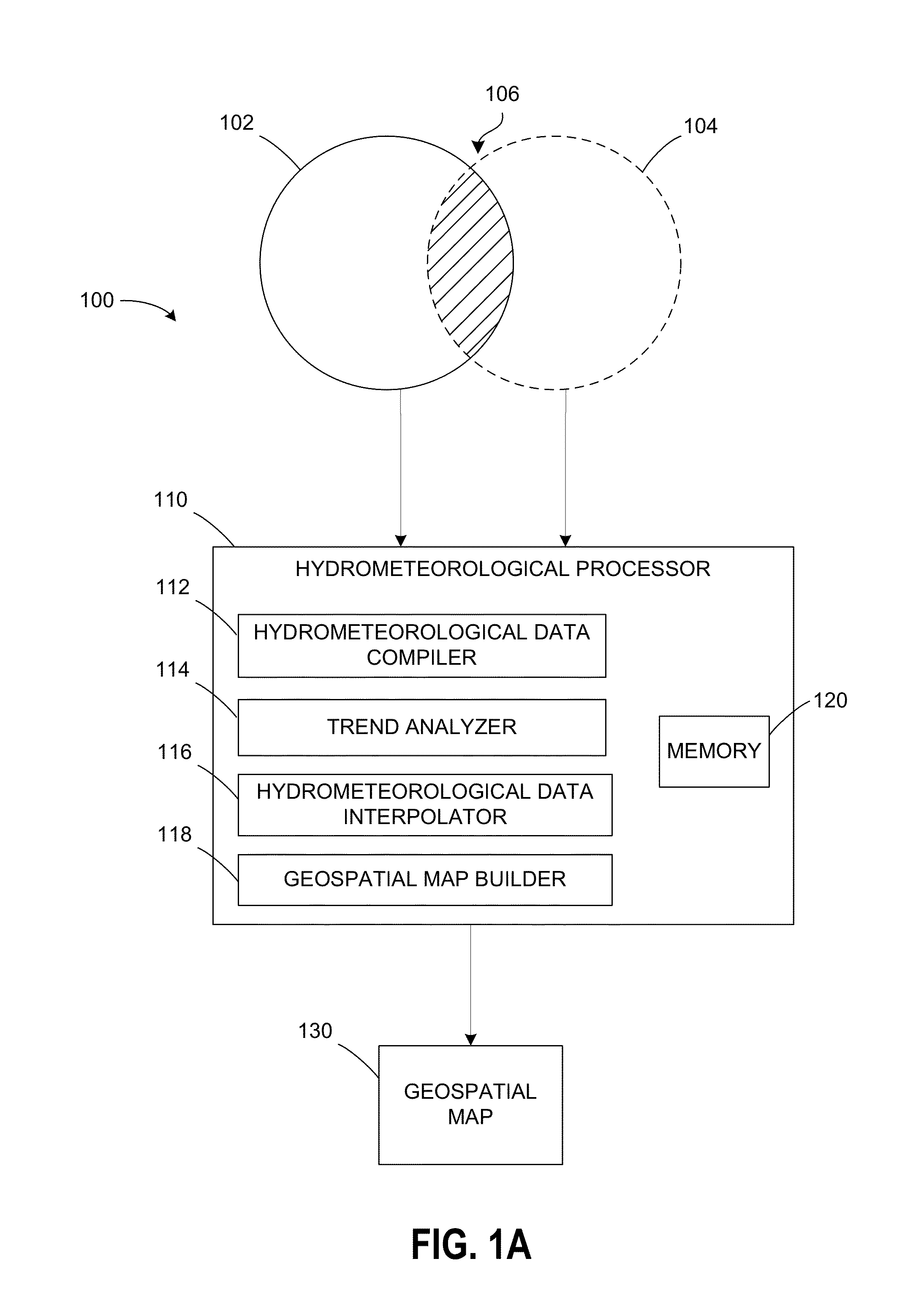
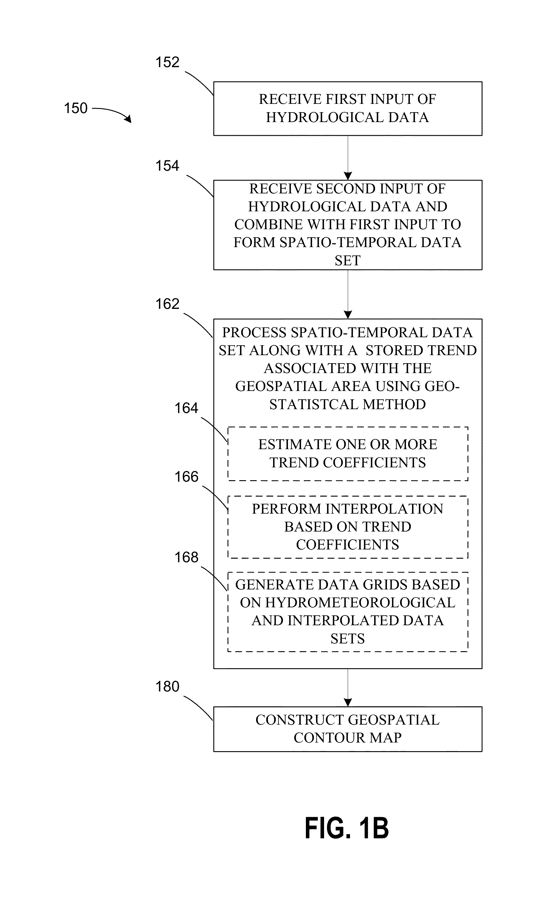
[0021] MEUK is demonstrated by application to the mapping of groundwater levels. With respect to FIGS. 1A and 1B, hydrometeorological system 100 may be configured to execute method 150 by processing the hydrometeorological data collected. For example, hydrometeorological system 100 may be a semi-automated software tool that predicts groundwater levels and flow patterns under dynamic stresses such as extraction and re-injection, or managed aquifer recharge. Thereby, although not explicitly indicated, hydrometeorological system 100 may be included within an integrated software system that uses semi-continuous data to support cost- and / or risk-benefit based optimization of groundwater remediation or groundwater supply systems. As one example, Geographic Information Systems (GIS) technology may be used in a computer program stationed remotely on a single computer along with the methods described to perform a hydraulic capture analysis using a series of groundwater potentiometric surface...
second embodiment
[0104]FIG. 15 schematically illustrates a geospatial area according to the present disclosure that illustrates how the simultaneous MEUK method may be used to create a map that indicates where populations of tuna fish are likely to reside. For instance, the methods may advantageously incorporate system-wide information to more accurately predict where fish populations reside within a geospatial area that is a body of water, e.g., water feature 1500.
[0105]For example, it is well established in the marine fisheries industry that ocean-going fish tend to accumulate in groups of fairly high density, particularly in the presence of oceanic flotsam / jetsam. As a result of this schooling pattern, the chances of obtaining representative samples of fish or fish density during large-scale sampling events is low—there is a tendency to miss these dense areas, unless their location is known. This schooling pattern has been advantageously used by fisheries who wish to recover the fish for profit, ...
PUM
 Abstract
Description
Claims
Application Information