Method for seamless mobile user experience between outdoor and indoor maps

a mobile user experience and outdoor global map technology, applied in wave based measurement systems, navigation instruments, instruments, etc., can solve the problems that current map application implementations do not provide for smooth integration of indoor localization applications with outdoor global maps, and achieve seamless mobile user experience. , the effect of more seamless

Inactive Publication Date: 2015-02-19
QUALCOMM INC
View PDF10 Cites 48 Cited by
  • Summary
  • Abstract
  • Description
  • Claims
  • Application Information

AI Technical Summary

Benefits of technology

[0006]Certain embodiments are described that allow for a more seamless mobile user experience between outdoor and indoor maps. In some instances, when using a global outdoor map application, control of a polygonal subset corresponding to a venue (e.g., shopping center) can be given to a third-party application designed to provide localization and / or map services in the venue. For example, when a user touches the screen within the polygonal area on the touchscreen of the mobile device corresponding to the venue, the third-party application associated with the venue can be given control. In some instances, the polygonal subset can include a circular or partially circular shape. The polygonal subset can indicate the boundary of the venue, where the global outdoor map may not provide localization service. The third-party map application can be created by the venue-owner to provide localization and map services in the venue.
[0021]In another embodiment, one or more computer-readable media storing computer-executable instructions for integrating an outdoor map and an indoor map associated with a venue that, when executed, may cause one or more computing devices included in a mobile device to: present the outdoor map associated with an outdoor map application, wherein the outdoor map includes an area associated with the venue; overlay the indoor map on the area of the outdoor map associated with the venue, wherein the indoor map is associated with an indoor map application; receive a first indication of a first event associated with the venue; and in response to receiving the first indication of the first event, allow the indoor map application to control an aspect associated with the presentation of the outdoor map with the overlaid indoor map.

Problems solved by technology

However, an outdoor map application typically covers only public areas.
Current implementations of map applications do not provide for smooth integration of indoor localization applications with an outdoor global map.

Method used


Image

  • Method for seamless mobile user experience between outdoor and indoor maps
  • Method for seamless mobile user experience between outdoor and indoor maps
  • Method for seamless mobile user experience between outdoor and indoor maps

Examples


Embodiment Construction

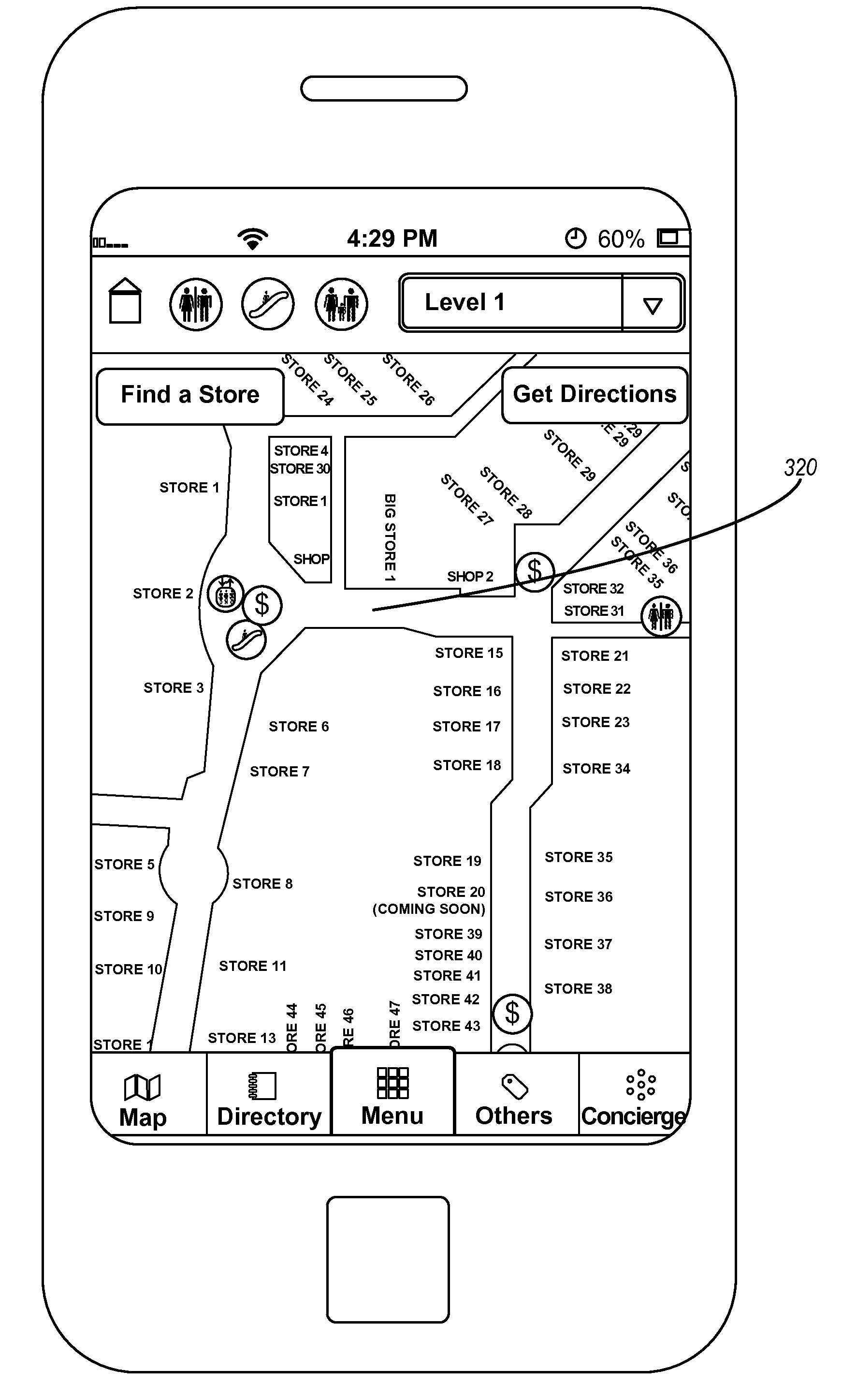
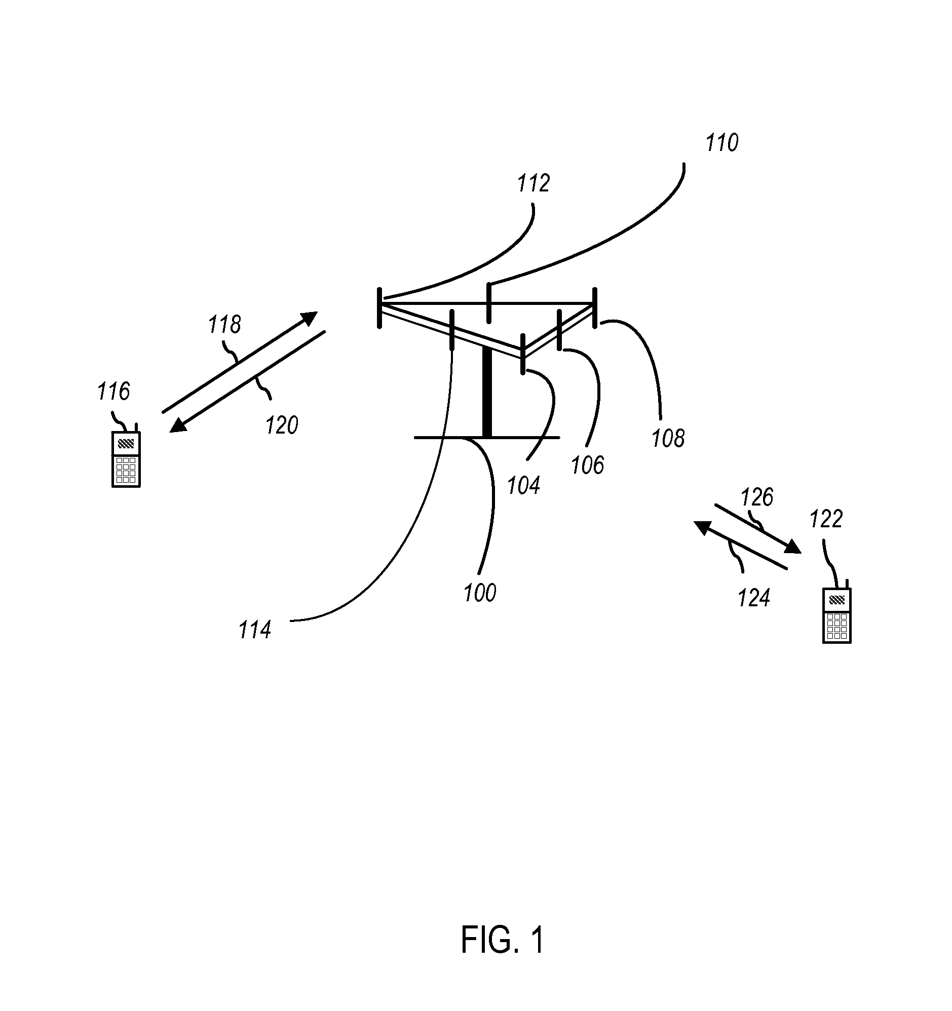
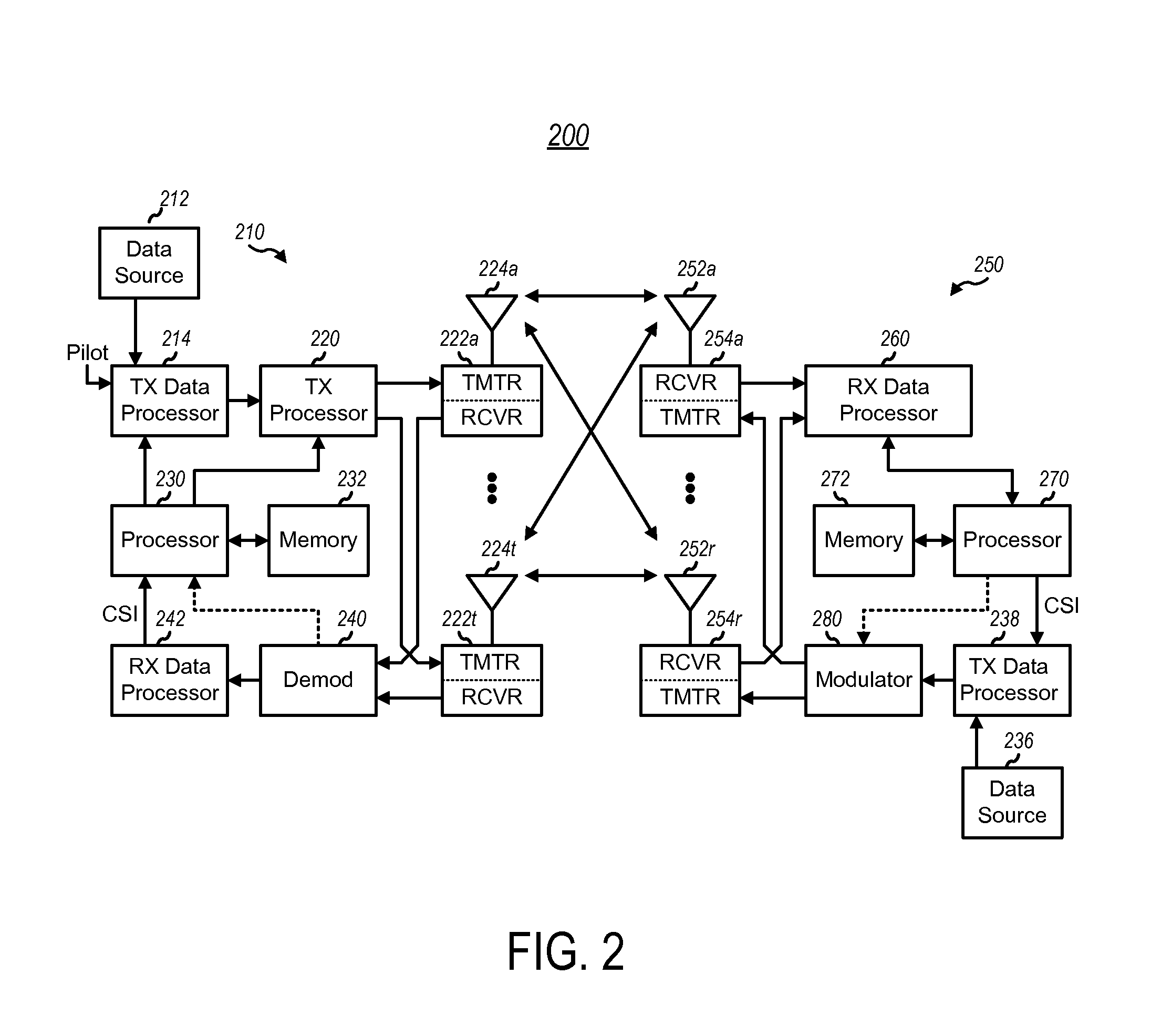
[0034]Several illustrative embodiments will now be described with respect to the accompanying drawings, which form a part hereof. While particular embodiments, in which one or more aspects of the disclosure may be implemented, are described below, other embodiments may be used and various modifications may be made without departing from the scope of the disclosure or the spirit of the appended claims.

[0035]The techniques described herein may be used for mobile device or client access to various wireless communication networks such as Code Division Multiple Access (CDMA) networks, Time Division Multiple Access (TDMA) networks, Frequency Division Multiple Access (FDMA) networks, Orthogonal FDMA (OFDMA) networks, Single-Carrier FDMA (SC-FDMA) networks, etc. The terms “networks” and “systems” are often used interchangeably. A CDMA network may implement a radio technology such as Universal Terrestrial Radio Access (UTRA), CDMA2000, etc. UTRA includes Wideband-CDMA (W-CDMA) and Low Chip R...


PUM


Abstract

Methods, systems, computer-readable media, and apparatuses for integration of an outdoor map and an indoor map associated with a venue using a mobile device are presented. The method may comprise presenting the outdoor map associated with an outdoor map application, wherein the outdoor map includes an area associated with the venue. Additionally, the method may comprise overlaying the indoor map on the area of the outdoor map associated with the venue, wherein the indoor map is associated with an indoor map application. Furthermore, the method may comprise receiving a first indication of a first event associated with the venue. Moreover, in response to receiving the first indication of the first event, the method may comprise allowing the indoor map application to control an aspect associated with the presentation of the outdoor map with the overlaid indoor map.

Description

BACKGROUND[0001]The present disclosure relates generally to map applications, and more specifically to techniques for a more seamless mobile user experience between outdoor and indoor maps.[0002]Outdoor map applications are widely used in mobile device to provide navigation aid and location information to mobile users. The outdoor map application may be used in conjunction with satellite location services, such as Global Positioning System (GPS), to provide navigation aid. An outdoor map application typically has a database containing public streets and points of interest. Points on streets and points of interest may be encoded as geographic coded coordinates (e.g., with longitude and latitude).[0003]However, an outdoor map application typically covers only public areas. Third-party venues, such as shopping centers, are typically not covered by the outdoor map application. An outdoor map application can normally display only public streets leading to entrances of a third-party venue...

Claims


Application Information

Patent Timeline
Patent Type & Authority Applications(United States)
IPC IPC(8): G06F3/0484G01S5/02
CPCG06F3/0484G01C21/20G01C21/206
Inventor MOHAMMAD MIRZAEI, FARAZDAS, SAUMITRA MOHANKHORASHADI, BEHROOZ
Owner QUALCOMM INC
Why Eureka
Try Eureka