Fire urgency estimator in geosynchronous orbit (FUEGO)

a geosynchronous orbit and urgency estimator technology, applied in the field of fire detection, can solve the problems of fires that grow to potentially unmanageable sizes, lack of sensitivity and rapid response times of wildfire detection systems,

US20160132714A1Active Publication Date: 2016-05-12RGT UNIV OF CALIFORNIA
9 Cites 40 Cited by

Patent Information

Authority / Receiving Office
US · United States
Patent Type
Applications(United States)
Current Assignee / Owner
Publication Date
2016-05-12

Smart Images

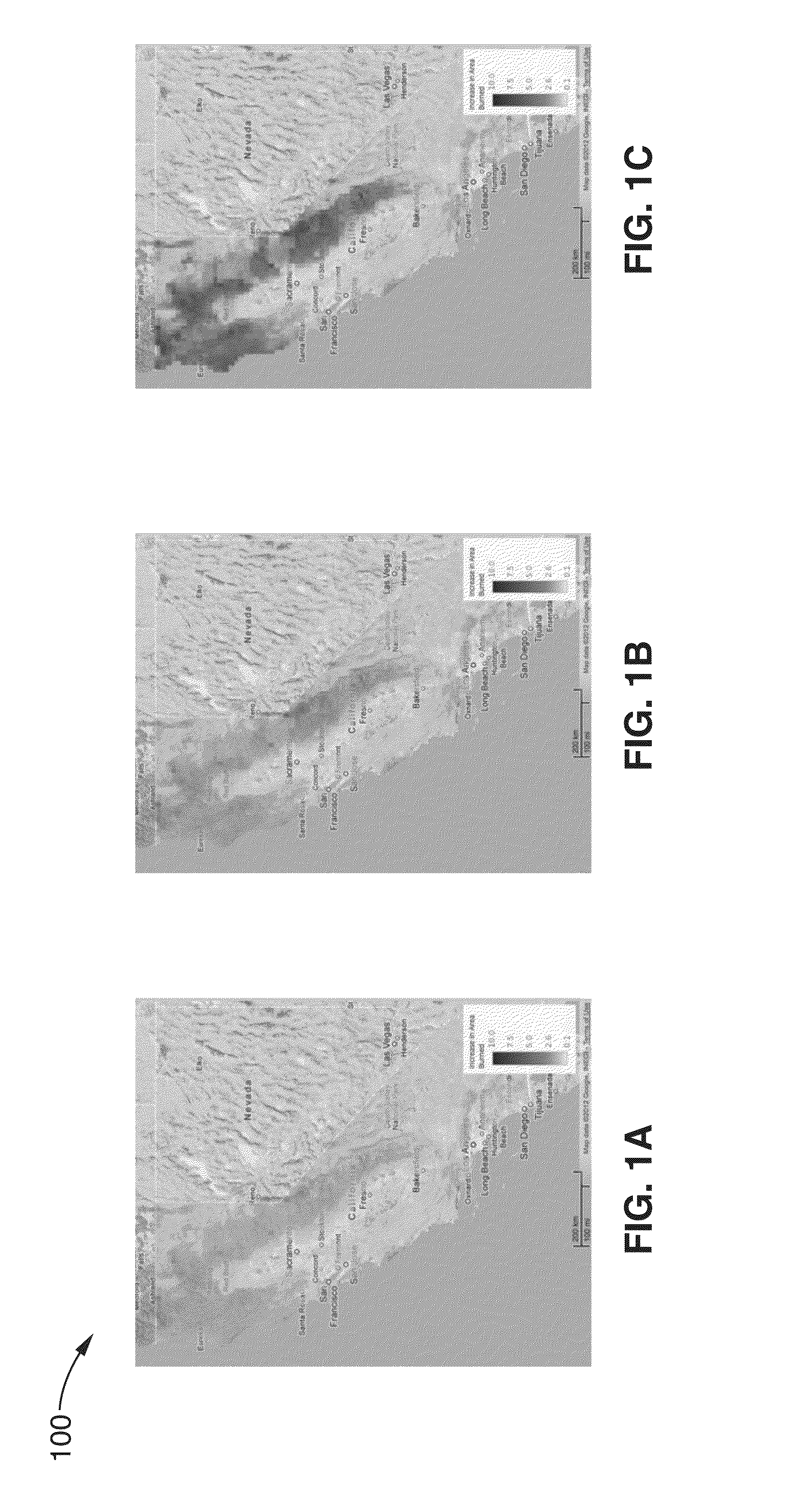
  • Figure 1
    Figure 1
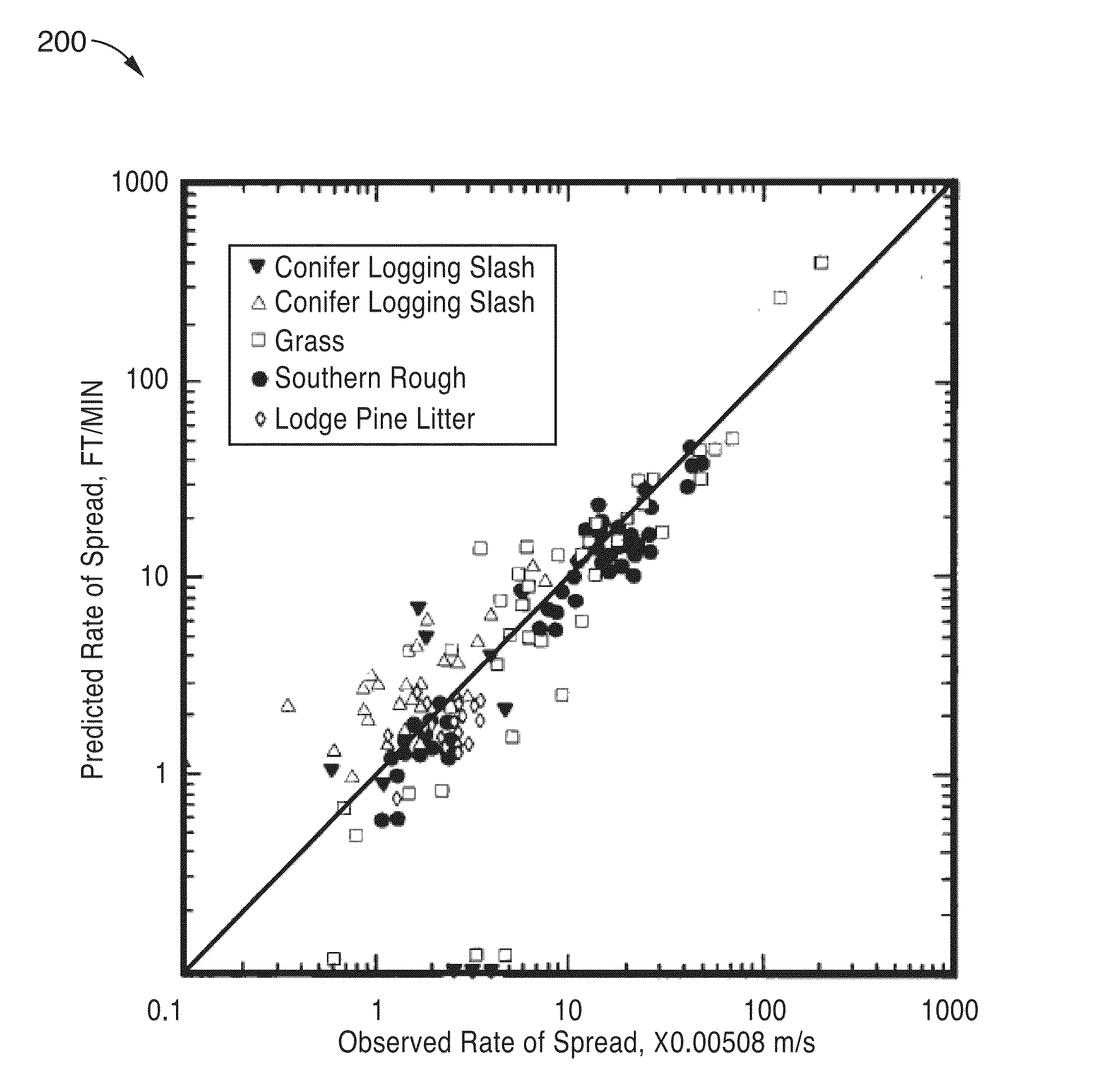
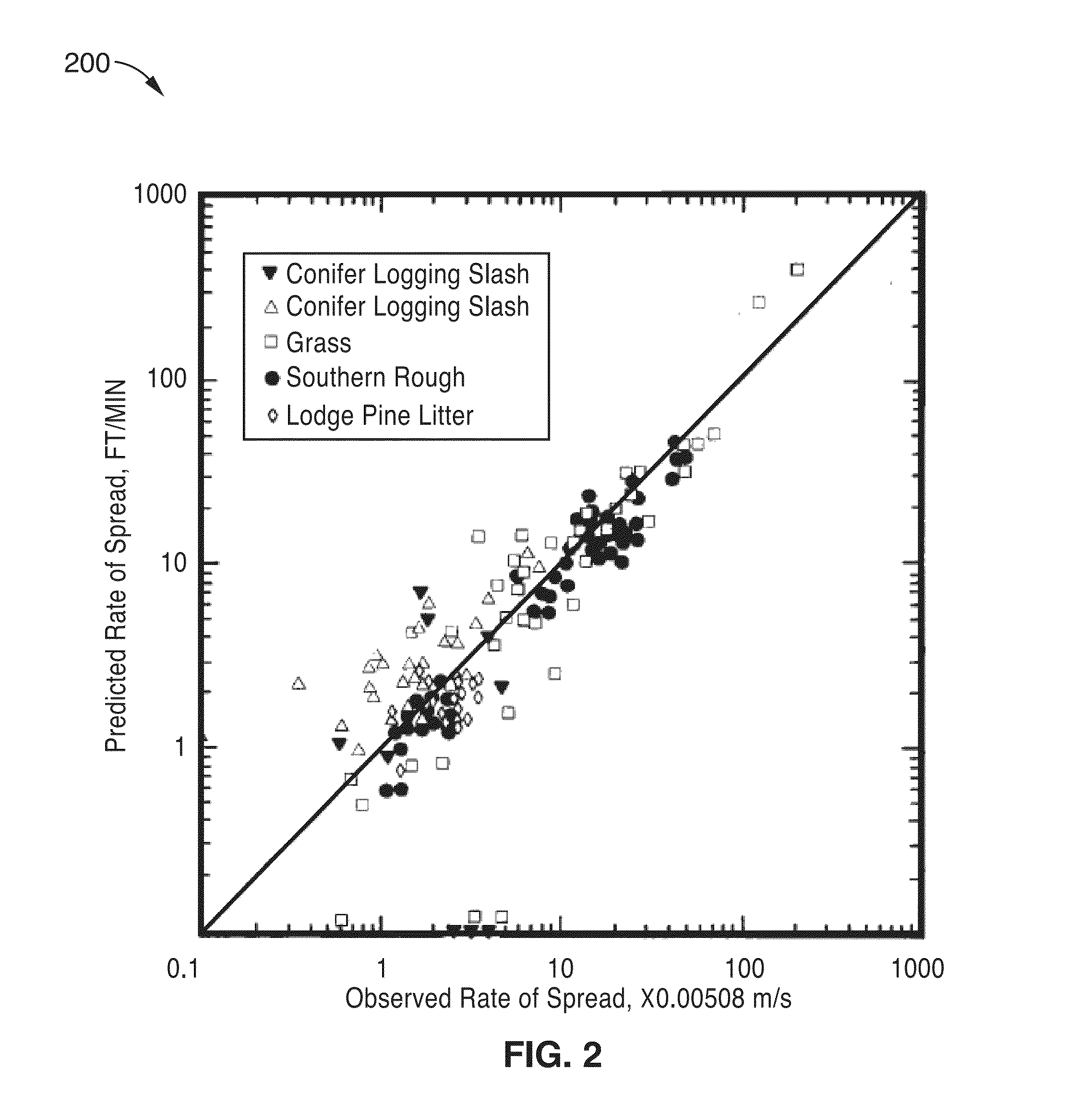
  • Figure 2
    Figure 2
  • Figure 3
    Figure 3
Patent Text Reader

Abstract

A fire detector is disclosed that successively images a particular area from geosynchronous Earth orbit satellite to attain very good signal-to-noise ratios against Poisson fluctuations within one second. Differences between such images allow for the automatic detection of small fires greater than 12 square meters. Imaging typically takes place in transparent bands of the infrared spectrum, thereby rendering smoke from the fire and light clouds somewhat transparent. Several algorithms are disclosed that can help reduce false fire alarms, and their efficiencies are shown. Early fire detection and response would be of great value in the United States and other nations, as wild land fires destroy property and lives and contribute around five percent of the US global carbon dioxide contribution. Such apparatus would incorporate modern imaging detectors, software, and algorithms able to detect heat from early and small fires, and yield detection times on a scale of minutes.
Need to check novelty before this filing date? Find Prior Art

Description

CROSS-REFERENCE TO RELATED APPLICATIONS

[0001] This application is a 35 U.S.C. §111(a) continuation of PCT international application number PCT / US2014 / 036209 filed on Apr. 30, 2014, incorporated herein by reference in its entirety, which claims priority to, and the benefit of, U.S. provisional patent application Ser. No. 61 / 817,803 filed on Apr. 30, 2013, incorporated herein by reference in its entirety. Priority is claimed to each of the foregoing applications.

[0002] The above-referenced PCT international application was published as PCT International Publication No. WO 2014 / 179482 on Nov. 6, 2014, which publication is incorporated herein by reference in its entirety.STATEMENT REGARDING FEDERALLY SPONSORED RESEARCH OR DEVELOPMENT

[0003] Not ApplicableINCORPORATION-BY-REFERENCE OF COMPUTER PROGRAM APPENDIX

[0004] Appendix A referenced herein is a computer program listing in a text file entitled “BK_2011_081_2_US_source_code_listing.txt” created on Oct. 29, 2015 and having a 19 kb file size...

Examples

Embodiment Construction

1. Introduction

[0049]1.1. Overview

[0050]Fire managers have to make difficult decisions about the allocation of resources for fire suppression. Allocations of suppression resources are based on numerous factors, including consideration of: the number of fires, fire location, potential fire damage to homes, fire impact on human life, and fire harm to natural resources. In the US, this is done at the Boise National Interagency Fire Center (NIFC) for all federal agencies. The ability to provide fast, reliable information on fire locations, especially when they are very small (2), would enhance fire management greatly, and potentially lower fire suppression costs.

[0051]Currently, fire managers rely on diverse sets of information to assess the location of fires. These include information on lightning strike locations, observations of fires from aircraft and fire lookouts, and on-the-ground observations from field personnel and the public. This network of data is not ideal for catching sma...