
Inertial system for gravity difference measurement

a gravity difference and gravity technology, applied in the field of airborne gravimetry, can solve the problems of inability to easily upgrade, bulky, expensive, etc., and achieve the effects of low measurement noise density, high relative precision, and simplified algorithm

Inactive Publication Date: 2017-04-20
KING SAUD UNIVERSITY
View PDF0 Cites 21 Cited by
  • Summary
  • Abstract
  • Description
  • Claims
  • Application Information

AI Technical Summary

Benefits of technology

The patent describes an inertial system that uses COTS nano accelerometers and GNSS-aided IMUs to measure gravity differences. The system uses stochastic modeling of gravity anomaly to simplify the algorithm. The main technical effect of the system is to provide high relative precision required in many applications by finding relative changes between points, as opposed to absolute values at the points.

Problems solved by technology

Conventional systems for gravity difference measurement use proprietary accelerometer designs built in-house that are usually bulky, expensive, and not easily upgradable.

Method used


Image

  • Inertial system for gravity difference measurement
  • Inertial system for gravity difference measurement
  • Inertial system for gravity difference measurement

Examples


Embodiment Construction

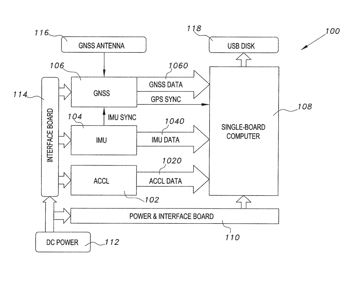
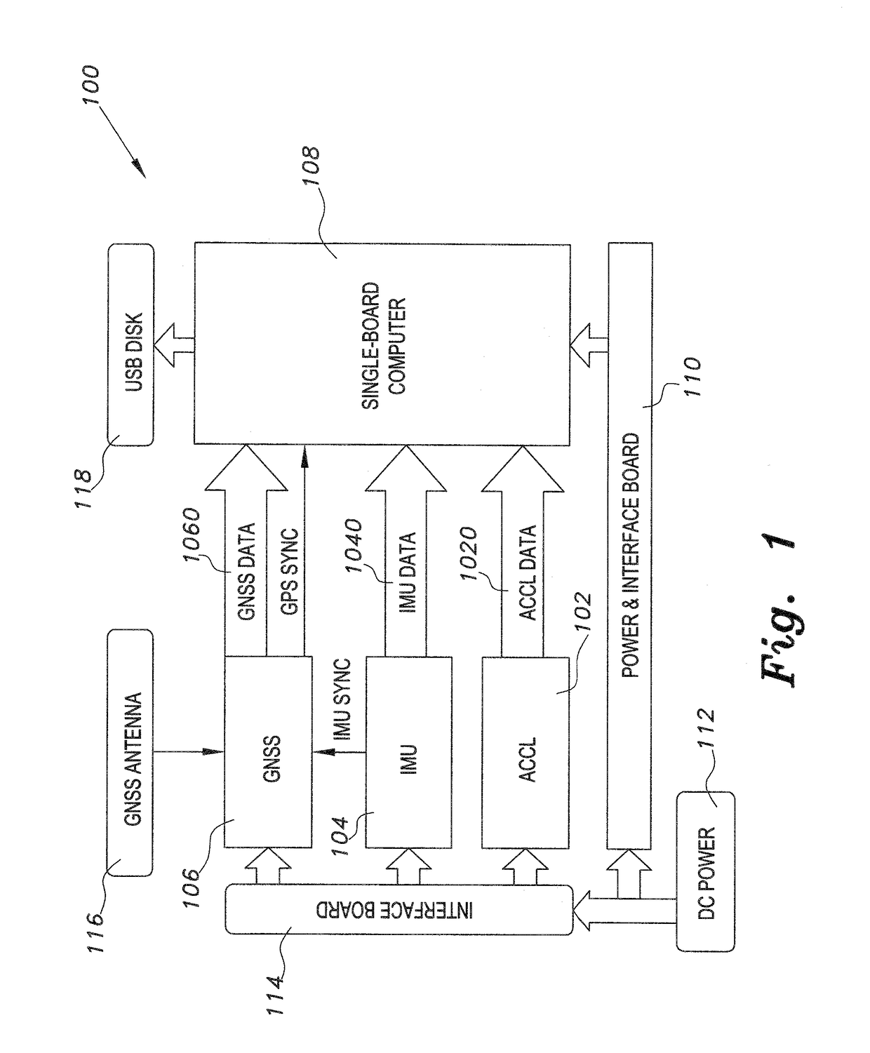
[0019]As shown in FIG. 1, the inertial system for gravity difference measurement (GravMap) 100 includes a GNSS receiver board 106 connected to a single-board computer 108. Inertial Measurement Unit (IMU) 104, and accelerometer 102 are also connected to the single-board computer 108. GNSS data 1060, IMU data 1040, and accelerometer data 1020 are exchanged between the GNSS 106, IMU 104 and accelerometer 102, respectively, and the single-board computer 108. The GNSS 106 also has a synchronization line connected to the computer 108. A GNSS antenna 116 is connected to the GNSS for reception of satellite global positioning data. Data processed by the computer 108 is stored on a USB disk or drive 118, which is connected to the computer 108.

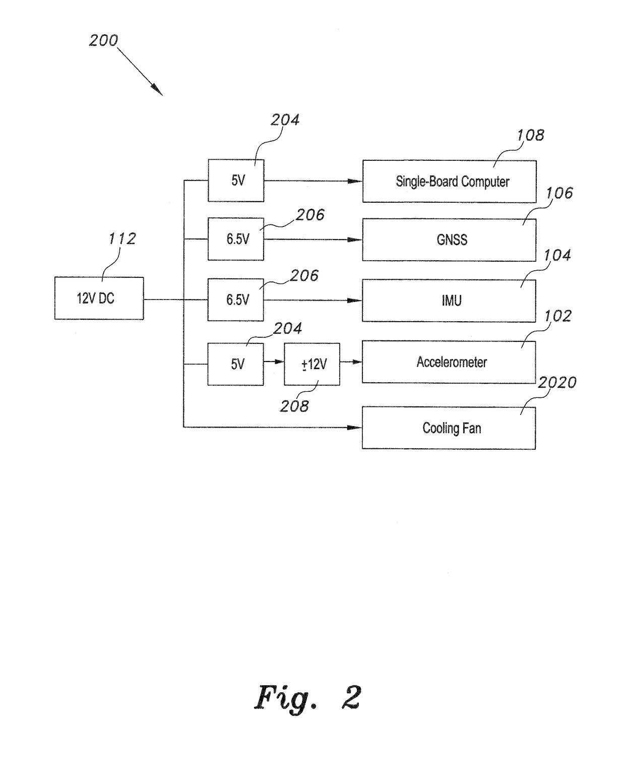
[0020]A DC power source 112 is connected to a communal power and interface board 110, which connects to and powers the single board computer 108. The DC power source 112 is also connected to a second interface board 114, which is connected to and powers ...


PUM


Abstract

The inertial system for gravity difference measurement uses COTS nano accelerometer and a strapdown Global Navigation Satellite System (GNSS)-aided inertial measurement unit (IMU). The former has low measurement noise density, while the latter is used to analytically stabilize the platform. Stochastic modeling of the gravity anomaly is utilized (as opposed to the deterministic modeling of causes and effects) to simplify the algorithm. The algorithm aims at finding relative changes between points, as opposed to absolute values at the points, which allows for high relative precision required in many applications.

Description

BACKGROUND OF THE INVENTION[0001]1. Field of the Invention[0002]The present invention relates to airborne gravimetry, and particularly to an inertial system for gravity difference measurement that uses a global navigation satellite system (GNSS) in combination with a strapdown inertial measurement unit (IMU) on an airborne platform to measure differences in the earth's gravitational field.[0003]2. Description of the Related Art[0004]Airborne gravimetry technology using strap-down IMU / GPS methods has been heavily researched at the University of Calgary over a 10+ year period. More recently, IMU / GPS gravimetry research has also been conducted at Ohio State University.[0005]All major airborne gravimeter solutions today use gimbaled systems to isolate the precision accelerometers from the attitude motion of the aircraft and require that the aircraft fly in light turbulence to achieve the necessary quiet environment for gravimetry sensing.[0006]Generally, these traditional methods use ex...

Claims


Application Information

Patent Timeline
Patent Type & Authority Applications(United States)
IPC IPC(8): G01V7/06G01V7/16
CPCG01V7/16G01V7/06
Inventor AGUIB, AYMAN S. HASSANMOHAMED, AHMED HASSAN
Owner KING SAUD UNIVERSITY
Learn More