

Method and apparatus for waypoint services navigational system
a navigational system and navigation method technology, applied in special services, navigation instruments, instruments, etc., can solve the problem of still being difficult to locate providers of various goods and services while traveling, and achieve the effect of reducing the need for a cellular link
- Summary
- Abstract
- Description
- Claims
- Application Information
AI Technical Summary
Benefits of technology
Problems solved by technology
Method used
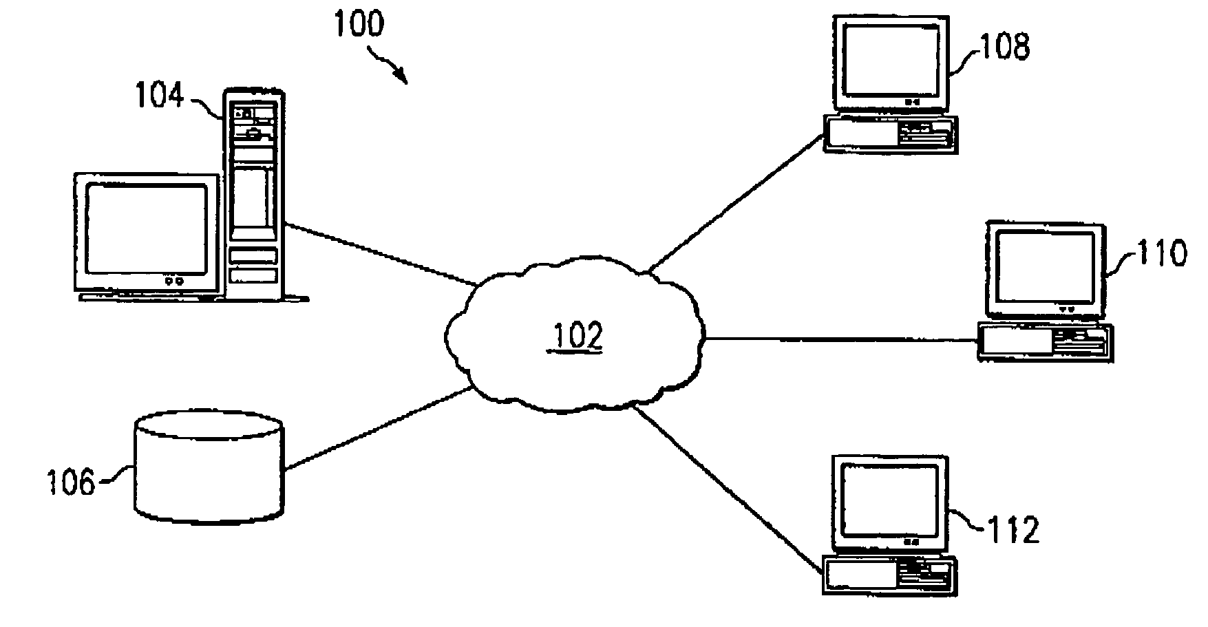
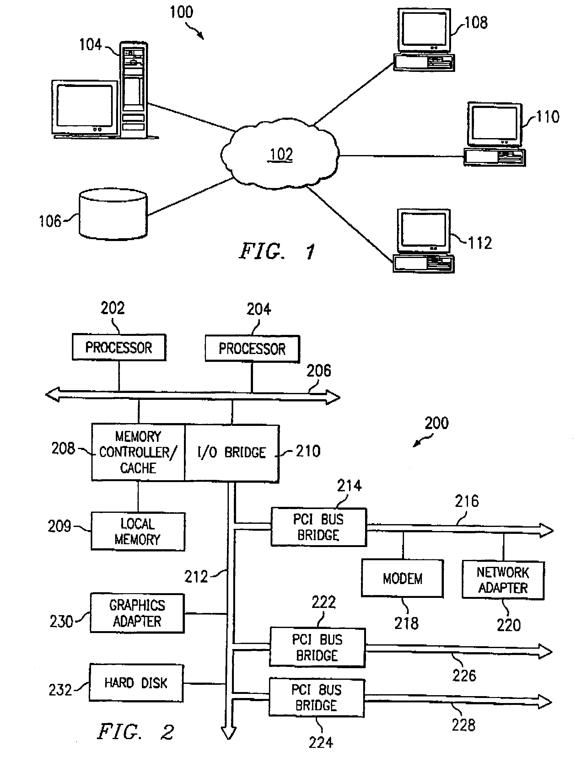
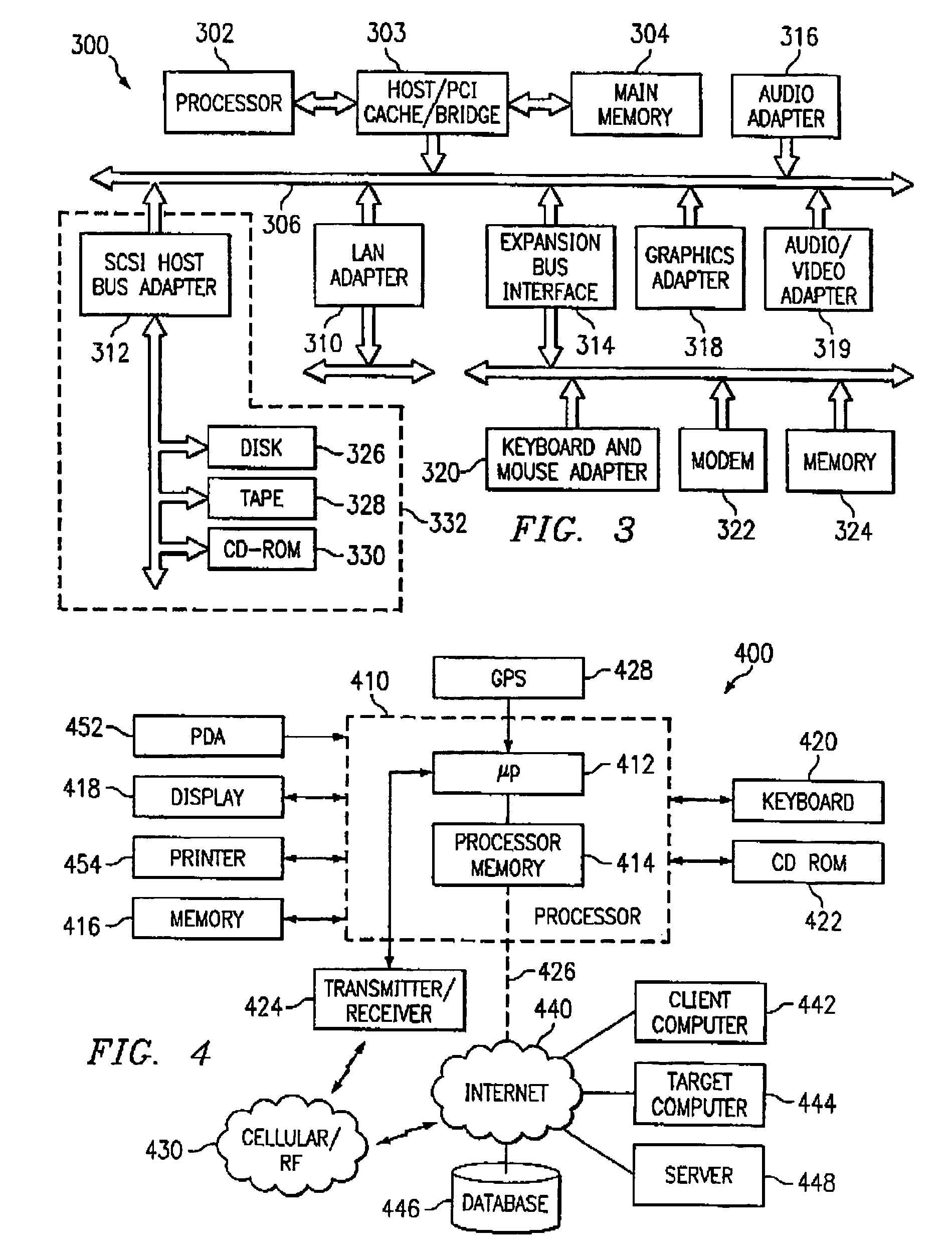
Image

Examples
Embodiment Construction
[0019]As used herein, Radiusimmediate shall mean and be numerically equal to the number of miles / kilometers around a vehicle for which to display businesses as being optimal for stopping.
[0020]As used herein, ForwardDistanceimmediate shall mean and be numerically equal to the forward distance before a vehicle, given the current direction of driving, for which to display optimal businesses.
[0021]As used herein, LateralDistance shall mean the perpendicular distance away from the highway at the point where ForwardDistance is calculated, and may be factored in either absolute terms, or via a suitable trigonometrical function. For example, if a business requires five miles forward and one mile lateral movement, it may or may not be considered “forward.” Similarly, if reaching a business requires one mile forward and five mile lateral movement, it may or may not be considered “forward.” Again, this will depend on lateral or angular permissiveness, contingent on implementation principles.
[...
PUM
 Abstract
Description
Claims
Application Information