Selective download of corridor map data

a map data and corridor technology, applied in the field of route corridor maps, can solve the problems of limiting the amount of map data that can be transmitted over the air from the server to the user's client device, subject to bandwidth constraints,

Inactive Publication Date: 2007-07-31
TAHOE RES LTD
View PDF46 Cites 69 Cited by
  • Summary
  • Abstract
  • Description
  • Claims
  • Application Information

AI Technical Summary

Benefits of technology

[0012]Corridor maps that are generated in this manner can make the most of the limited available server / client bandwidth, so as to present the user with the road detail that is likely to be most useful in the event of a deviation from the original route. Furthermore, in some embodiments, the server computes optimal routes to the destination from the roads in the corridor map onto which the user may deviate from the original route. Inclusion in the corridor map of high-speed roads that are relatively far from the original route makes it possible to find and display on the client device efficient alternate routes that do not require the user simply to return to the original route.
[0058]There is also provided, in accordance with an embodiment of the present invention, a computer software product for displaying a map on a mobile client device, the product including a computer-readable medium in which program instructions are stored, which instructions, when read by a computer, cause the computer to read map data, including road data with respect to roads of multiple different road types, and to determine a route from a starting point to a destination within an area covered by the map data, the route including one or more route segments, the instructions further causing the computer to define a corridor map including the route segments and the roads of the different road types that are within different, respective distances, determined by the road types, of the route segments, and to download the road data with respect to the route segments and the roads of the different road types included in the corridor map to the client device so as to enable the client device, using the downloaded road data, to render one or more images, each image including at least a respective portion of the corridor map.
[0060]There is further provided, in accordance with an embodiment of the present invention, a computer software product for displaying a map on a mobile client device, the product including a computer-readable medium in which program instructions are stored, which instructions, when read by a computer, cause the computer to read map data and to determine a route from a starting point to a destination within an area covered by the map data, the route including a sequence of route segments, and to associate a prompt with at least one of the route segments, so as to cause the client device to request updated information with respect to the route as a user of the client device travels over the route at a location associated with the at least one of the route segments, and to download the route segments to the client device so as to enable the client device to render an image of a map indicative of the route, using the downloaded route segments, the instructions further causing the computer to receive, responsively to the prompt, a request from the client device for the updated information, and to provide the updated information with respect to the route in response to the request.

Problems solved by technology

Off-board navigation systems, however, are subject to bandwidth constraints, which limit the amount of map data that can be transmitted over the air from the server to the user's client device.
Therefore, the amount of ancillary road data that can be downloaded along with the actual route is severely limited.
Narrow corridor maps, however, are generally not capable of supporting this sort of rerouting.

Method used


Image

  • Selective download of corridor map data
  • Selective download of corridor map data
  • Selective download of corridor map data

Examples


Embodiment Construction

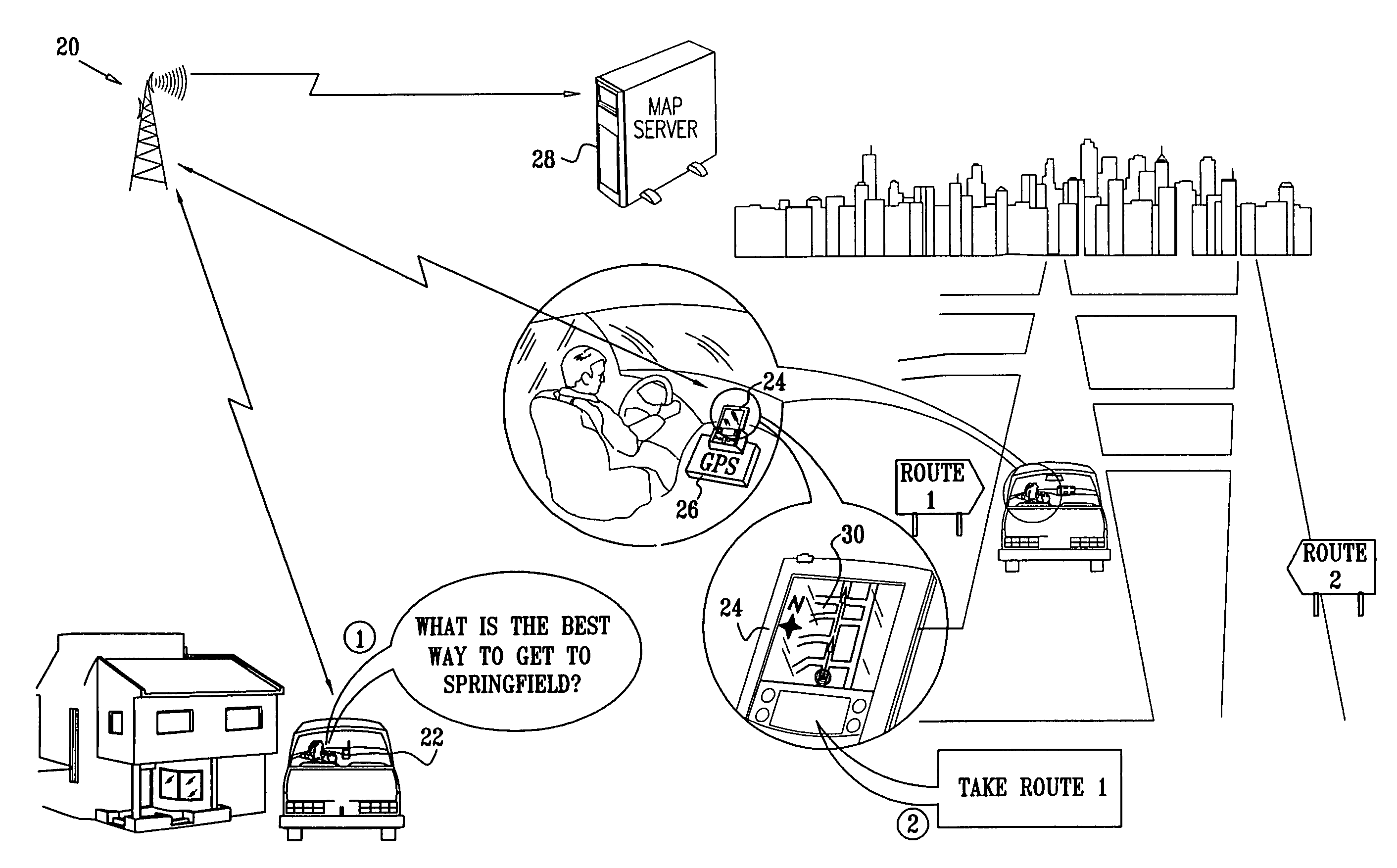
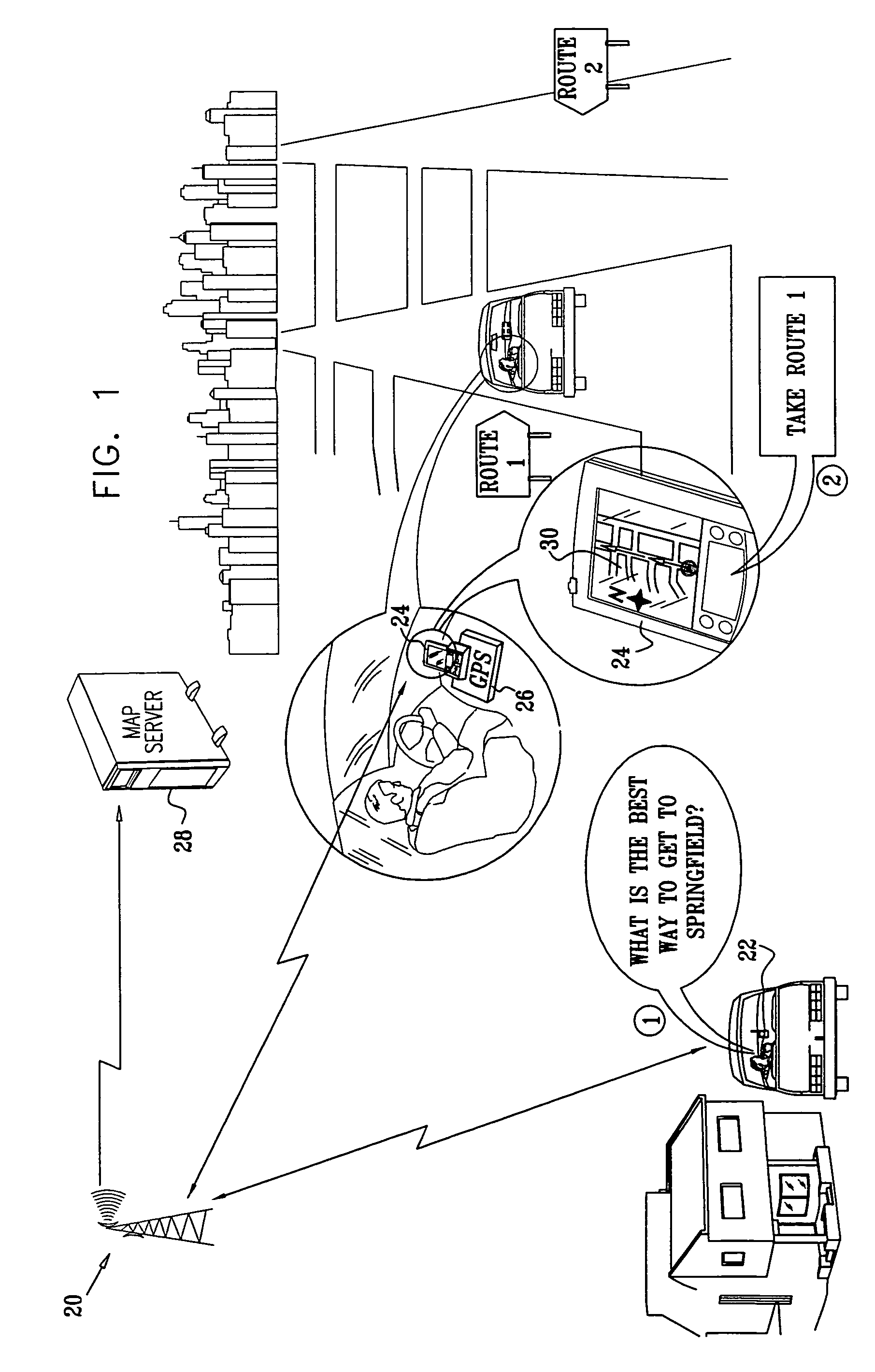
[0070]FIG. 1 is a simplified pictorial illustration of a real-time map distribution and display system 20, constructed and operative in accordance with an embodiment of the present invention. As seen in FIG. 1, a driver of a vehicle 22 communicates with a map server 28 via a client device 24, typically a wireless communicator, such as a personal digital assistant (PDA) 24 having cellular telephone functionality or a smart cellular telephone. Optionally, PDA 24 communicates with server 28 via an interactive voice response (IVR) processor and / or via the Internet. Server 28 typically comprises a general-purpose computer, comprising a memory in which map data are stored and processor, which carries out the methods described herein under the control of software. The software may be downloaded to the processor in electronic form, over a network, for example, or it may alternatively be provided on tangible media, such as CD-ROM, DVD, magnetic media or non-volatile memory.

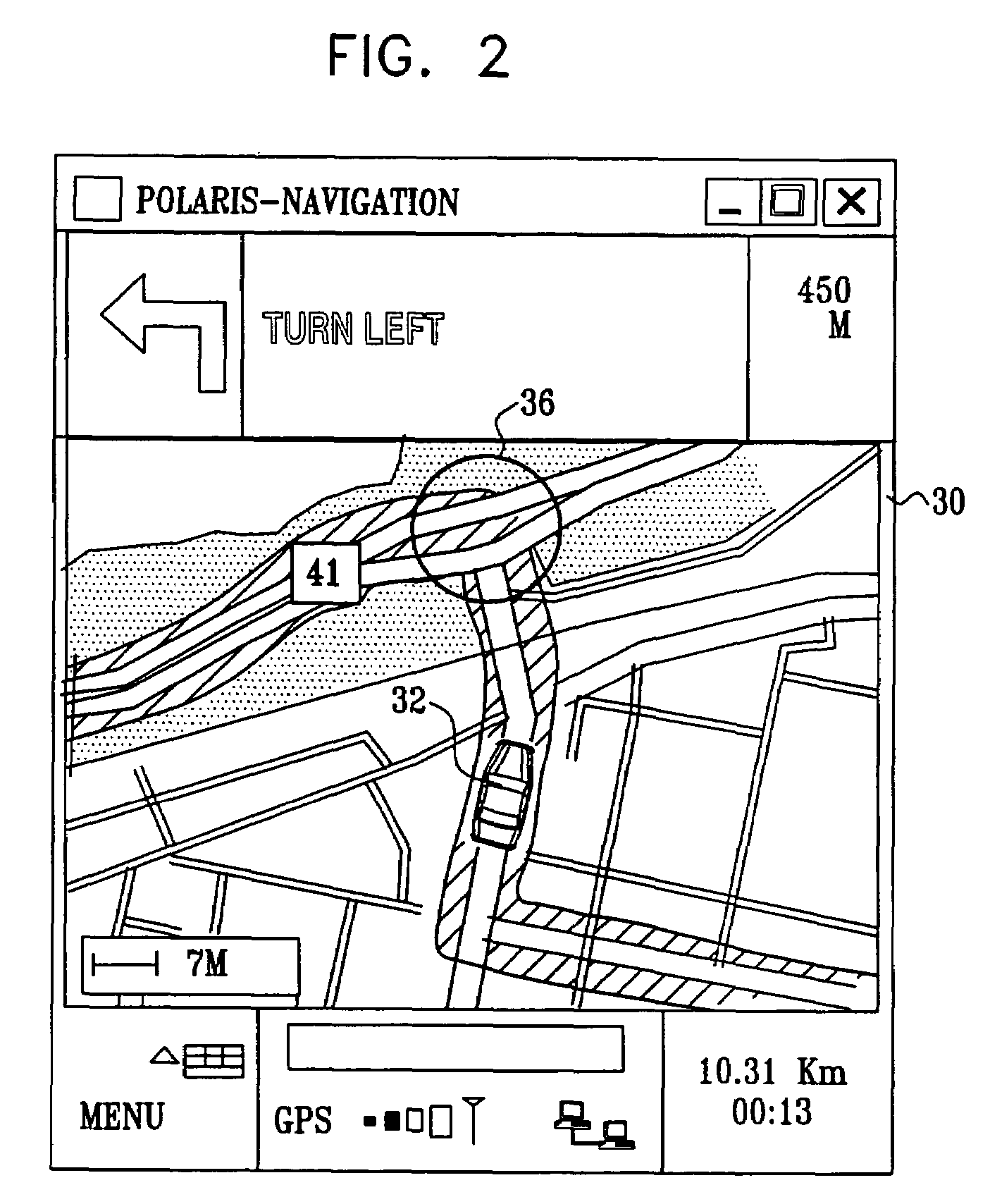
[0071]A location d...


PUM


Abstract

A method for displaying a map on a mobile client device. The method includes storing map data on a server, the map data including road data with respect to roads of multiple different road types. The server determines a route from a starting point to a destination within an area covered by the map data, the route including one or more route segments. The server defines a corridor map including the route segments and the roads of the different road types that are within different, respective distances, determined by the road types, of the route segments. The server downloads the road data with respect to the route segments and the roads of the different road types included in the corridor map to the client device. The client device, using the downloaded road data, renders one or more images, each image comprising at least a respective portion of the corridor map.

Description

CROSS-REFERENCE TO RELATED APPLICATION[0001]This application is related to U.S. patent application Ser. No. 10 / 426,946, filed Apr. 30, 2003, published as US 2004 / 0030493 A1, which is assigned to the assignee of the present patent application and whose disclosure is incorporated herein by reference.COPYRIGHT NOTICE[0002]A portion of the disclosure of this patent document contains material that is subject to copyright protection. The copyright owner has no objection to the facsimile reproduction by anyone of the patent document or the patent disclosure, as it appears in the Patent and Trademark Office patent file or records, but otherwise reserves all copyright rights whatsoever.FIELD OF THE INVENTION[0003]The present invention relates generally to methods and systems for electronic download and display of maps, and specifically to route corridor maps.BACKGROUND OF THE INVENTION[0004]A variety of systems are known in the art for providing drivers with in-vehicle electronic routing map...

Claims


Application Information

Patent Timeline
Patent Type & Authority Patents(United States)
IPC IPC(8): G01C21/00G01S19/34
CPCG01C21/32G08G1/096861G08G1/096822G01C21/367G01C21/3889G01C21/3815
Inventor DOTAN, EMANUELKUPFERMAN, MICHAEL MENACHEMELAD, TAL
Owner TAHOE RES LTD
Why Eureka
Try Eureka