

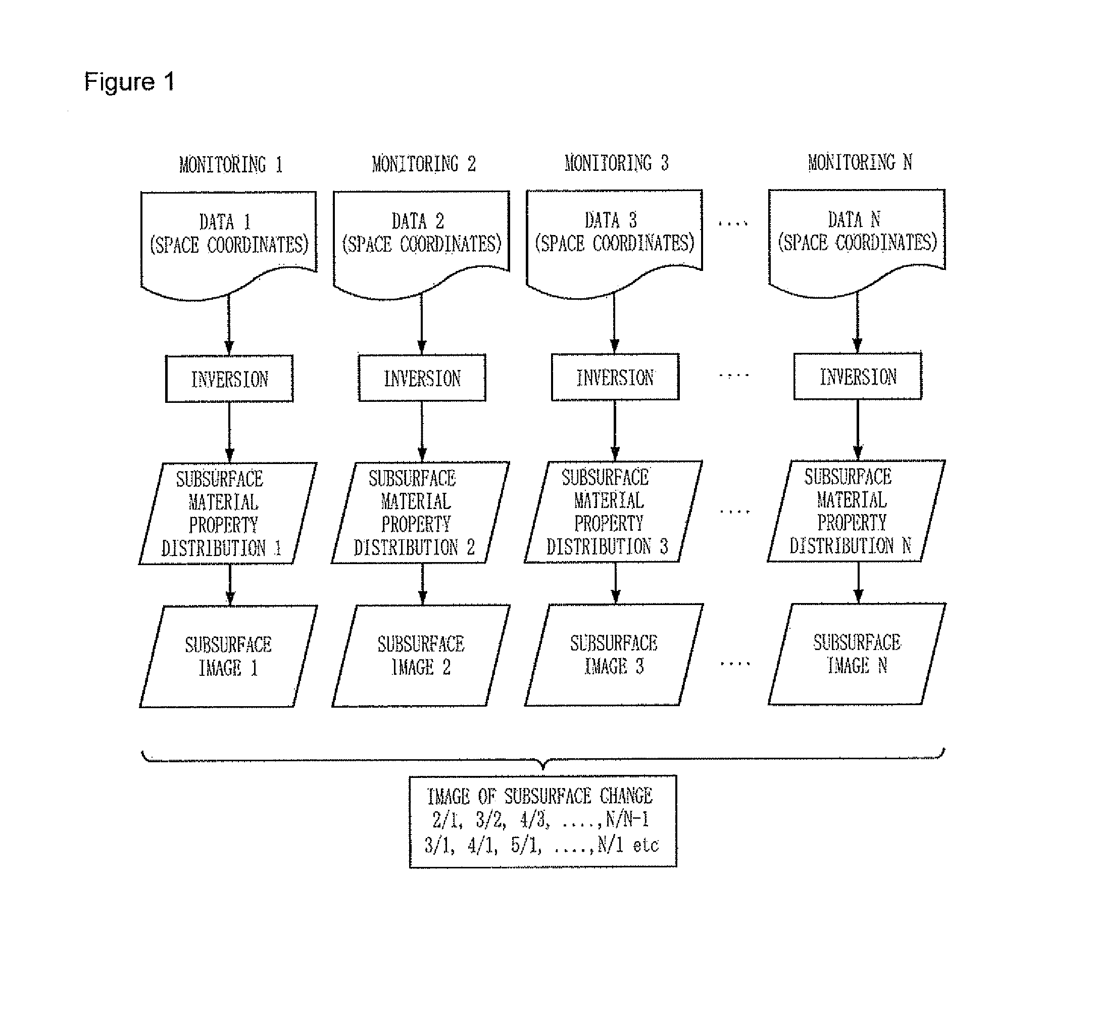
4-D inversion of geophysical data and 4-D imaging method of geological structure using it
a geophysical data and geophysical data technology, applied in the field of geophysical data inversion and geophysical data inversion 4d imaging method of geologic structure using it, can solve the problems of distorted subsurface images, high probability of erroneous analysis, and the distortion appearing in the image of changing geologic structure gets worse, so as to accurately calculate the change of geologic structure and achieve reliable images.
- Summary
- Abstract
- Description
- Claims
- Application Information
AI Technical Summary
Benefits of technology
Problems solved by technology
Method used
Image

Examples
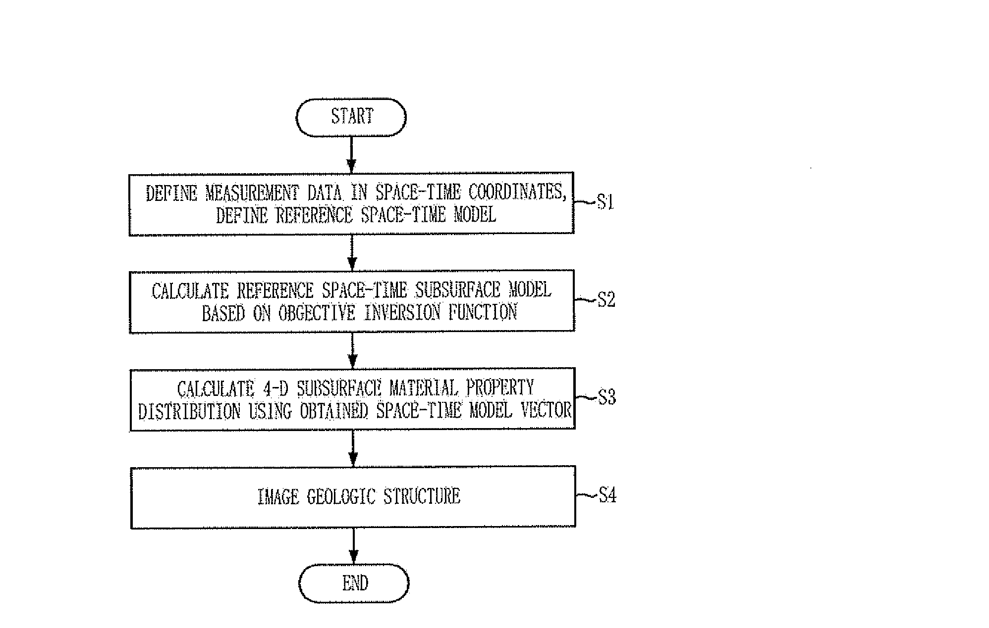
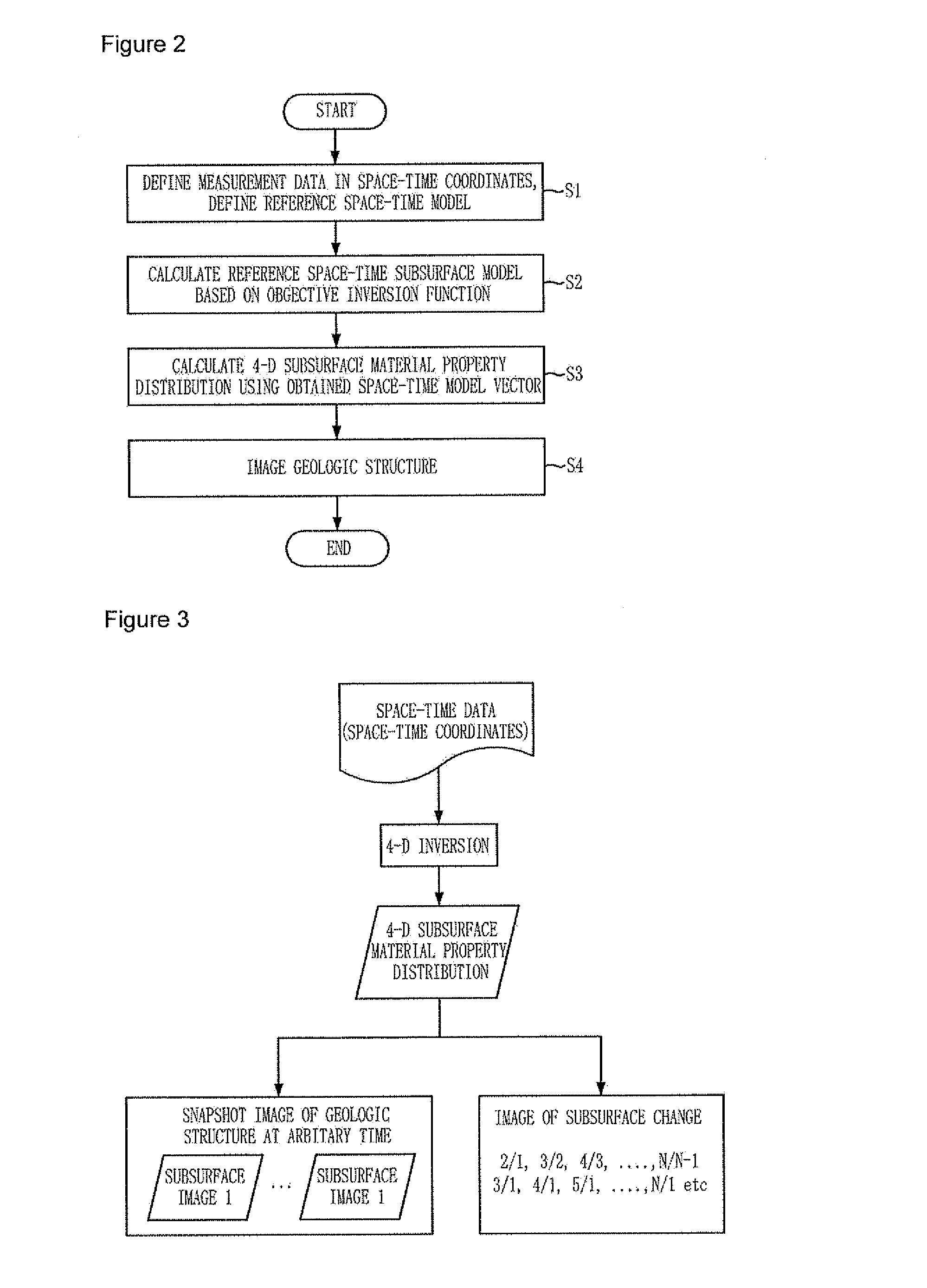
Embodiment Construction
[0065]Hereinafter, inversion experiments to verify effectiveness of the 4-D inversion and the imaging method using it according to the present invention will be explained.
[0066]The inversion experiments were conducted using non-conductive tomography numerical modeling data, pole-dipole array being adopted as an electrode array, the space-time model being sampled into 30 space models (n=30) continuously changing. Numerical modeling was conducted for all of 30 models, and one data set is configured from the data of 30 sets. It is apparent that experiments will be much more difficult in case only one data set exists rather than in case a plurality of iterative measured monitoring data exist, when geologic structure changes severely as above. This experiment was conducted under the assumption that only one data set is obtained.
[0067]One data set is composed of 1) crosshole, 2) inline, and 3) hole-to-surface surveys.
[0068]FIG. 4 shows snapshots of the model change of subsurface space set...
PUM
 Abstract
Description
Claims
Application Information