
Surveying instrument and method of providing survey data of a target region using a surveying instrument

a technology of surveying instrument and target region, which is applied in the field of surveying instrument and providing survey data of a target region using a surveying instrument, can solve the problems of time-consuming and laborious surveying of a target region, and achieve the effect of avoiding gaps between or overlaps of neighboring pixels, improving comfort and improving accuracy

Active Publication Date: 2011-09-20
TRIMBLE JENA
View PDF36 Cites 54 Cited by
  • Summary
  • Abstract
  • Description
  • Claims
  • Application Information

AI Technical Summary

Benefits of technology

Enables faster and more comfortable data acquisition with increased accuracy by generating panoramic images and projecting data onto defined surfaces, reducing the need for manual repositioning of the instrument and improving data processing efficiency.

Problems solved by technology

Thus, surveying of a target region, in particular of given objects in a target region, can be quite time consuming.

Method used


Image

  • Surveying instrument and method of providing survey data of a target region using a surveying instrument
  • Surveying instrument and method of providing survey data of a target region using a surveying instrument
  • Surveying instrument and method of providing survey data of a target region using a surveying instrument

Examples


Embodiment Construction

[0158]In the exemplary embodiments described below, components that are alike in function and structure are designated as far as possible by alike reference numerals. Therefore, to understand the features of the individual components of a specific embodiment, the descriptions of other embodiments and of the summary of the invention should be referred to.

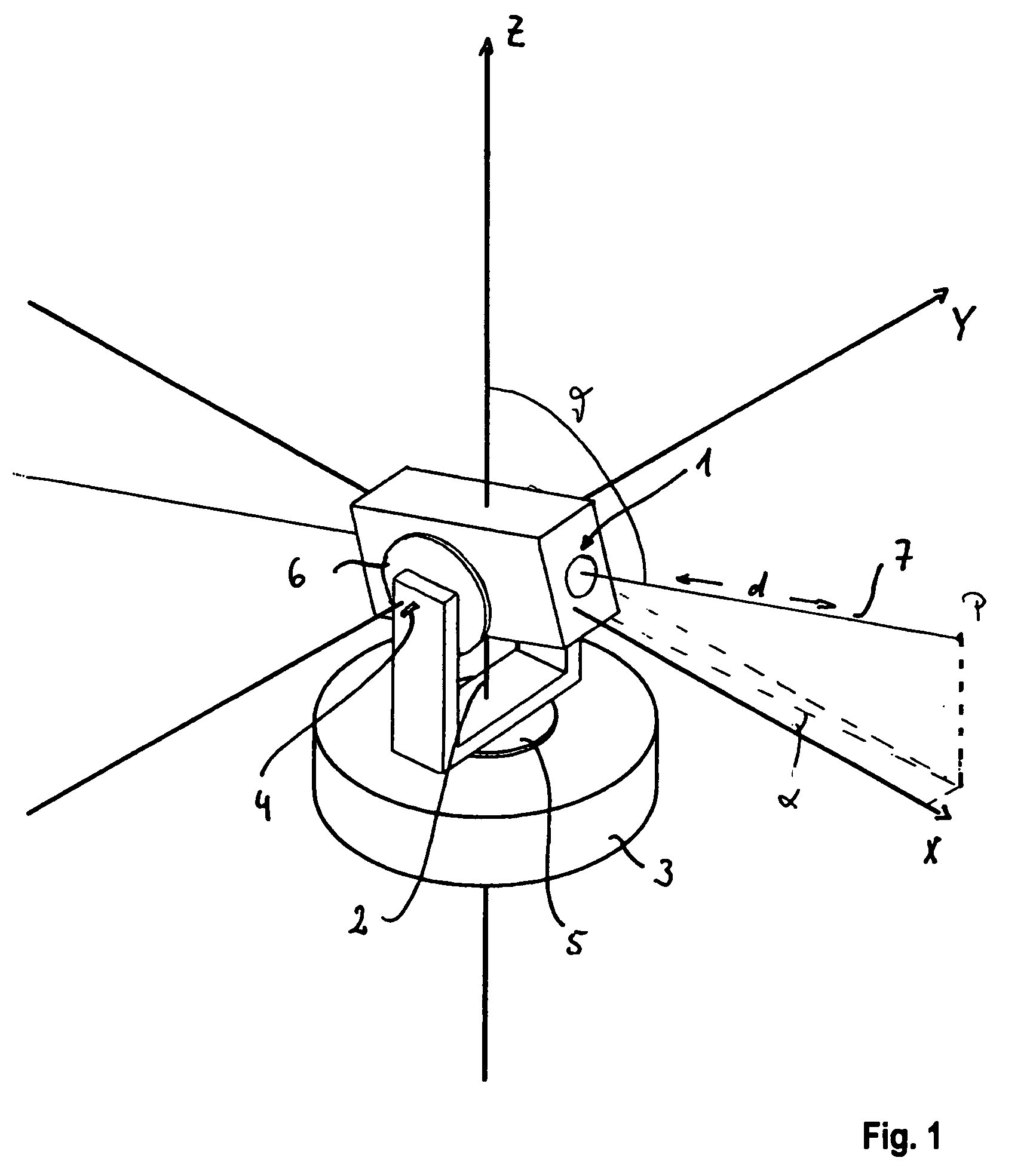
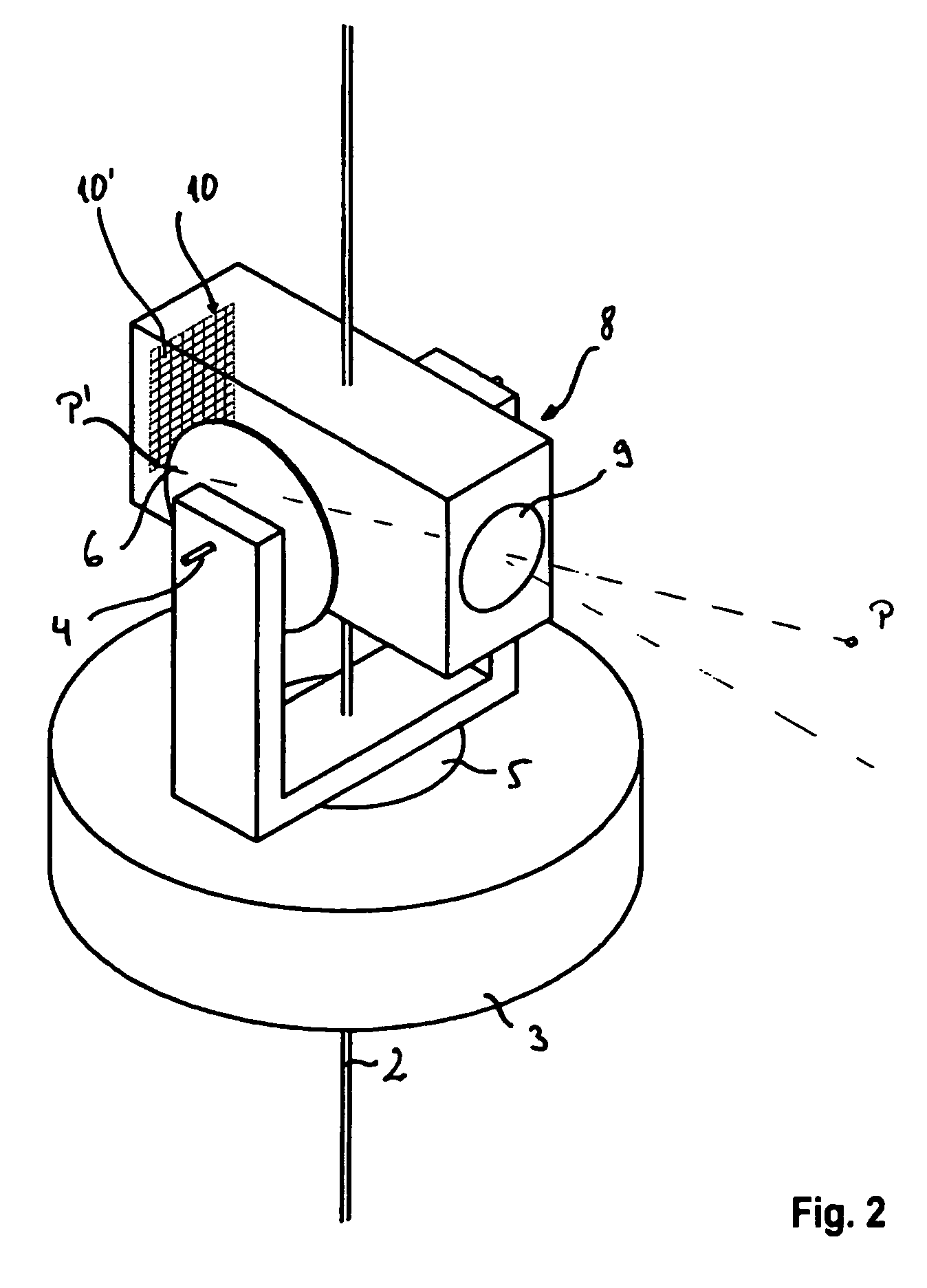
[0159]A video-tacheometer 11 according to a first embodiment of the invention is shown in FIGS. 3 to 5 in a schematic and simplified manner.

[0160]An alidade 12 is arranged on a base element 13 of a tripod 14 serving as stand for the video-tacheometer 11. The alidade 12 is rotatable about a vertical axis 15, which is oriented vertical to the ground if the video-tacheometer 11 is correctly oriented with respect to ground. The alidade 12 carries a telescope unit 16, which comprises in a housing 17, a finder camera 18 having a wide field of view and a telecamera 19. The telescope unit 16 is rotatable about a tilting axis 20, which is ort...


PUM


Abstract

A surveying instrument (11) comprises a telescope unit having imaging optics and an array of optical detector elements, orientation sensors detecting an orientation of the telescope unit, rotation drives for rotating the telescope unit about a horizontal and a vertical axis, a controllable distance-measuring unit, and a processing unit. The processing unit comprises a memory storing instructions and calibration data for relating the location of each optical detector element to a sighting direction and a processor for: obtaining target region data; obtaining projection surface data (133) representing a projection surface (135), acquiring a set of pixel data representing a two-dimensional image of a target region, transforming the set of pixel data to a set of projected image data representing a projection of the image to the projection surface using the calibration data, and storing the projected image data as surveying data.

Description

[0001]This application claims the benefit of U.S. Provisional Patent Application No. 60 / 716,338, filed on Sep. 12, 2005, the entire contents of which are incorporated herein by reference.BACKGROUND OF THE INVENTION[0002]1. Field of the Invention[0003]The present invention relates to a method of providing survey data using a surveying instrument, means for performing the method and a corresponding surveying instrument.[0004]2. Brief Description of the Related Art[0005]Surveying often includes determination of angles or of positions of points, e.g. reflectors (triple reflectors) or targets in the terrain. Those angles or positions may be measured by surveying instruments such as theodolites or tacheometers.[0006]Positions in space can be defined by coordinates in a suitable coordinate system. For example, the position of a point may be defined by its Cartesian coordinates which are defined with respect to a Cartesian coordinate system having three axes which are orthogonal to each oth...

Claims


Application Information

Patent Timeline
Patent Type & Authority Patents(United States)
IPC IPC(8): G06F19/00G01S17/89G06V10/24
CPCG01C15/00G01S5/163G06T3/4038G06K9/32G06T3/0062G01S17/89G06V10/24G06T3/12
Inventor KLUDAS, TORSTENSCHUNEMANN, AXELVOGEL, MICHAEL
Owner TRIMBLE JENA
Learn More