
Methodology and system for routing optimization in GPS-based Navigation, combining dynamic traffic data

a technology of dynamic traffic data and routing optimization, applied in navigation, surveying and navigation, instruments, etc., to achieve accurate routing

Active Publication Date: 2013-03-05
LIOTOPOULOS FOTIOS K +1
View PDF14 Cites 14 Cited by
  • Summary
  • Abstract
  • Description
  • Claims
  • Application Information

AI Technical Summary

Benefits of technology

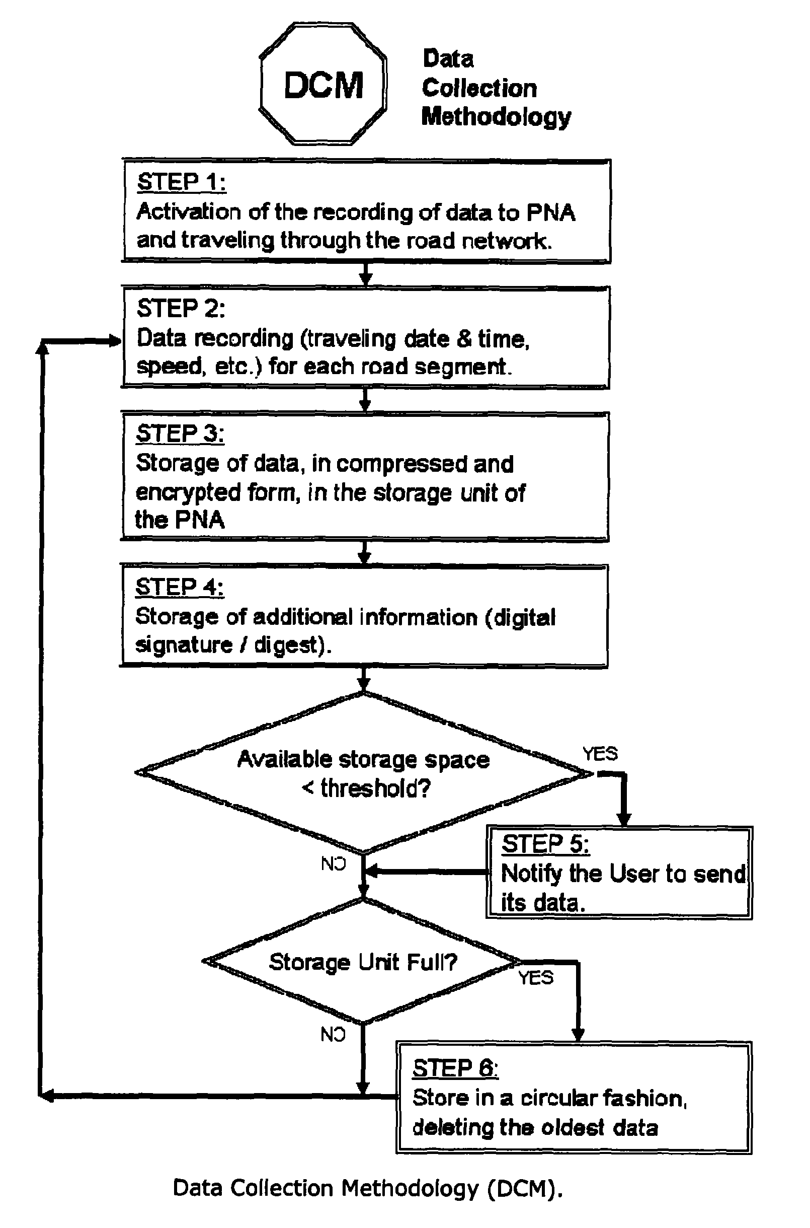
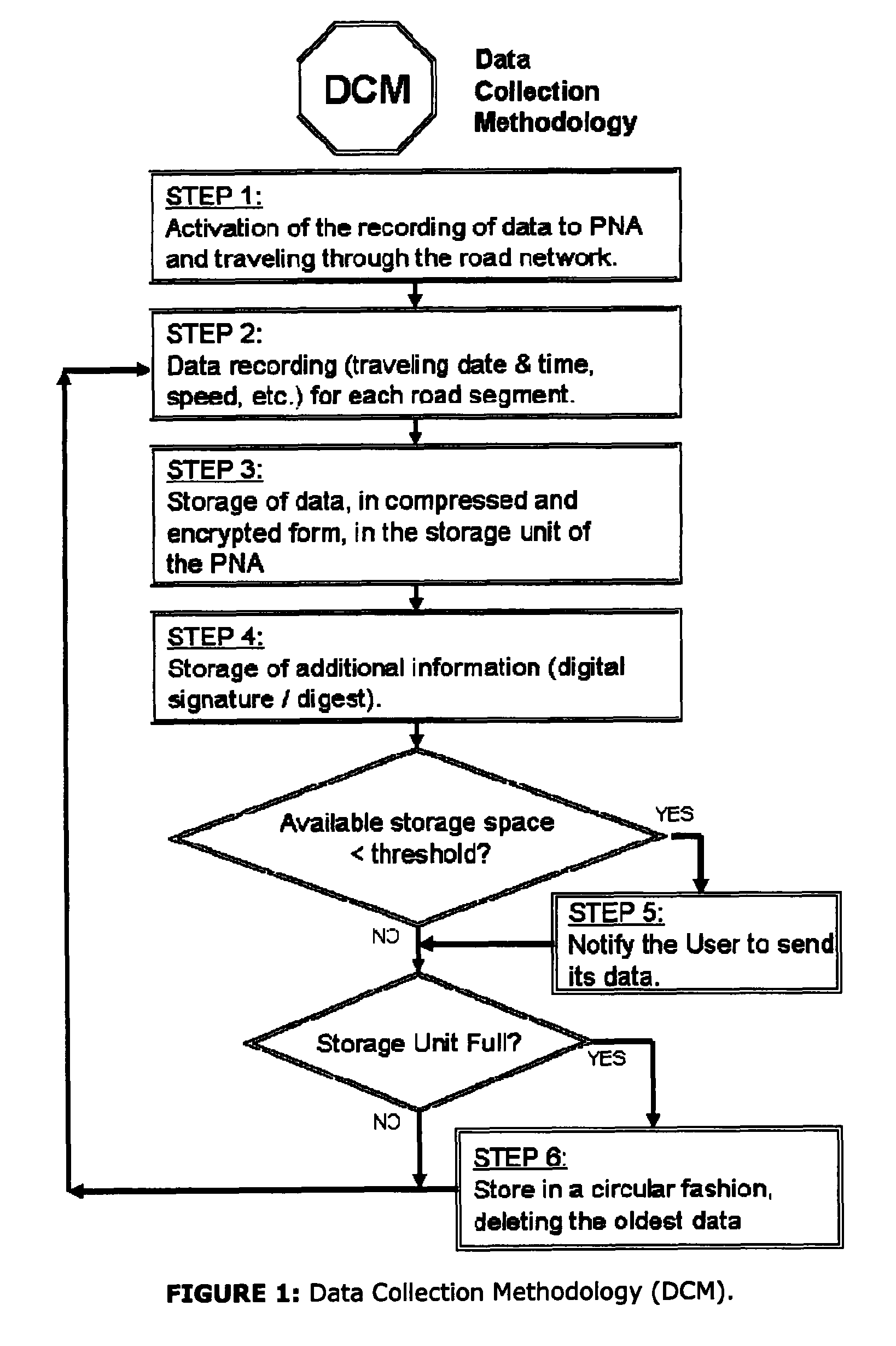
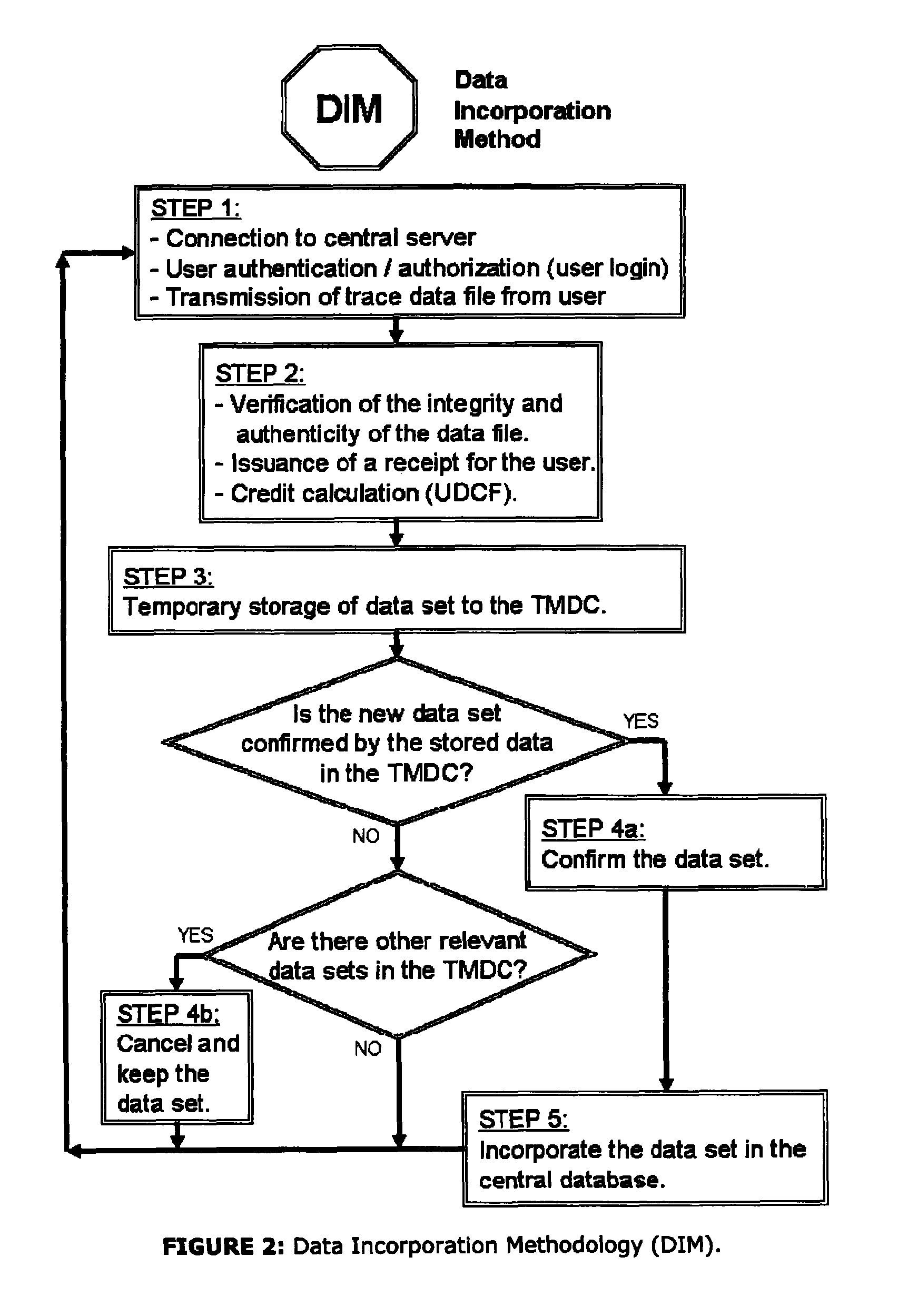
The present invention is related to a method for collecting, processing and distributing traffic data to improve the accuracy of GPS-based Personal Navigation Assistants (PNAs). The method includes a data collection method for information related to traffic flow in each road, a data incorporation method performed at a central system outside the PNA for incorporating user-submitted route-related information, and a routing method performed by suitable PNA software for determining the shortest route from a starting point to a final destination by combining static data from existing maps with dynamic data derived from the data collection and incorporation methods. This technology can help drivers to reach their destinations faster and safer by providing more accurate routing information.

Problems solved by technology

However, this data is of general type (i.e. not directly exploitable by the available PNAs) and the respective systems do not process nor distribute road-segment related information for the optimization of the routing, but simply compose a common global map without traffic data about the road network.

Method used


Image

  • Methodology and system for routing optimization in GPS-based Navigation, combining dynamic traffic data
  • Methodology and system for routing optimization in GPS-based Navigation, combining dynamic traffic data
  • Methodology and system for routing optimization in GPS-based Navigation, combining dynamic traffic data

Examples


Embodiment Construction

Advantages of Our Methodology and Systems

[0039]The time-dependent data collected and used by our method and systems lead to more accurate routing decisions than those from the commercially available PNA, which are based on static traffic information (e.g. the speed limit or the kind of the road).[0040]The method and the systems do not require special infrastructure or other external information sources (e.g. road sensors or mobile phone density depiction). These external information sources may be exploited for further optimization of the routing decision, but their use is optional.[0041]The method and the systems provide results more accurate than those from other methods, which are based on references and density data of the mobile-telephony users, since these methods do not accurately distinguish and isolate traffic data for specific roads, or for vary small roads.[0042]The method and the systems have an inherent, independent mechanism: a) for the production of new maps (as regar...


PUM


Abstract

Disclosed is a methodology for the collection, processing and distribution of traffic data and delivering more accurate routing in GPS-based Personal Navigation Assistants (PNAs). The methodology includes a) Data Collection Methodology (DCM), b) a Data Incorporation Methodology (DIM), and c) a Routing Methodology (RM). The DCM regards the collection of information related to the traffic flow in each road. The DIM includes a procedure executed at a central system (CS), outside the PNA, performing the incorporation of the “trace data” (i.e. user-submitted route-related information, including a list of periodically collected, time-stamped GPS samples, augmented with other parameter values defining the vehicle-type, weather-conditions, road-type, holiday-type), collected by the DCM. The RM determines, by means of suitable PNA software, the shortest route from a starting point to a final destination, through the combining the static data from existing maps residing inside the PNA, with the dynamic (time-variant) data derived by the DIM.

Description

CROSS-REFERENCE TO RELATED APPLICATIONS[0001]This Application is the U.S. National Phase of International Patent Application PCT / GR2009 / 000066 filed 10 Dec. 2009 METHODOLOGY AND SYSTEM FOR ROUTING OPTIMIZATION IN GPS-BASED NAVIGATION, COMBINING DYNAMIC TRAFFIC DATA. Application PCT / GR2009 / 000066 claims priority benefits under 35 U.S.C §119 of Application GR 20080100812, filed 22 Dec. 2008.BACKGROUND OF THE INVENTION[0002]1. Field of the Invention[0003]The methodology and system relates to an improvement on the routing accuracy of GPS-based navigation systems, or “Personal Navigation Assistants” (PNAs), using a combination of user collected dynamic traffic data.[0004]2. Description of Related Art[0005]One of the most useful operations of a PNA is the determination of the optimal (or sub-optimal) route between two points (start and destination), based on specific criteria and constraints. The theoretical problem of the routing optimization between two nodes in a system of interconnect...

Claims


Application Information

Patent Timeline
IPC IPC(8): G01C21/00
CPCG08G1/0969G01C21/3492G08G1/0968
Inventor LIOTOPOULOS, FOTIOS K.KARYPIDOU, PARASKEVI
Owner LIOTOPOULOS FOTIOS K
Learn More