
Validity check of vehicle position information

a vehicle position and information technology, applied in the field of traffic surveillance, can solve the problems of nuisance warnings, uncertainty in the determined relative position, and the tcas system of today is not considered suitable for future collision avoidance and/or separation provision systems, so as to reduce the risk of malicious use and less prone to errors

Active Publication Date: 2013-12-17
SAAB AB
View PDF8 Cites 3 Cited by
  • Summary
  • Abstract
  • Description
  • Claims
  • Application Information

AI Technical Summary

Benefits of technology

The present invention provides a vehicle surveillance system that is less prone to errors and less sensitive to malicious use. The method discards received positional data that is found unreliable, ensuring that navigational decisions are made based on correct information of surrounding traffic, which increases safety in such systems. The use of such systems for automatic aircraft separation provision reduces fuel consumption since their pre-programmed flight plan is not altered due to erroneous ADS-B messages reported by surrounding radio sources.

Problems solved by technology

A drawback of today's TCAS systems is the uncertainties in the determined relative position (especially at large distances) due to the uncertainties in the directional antennas and the estimated distances to surrounding aircraft.
These uncertainties may result in nuisance warnings from the system.
The TCAS systems of today are therefore not considered to be suitable candidates for future collision avoidance and / or separation provision systems.
Unfortunately, ADS-B systems of today suffer from a drawback.
This is both a safety and security problem, safety in the sense that if the transmitting system emits an erroneous position it might cause a hazardous situation, and security in the sense that the system becomes prone to malicious use by emitting faked position reports.
For example, if an ADS-B message indicates an erroneous position of the aircraft from which it is transmitted, decisions made on the basis of that ADS-B message may have devastating consequences.
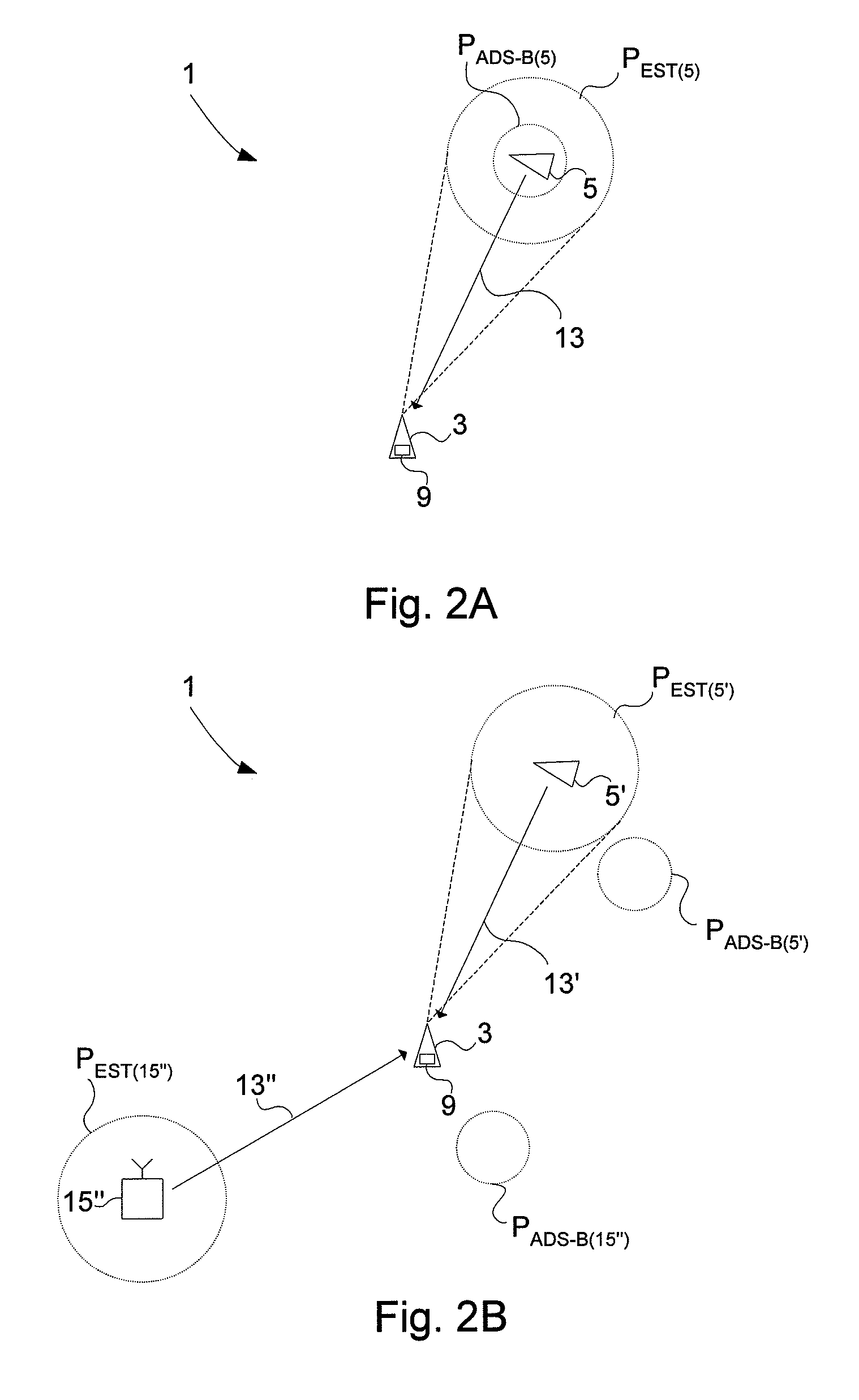
Since the method is used in a self-reporting vehicle surveillance system, meaning that each vehicle transmits positional data indicating its own position, a mismatch between the alleged position of a vehicle according to the received data and the estimated position of the radio source indicates that something is not right and that the received positional data cannot be indiscriminately relied upon.

Method used


Image

  • Validity check of vehicle position information
  • Validity check of vehicle position information
  • Validity check of vehicle position information

Examples


Embodiment Construction

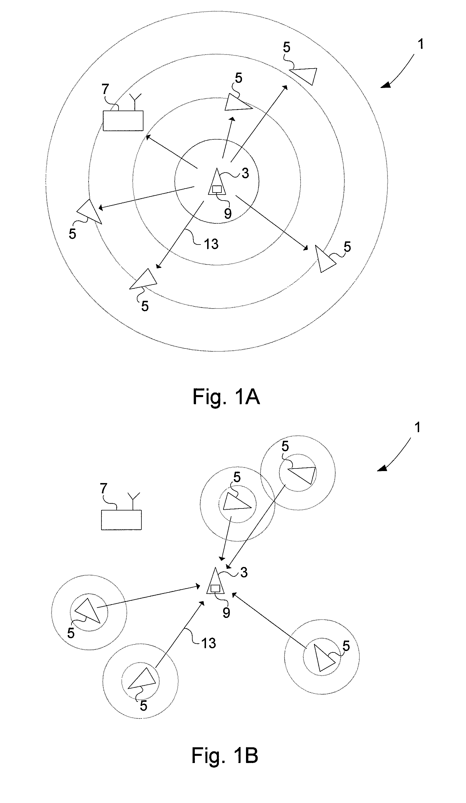
[0060]An aircraft or an air traffic control (ATC) ground station utilizing an ADS-B-based vehicle surveillance system is completely dependent on that the information in ADS-B messages received from surrounding aircraft is correct. Specifically, positional data contained in the ADS-B messages from emitting aircraft have to be trusted to be correct. The flaw is that as long as the received messages conform to the correct format they will be interpreted as ADS-B messages and, as such, relied upon by the vehicle surveillance systems. This fact makes ADS-B-based vehicle surveillance systems extremely vulnerable to ADS-B transponder malfunction and malicious use by transmission of faked ADS-B data.

[0061]All three data link technologies (Mode S ES, VDL Mode 4 and UAT) used for ADS-B suffer from the same shortcoming; the receiver of a message does not have any means to check whether the contents of the message are valid. An erroneous report will not be detected as long as it conforms to the...


PUM


Abstract

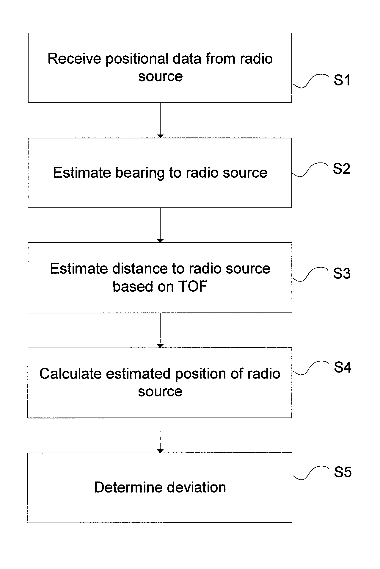
A method for validating received positional data in vehicle surveillance applications wherein vehicles transmit positional data indicating their own position to surrounding vehicles. A a radio direction finding antenna arrangement of a receiving unit receives a signal carrying positional data indicating an alleged position of a vehicle, transmitted from a radio source. The bearing from the receiving unit to the radio source is estimated utilizing the radio direction finding antenna arrangement and the received signal. The distance between the receiving unit and the radio source is estimated based on the time of flight for a signal travelling there between at known speed. An estimated position of the radio source is calculated based on the estimated bearing and the estimated distance. A deviation value indicating the deviation / coincidence between the alleged position of a vehicle is determined according to the received positional data and the estimated position of the radio source.

Description

CROSS-REFERENCE TO RELATED APPLICATIONS[0001]This application claims priority to European patent application 08158503.6 filed 18 Jun. 2008 and is the national phase of PCT / SE2009 / 0505701 filed 10 Jun. 2009.TECHNICAL FIELD[0002]The present invention relates to the field of traffic surveillance, and more particularly to a method for validating positional data allegedly indicating the position of a vehicle.BACKGROUND ART[0003]Traffic Surveillance and Traffic Management[0004]Surveillance of air traffic is today managed by air traffic control (ATC) systems using primary and secondary radar. ATC systems currently under development use other or complementary techniques in the surveillance of air traffic. One such system is called automatic dependent surveillance-broadcast (ADS-B) which, on a long time scale, is expected to gradually replace current systems as a source for ATC information.[0005]The basic idea of the ADS-B system is that all aircraft broadcast their own state vector, compris...

Claims


Application Information

Patent Timeline
Patent Type & Authority Patents(United States)
IPC IPC(8): G01S13/74G08G5/00G01S5/02G01S13/93G01S13/933
CPCG01S5/0072G01S13/765G01S13/9303G08G5/0008G08G5/0021G08G5/04G01S13/865G01S13/91G01S2205/003G01S13/933
Inventor ANDERSSON, SVANTEPERSSON, ANDREAS
Owner SAAB AB
Learn More