

Land surveying using GNSS device
a technology of land surveying and gnss, applied in wave based measurement systems, using reradiation, instruments, etc., can solve problems such as generating incorrect boundaries for plots of land, problems that may occur
- Summary
- Abstract
- Description
- Claims
- Application Information
AI Technical Summary
Benefits of technology
Problems solved by technology
Method used
Image

Examples
Embodiment Construction
[0038]The following description is presented to enable a person of ordinary skill in the art to make and use the various embodiments. Descriptions of specific devices, techniques, and applications are provided only as examples. Various modifications to the examples described herein will be readily apparent to those of ordinary skill in the art, and the general principles defined herein may be applied to other examples and applications without departing from the spirit and scope of the invention as claimed. Thus, the various embodiments are not intended to be limited to the examples described herein and shown, but are to be accorded the scope consistent with the claims.
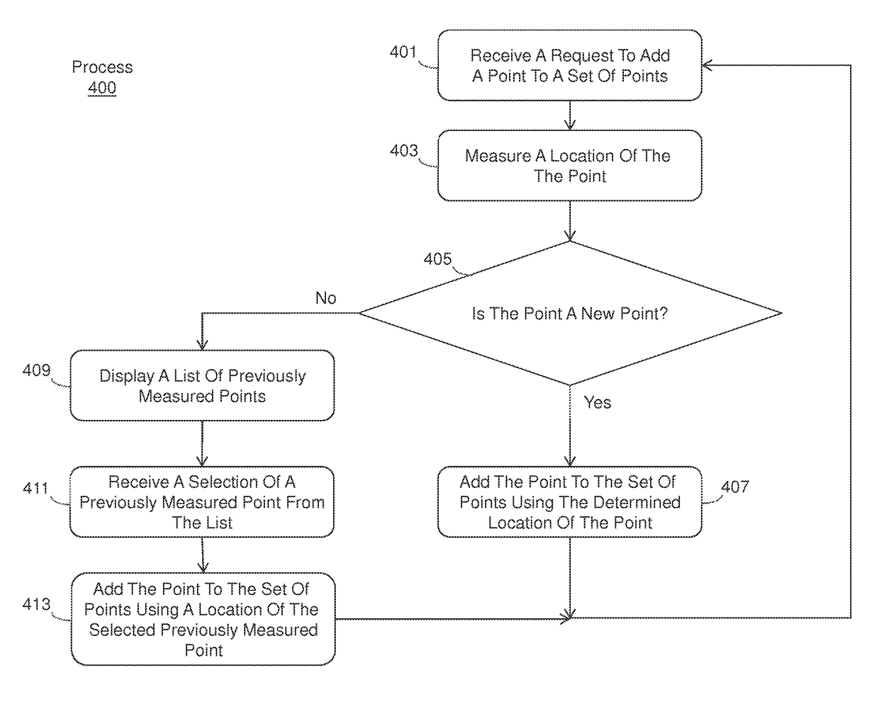
[0039]Systems and methods for surveying using a GNSS device are provided. In one example method, a GNSS device may be used to determine the location of points along a path and to add those points to a set of points representing the path. When adding each point, the device may determine if the point represents a new poi...
PUM
 Abstract
Description
Claims
Application Information