Method and apparatus for processing geography information based on spot source

An information processing method and point source technology, which are applied in the field of point source-based geographic information processing and devices, can solve the problems of limited analysis and decision-making transaction realization, data segmentation of different scales, etc., and achieve the effect of loading and fusion.

Inactive Publication Date: 2008-06-25
孙建中 +1
View PDF0 Cites 6 Cited by
  • Summary
  • Abstract
  • Description
  • Claims
  • Application Information

AI Technical Summary

Problems solved by technology

In such a GIS, all kinds of queries and calculations can only be performed on the same layer, and there is basically no interactive relationship between spatial data of different scales, resulting in the separation of data of different temporal

Method used


Image

  • Method and apparatus for processing geography information based on spot source
  • Method and apparatus for processing geography information based on spot source
  • Method and apparatus for processing geography information based on spot source

Examples


Embodiment Construction

[0029] The present invention will be further described below in conjunction with the accompanying drawings and embodiments.

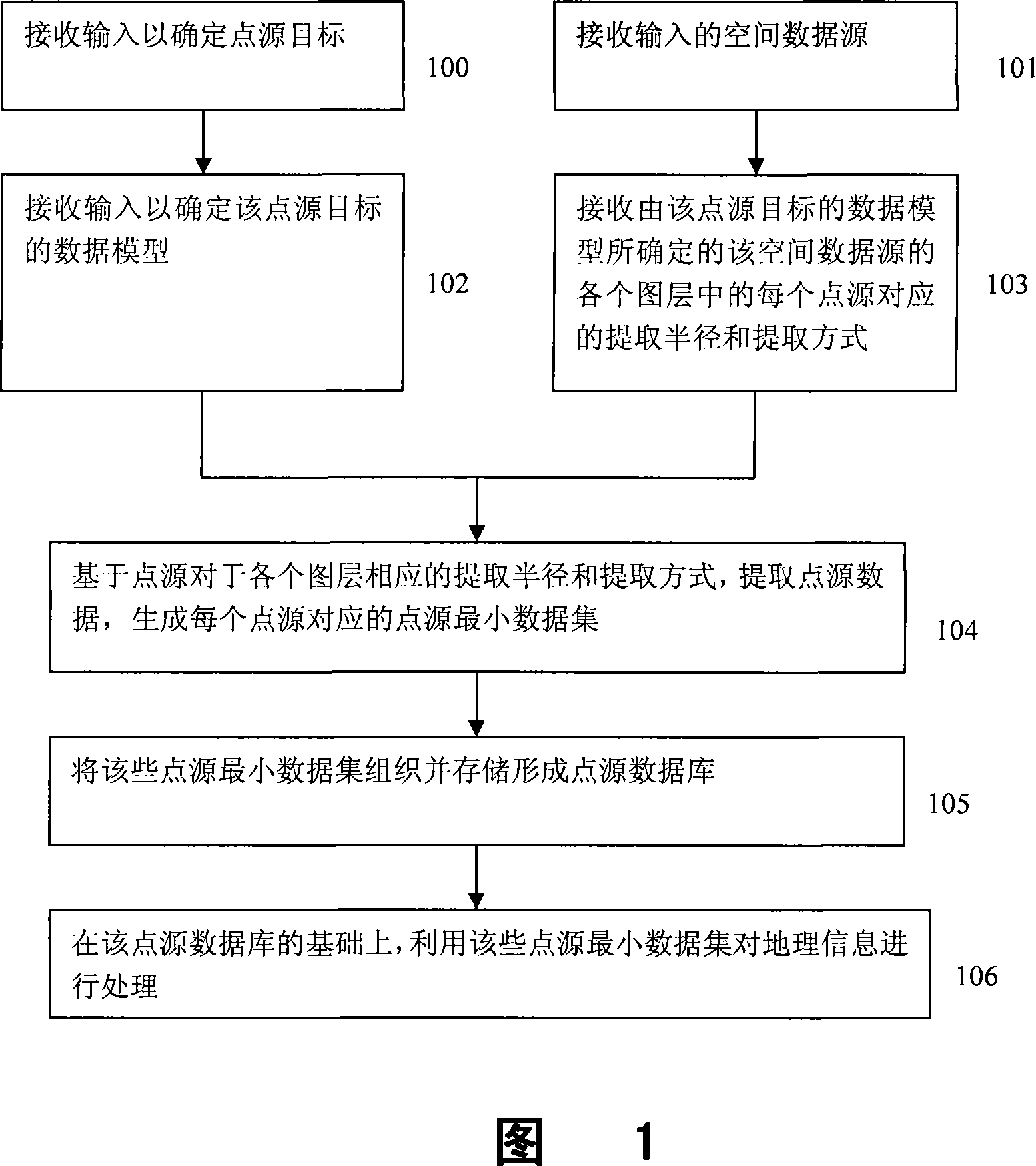
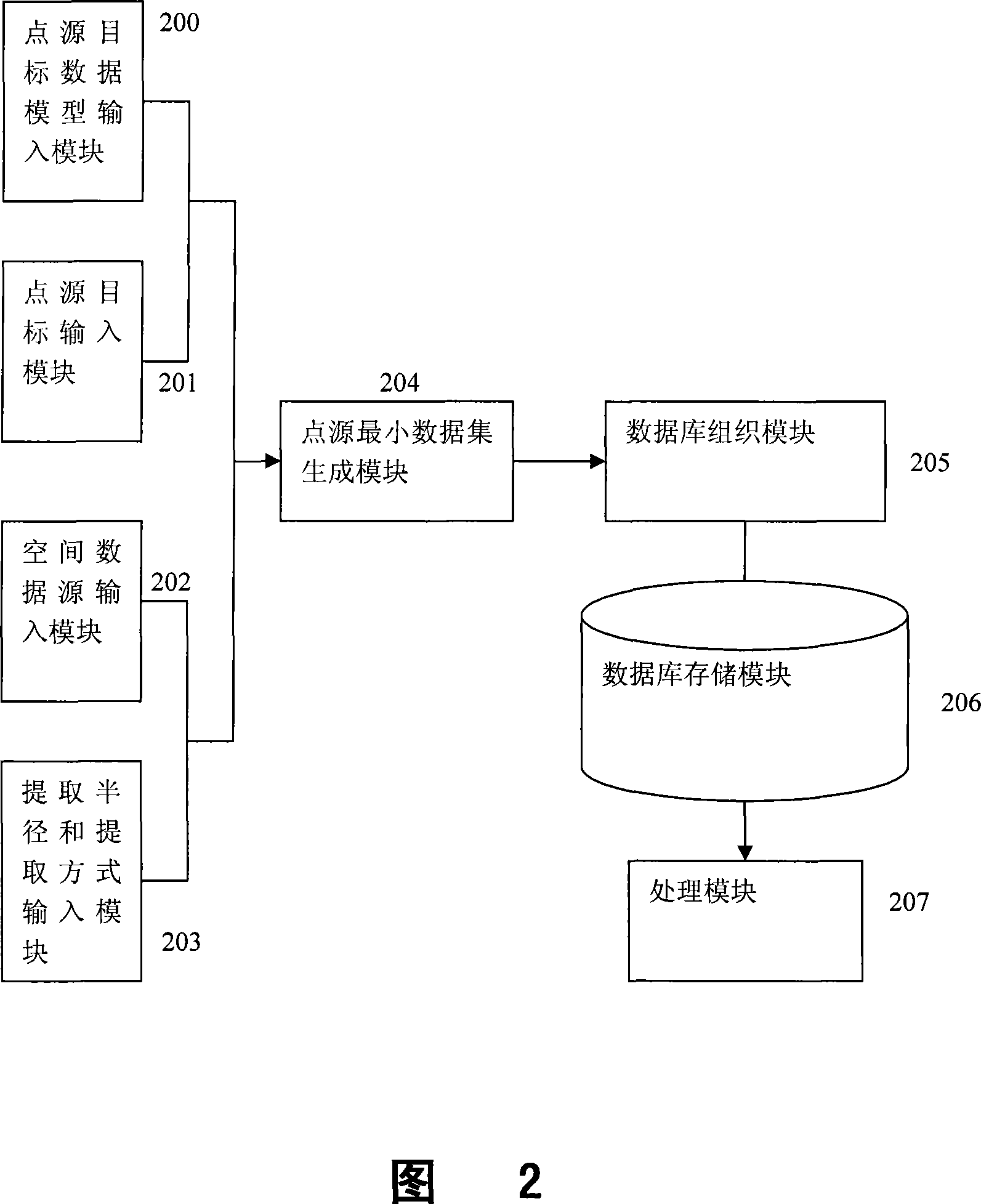
[0030] Fig. 1 shows the flow of a preferred embodiment of the point source-based geographical information processing method of the present invention. Please refer to Figure 1, the following is a detailed description of each step in the method.

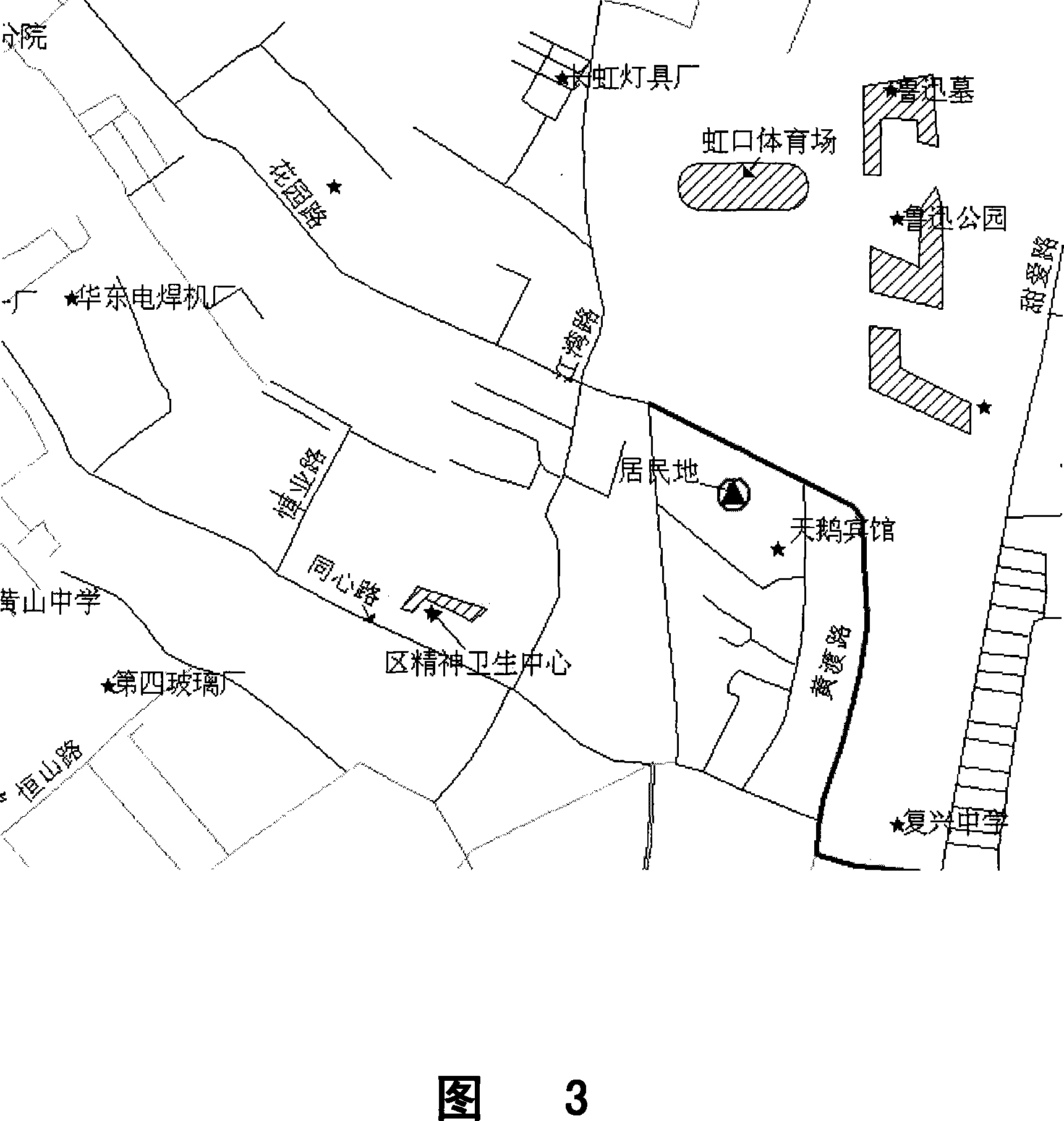
[0031] In the process of describing this embodiment, it is described in conjunction with an example of human settlement environment evaluation. Human settlements evaluation is based on the standard human settlements evaluation index system to achieve data acquisition, statistics, analysis, and finally achieve the purpose of comprehensive scoring of human settlements.

[0032] Step S100: Receive an input to determine a point source target.

[0033] That is, an abstract point source target, which can be any target or event on the surface of the earth. In the evaluation of human settlements, according to the nee...


PUM


Abstract

The invention discloses a geographic information processing method based on a point source and a device. The invention realizes the data organization directly facing spatial solid targets and the interaction of spatial data with different sizes and times and states. The technical proposal is as follows: the method comprises the following steps that: an input is received to determine a point source target, an inputted spatial data source is received; an input is received to determine a data model of the point source target, extraction radius and extraction way corresponding to each point source in each layer of the spatial data source determined by the data model of the point source target are received; point data are generated on the basis of the extraction radius and the extraction way of each layer corresponding to each point source to generate the minimum point source data set corresponding to each point source; the minimum point source data sets are organized and stored to form a point source database; on the basis of the point source database, the minimum point source data sets are adopted to process the geographic information. The invention is applicable to the geographic information analysis field.

Description

technical field [0001] The present invention relates to a geographic information processing method and device, in particular to a geographic information processing method and device for converting traditional GIS (Geographic Information System) data organization by means of point sources. Background technique [0002] Geographic Information System (GIS) is a class of computer application systems that acquire, process, analyze, represent, and transmit digitized spatial data between different systems, different locations, and different users. Spatial location, attribute and time are the three elements of geospatial analysis. Traditional GIS uses layers as the basis of processing to realize static, single-temporal spatial data organization and management. In such a GIS, all kinds of queries and calculations can only be performed on the same layer, and there is basically no interactive relationship between spatial data of different scales, resulting in the separation of data of...

Claims


Application Information

Patent Timeline
IPC IPC(8): G06F17/30
Inventor 孙建中戎恺
Owner 孙建中
Why Eureka
Try Eureka