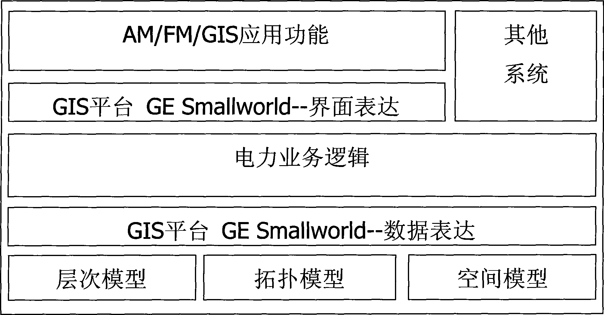
Geographical information system used for electric system
A geographic information system and power system technology, applied in the field of electric power digital comprehensive management system, can solve the problems that power planning and construction cannot meet the development needs, and achieve high security and economical effects
- Summary
- Abstract
- Description
- Claims
- Application Information
AI Technical Summary
Problems solved by technology
Method used
Image
Examples
Embodiment 1
[0015] A kind of geographic information system used for electric power system of the present invention comprises following functional modules:
[0016] 1. Man-machine interface Man-machine interface
[0017] The human-machine world is friendly, the mouse is combined with the keyboard, and the functions of conventional operations are added to the toolbar and the right-click menu of the mouse, making the operation intuitive and simple, clear at a glance, simple and flexible; the main interface is all built with the magik language provided by the Smallworld platform, which fully complies with The operating habits of Windows users.
[0018] 2. Basic geographic data Basic geographic data
[0019] (1) Support hierarchical display control;
[0020] (2) It can convert existing electronic maps (DXF, DWG, DGN, SHAPEFILE and other formats) or perform manual counting;
[0021] (3) Characterization, providing complete graphics production tools;
[0022] (4) Support seamless splicing of...
PUM
 Abstract
Description
Claims
Application Information
 - R&D
- Intellectual Property
- Life Sciences
- Materials
- Tech Scout
- Unparalleled Data Quality
- Higher Quality Content
- 60% Fewer Hallucinations
Browse by: Latest US Patents, China's latest patents, Technical Efficacy Thesaurus, Application Domain, Technology Topic, Popular Technical Reports.
© 2025 PatSnap. All rights reserved.Legal|Privacy policy|Modern Slavery Act Transparency Statement|Sitemap|About US| Contact US: help@patsnap.com

