

Three-dimensional R tree spacial index method considering levels of detail
A multi-level of detail and spatial indexing technology, applied in the field of geographic information systems, can solve problems such as serious overlapping of nodes in the same layer, low efficiency of spatial query, irregular node shapes, etc. The effect of subtraction and node shape regularity
- Summary
- Abstract
- Description
- Claims
- Application Information
AI Technical Summary
Problems solved by technology
Method used
Image

Examples
Embodiment
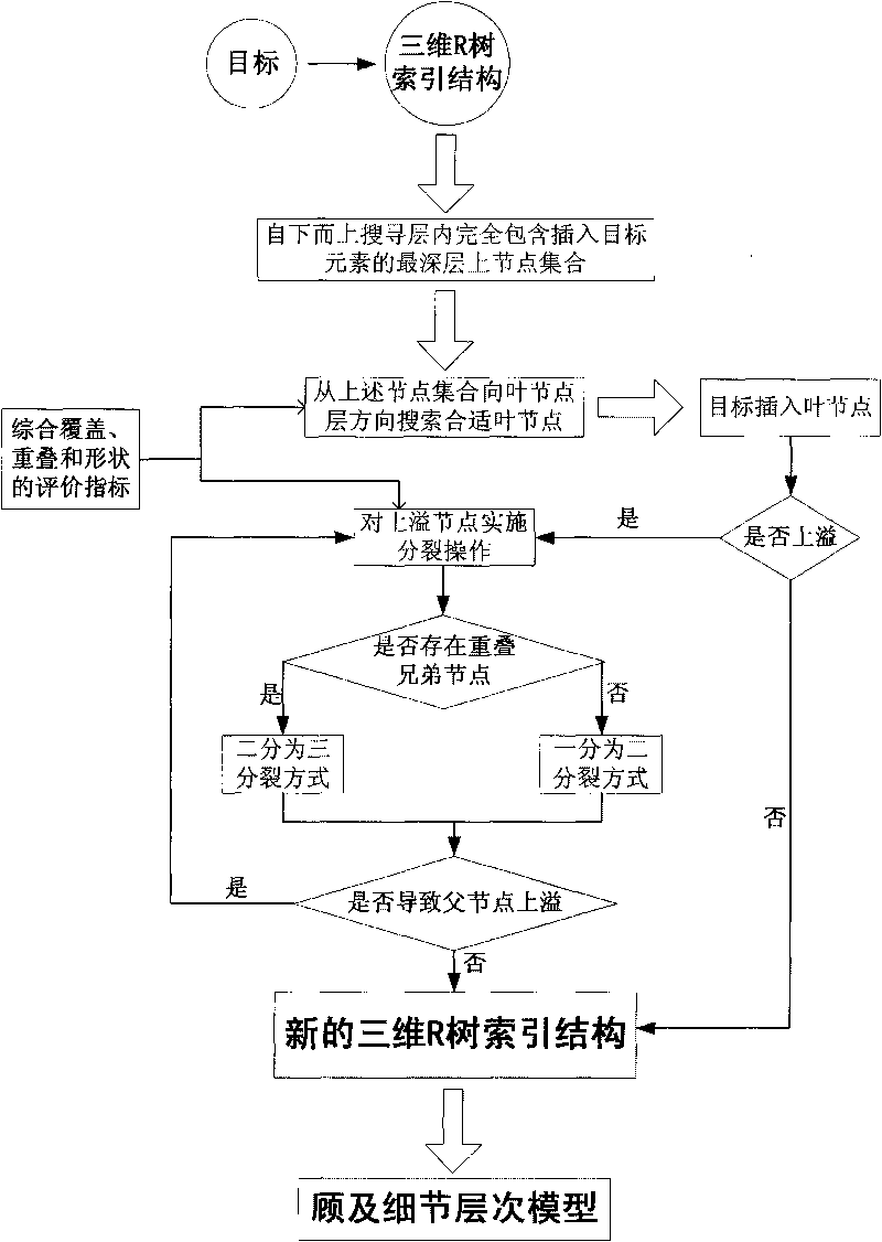
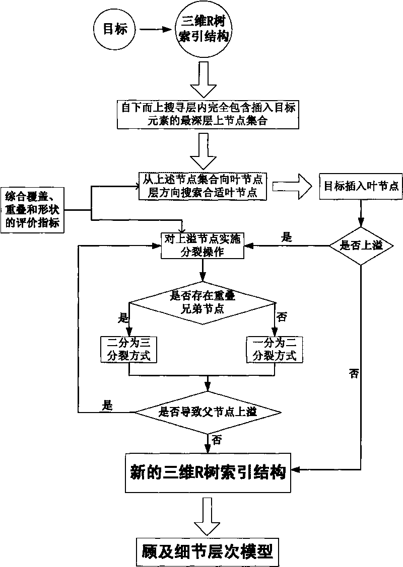
[0040] The embodiment comprehensively considers the three factors of node overlap, node coverage and node shape. Through testing, it is found that the three factors are given the same weight to generate the most reasonable R-tree tree shape. Therefore, the evaluation standard is set as the comprehensive evaluation index change value Metric=Overlap / 3+Overlay / 3+Shape / 3, wherein, assuming that the side length of the node is X, Y, Z, then Overlap is the node and sibling node after the spatial object is inserted The overlap volume increase value of , Overlay is the node volume increase value after insertion, and Shape is the increase value of the node's 3D Cauchy value after insertion.
[0041] The algorithm flow of the node selection link in the embodiment is as follows. The so-called guarantee that the change value of the comprehensive evaluation index of the node is the smallest after adding the spatial object is determined by comparing the change value of the corresponding compr...
PUM
 Abstract
Description
Claims
Application Information