Unmanned aerial vehicle (UAV) position and orientation estimation method based on cooperative target characteristic lines

A technology for cooperative target and pose estimation, which is applied in the field of image processing and can solve problems such as unmanned aerial vehicles being unable to achieve autonomous navigation and landing, and unmanned aerial vehicles being damaged.

Inactive Publication Date: 2010-09-15
NANJING UNIV OF AERONAUTICS & ASTRONAUTICS
View PDF3 Cites 15 Cited by
  • Summary
  • Abstract
  • Description
  • Claims
  • Application Information

AI Technical Summary

Problems solved by technology

However, GPS is controlled by people. Once the GPS is turned off or we receive error codes, the UAV will not be able to navigate and land autonomously, or even cause the UAV to be damaged due to wrong landing guidance. Therefore, we must have autonomous control. Navigation and Landing Guidance Systems

Method used


Image

  • Unmanned aerial vehicle (UAV) position and orientation estimation method based on cooperative target characteristic lines
  • Unmanned aerial vehicle (UAV) position and orientation estimation method based on cooperative target characteristic lines
  • Unmanned aerial vehicle (UAV) position and orientation estimation method based on cooperative target characteristic lines

Examples


Embodiment Construction

[0016] The present invention will be further described in detail below in combination with specific embodiments.

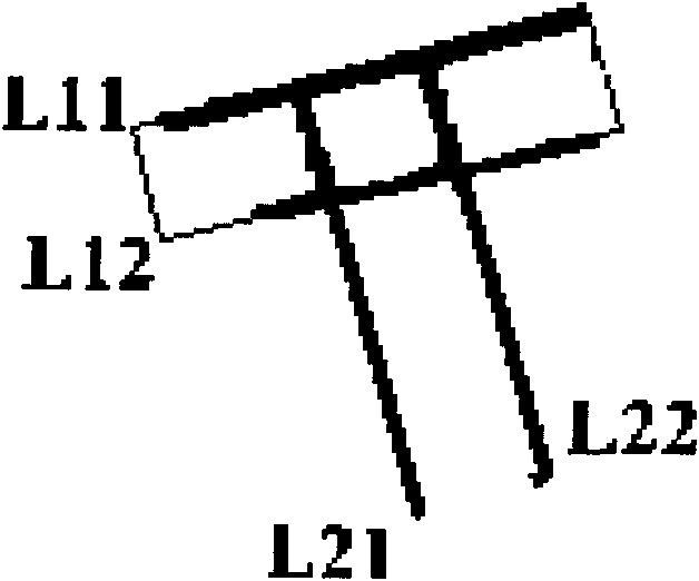
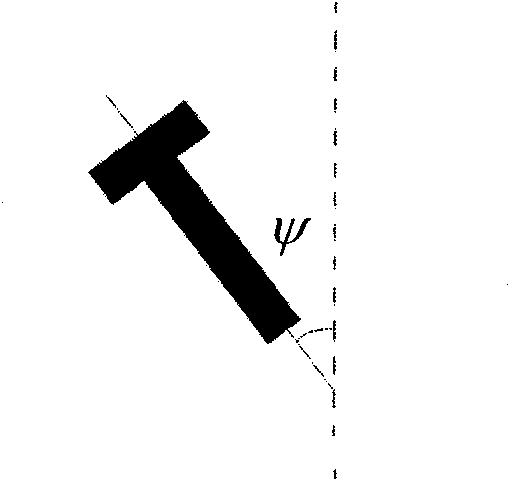
[0017] Such as figure 2 As shown, calculate the vanishing line equation of the two sets of parallel lines of the cooperative target; then, get the slope of the vanishing line, and thus calculate the roll angle; as image 3 The yaw angle of the UAV is obtained as shown; Substitute the known four point coordinates into the relationship equation between the UAV camera coordinate system and the world coordinate system to calculate the remaining four pose parameters.

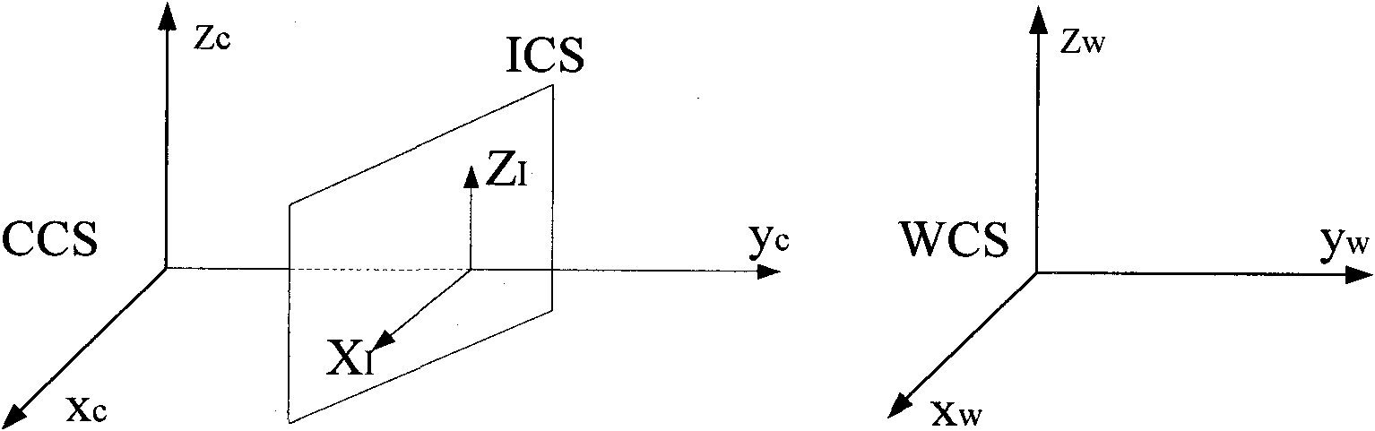
[0018] Such as figure 1 As shown, WCS is the world coordinate system, the origin is established at a point on the plane where the landing icon is located, and the xw-yw plane is parallel to the ground; CCS is the camera coordinate system, the origin is established at the optical center, the yc axis coincides with the optical axis, and the xc-zc plane Parallel to the image plane; ICS is the image coord...


PUM


Abstract

The invention discloses an unmanned aerial vehicle (UAV) position and orientation estimation method based on cooperative target characteristic lines, which is characterized by comprising the following steps: (1) pre-processing an input image to obtain two groups of parallel lines of a cooperative target; (2) analyzing and calculating vanishing line equations for extracted parallel lines to obtain slopes of vanishing lines so as to calculate the roll angle of the UAV; and (3) directly obtaining the yaw angle of the UAV according to the image, substituting known coordinates of four points in the relation equation of a camera coordinate system and a world coordinate system of the UAV, and calculating out the other four position and orientation parameters. The invention can realize accurate calculation of the UAV position and orientation information.

Description

technical field [0001] The invention relates to a method in the technical field of image processing, and specifically discloses a method for estimating the pose of an unmanned aerial vehicle based on characteristic lines of cooperative targets. Background technique [0002] In the navigation and landing guidance of unmanned aerial vehicles, the most widely used is to use the GPS / SINS integrated navigation system combined with the altimeter to complete. However, GPS is controlled by people. Once the GPS is turned off or we receive error codes, the UAV will not be able to navigate and land autonomously, or even cause the UAV to be damaged due to wrong landing guidance. Therefore, we must have autonomous control. Navigation and landing guidance systems. Only in this way can the requirements of unmanned aerial vehicle navigation and all-weather autonomous precise landing be met in wartime. Therefore, in order to improve the anti-jamming ability of our UAVs, solve the problem t...

Claims


Application Information

Patent Timeline
IPC IPC(8): G06T7/00G01C21/24
Inventor 张勇徐贵力李文跃汪凌燕陈燕
Owner NANJING UNIV OF AERONAUTICS & ASTRONAUTICS
Why Eureka
Try Eureka