Intelligent spatial data object modeling method applied to management of spatial data resource of road system

A spatial data and intelligent space technology, applied in the fields of electrical digital data processing, data processing applications, special data processing applications, etc., can solve the problems of the complexity and singleness of the secondary development of data model management, reduce service costs, reduce The degree of dependence and the effect of reducing the cost of construction investment

Active Publication Date: 2010-12-15
南京中图数码科技有限公司
View PDF2 Cites 9 Cited by
  • Summary
  • Abstract
  • Description
  • Claims
  • Application Information

AI Technical Summary

Problems solved by technology

[0004] The purpose of the present invention is to solve the problems of singleness, data model management and the complexity of secondary development in the traditional modeling method, and propose a method that can better solve the modeling of urban ba

Method used


Image

  • Intelligent spatial data object modeling method applied to management of spatial data resource of road system
  • Intelligent spatial data object modeling method applied to management of spatial data resource of road system
  • Intelligent spatial data object modeling method applied to management of spatial data resource of road system

Examples


Embodiment Construction

[0047] The present invention will be further described below in conjunction with the accompanying drawings and embodiments.

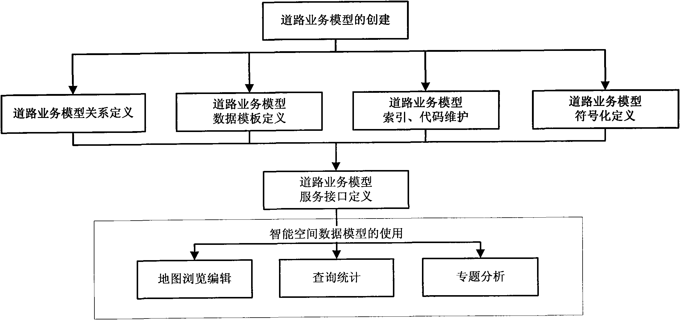
[0048] Such as figure 1 As shown, an intelligent spatial data object modeling method applied to road system spatial data resource management includes the following steps:

[0049] Step 1: abstract the road system spatial data resources, and create road business model objects: the road system space data resources include road centerlines, planned road surfaces and road details of various grades and categories; the road business model Objects include: road centerline (road_object), planned road surface (road_part), road details (road_detail);

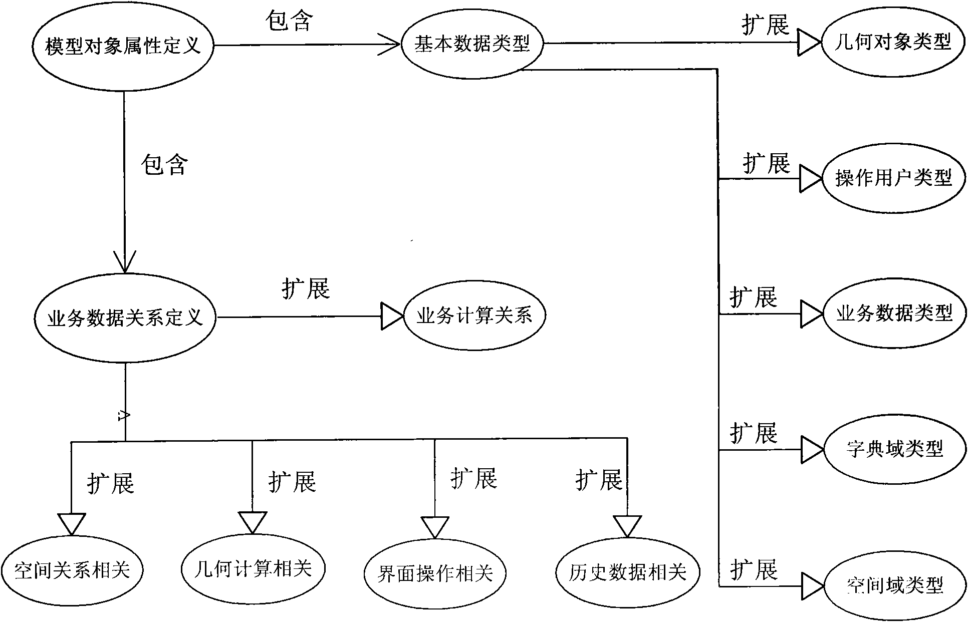
[0050] Defining a spatial model object is represented as a spatial data table from the perspective of database storage. In this method, defining the attribute information of a spatial model object mainly includes:

[0051] ●Description of basic data types, including basic data (library) types and extended types; ...


PUM


Abstract

The invention discloses an intelligent spatial data object modeling method applied to the management of a spatial data resource of a road system, which comprises the following steps of: abstracting the spatial data resource of the road system, and creating objects of road service models; defining the relationship of the road service models; defining data templates of the road service models in the road system; carrying out indexing and code maintenance on the road service models; carrying out symbolic definition on the road service models; and defining service interfaces of the road service models, and using the intelligent spatial data models of the road service models. The method of the invention can model the urban basic information resources better, which especially can widely be used in the industries such as municipal administration, planning and mapping, land resources, and environmental protection, and the like.

Description

technical field [0001] The present invention relates to a method for spatial data modeling and management in industries such as municipal administration, planning and surveying and mapping, land and resources, and environmental protection, especially for better management and analysis of these data, including non-spatial data models and spatial data models , a method of optimizing and abstracting the traditional modeling method, specifically an intelligent spatial data object modeling method applied to the management of road system spatial data resources. Background technique [0002] At present, the popular spatial data modeling methods at home and abroad mainly use third-party GIS platform software to build databases, which only solves the storage problem of spatial data in the form of files or databases (for example, using platforms such as Autodesk Map / ArcGis / Mapinfo), That is to say, the spatial data of the established database does not have the ability to automatically...

Claims


Application Information

Patent Timeline
IPC IPC(8): G06F17/30G06Q50/00G06Q50/30
Inventor 周继山沈瑞冯强
Owner 南京中图数码科技有限公司
Why Eureka
Try Eureka