
Reactive routing protocol based on geographic information in wireless sensor network

A wireless sensor and geographic information technology, applied in wireless communication, network topology, electrical components, etc., can solve problems such as data inability to transmit, and achieve the effect of reducing overhead, extending network life, and improving performance

Inactive Publication Date: 2011-01-19
BEIHANG UNIV
View PDF2 Cites 16 Cited by
  • Summary
  • Abstract
  • Description
  • Claims
  • Application Information

AI Technical Summary

Problems solved by technology

The node that generates or receives the data forwards the data to the neighbor node closest to the destination node calculated by the Euclidean distance, but the data cannot be transmitted because the data will reach an area that is not closer to the destination than the node (called a hole). , when this happens, the nodes around the hole can be detected, and use the right-hand rule to transmit around the hole to solve this problem

Method used


Image

  • Reactive routing protocol based on geographic information in wireless sensor network
  • Reactive routing protocol based on geographic information in wireless sensor network
  • Reactive routing protocol based on geographic information in wireless sensor network

Examples


Embodiment Construction

[0040] In view of the disadvantages of large overhead, low reliability and poor efficiency in the past geographical routing protocols, the present invention develops the protocol in a targeted manner, which can be divided into three parts: reducing the cost of routing discovery, finding the shortest path, and reliability of link breaks measure.

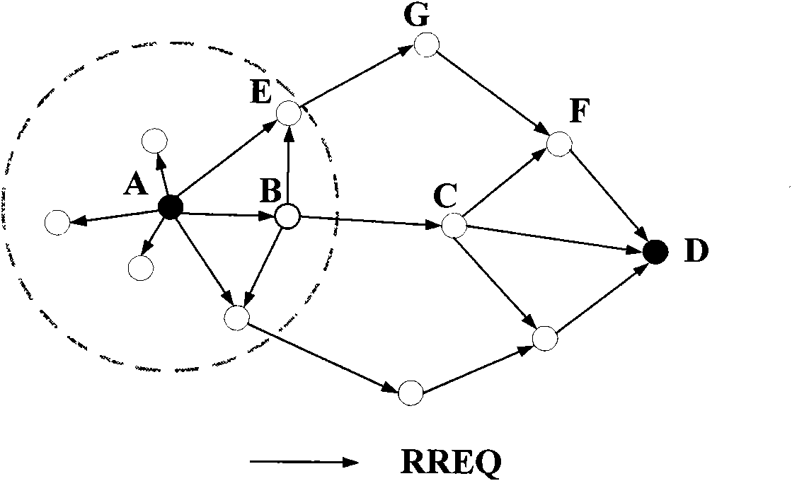
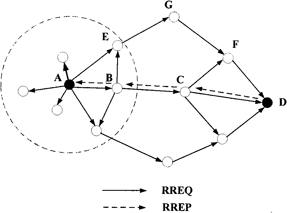
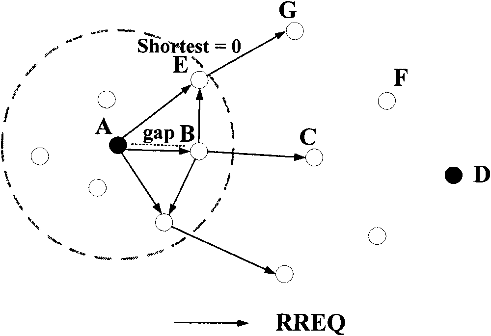
[0041] 1. Reduce the cost of route discovery: In order to reduce the cost of route discovery, the present invention only uses two kinds of data packets to complete the entire route discovery process: route request data packet and route reply data packet. The entire route discovery process can be divided into two stages: the route request stage and the route reply stage.

[0042] 1) Routing request stage: refer to figure 1 , when node A wants to transmit data information to node D, node A creates a routing request packet, sets the address of the destination node of the routing request packet as the address of node D, and sends it to the...


PUM


Abstract

The invention discloses a reactive routing protocol based on geographic information in a wireless sensor network, which utilizes the geographic information in a wireless sensor network and combines the thought of a reactive route to design a novel routing protocol. By a reactive routing mechanism, a neighbor table built between nodes is cancelled, the function of a routing table is strengthened so as to lower cost for searching routes, and the routing table is only built when data is required to transmit. The routing protocol searches the shortest path between a resource node and a target node when finishing a route request and a route recovery stage; in the route request stage, broadcast is applied to send a route request data packet to build a reverse routing table and find the shortestpath to reach the resource node. In the route recovery stage, unicast is applied to send a route recovery data packet, and the built reverse routing table is utilized to find a shortest path between the resource node and the target node. The invention lowers route discovery cost, improves route discovery reliability and increases route transmission efficiency.

Description

Technical field: [0001] The invention proposes a reactive routing protocol based on geographic information in a wireless sensor network, and the part involved is the wireless sensor network routing protocol technology. Background technique: [0002] Wireless Sensor Networks (WSN) is a multi-hop self-organizing network system formed by a large number of micro sensor nodes deployed in the monitoring area through wireless communication. Object information, and sent to observers. [0003] A wireless sensor network is a fully distributed system without a central node. Through random placement, many sensor nodes are densely deployed in the monitoring area. These sensor nodes are integrated with sensors, data processing units and communication modules, and they are connected through wireless channels to form a self-organized network system. The sensor nodes have good cooperation ability, and complete the global task through local data exchange. Due to the energy-saving requirem...

Claims


Application Information

Patent Timeline
IPC IPC(8): H04W40/02H04W40/28H04W84/18
Inventor 丁嵘杨磊
Owner BEIHANG UNIV
Learn More