

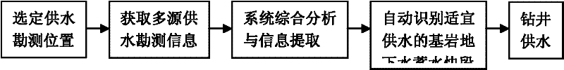
Proper water supply position intelligent recognition technology based on multi-source hydrogeology survey information
A hydrogeological and intelligent identification technology, applied in measurement devices, geophysical measurements, groundwater detection/exploration, etc., can solve problems such as randomness, reduce economic losses, avoid blind mining and concentrated mining, and inhibit the attenuation of groundwater resources Effect
- Summary
- Abstract
- Description
- Claims
- Application Information
AI Technical Summary
Problems solved by technology
Method used
Image

Examples
Embodiment Construction
[0022] The present invention will be described in further detail below in conjunction with the accompanying drawings and embodiments.
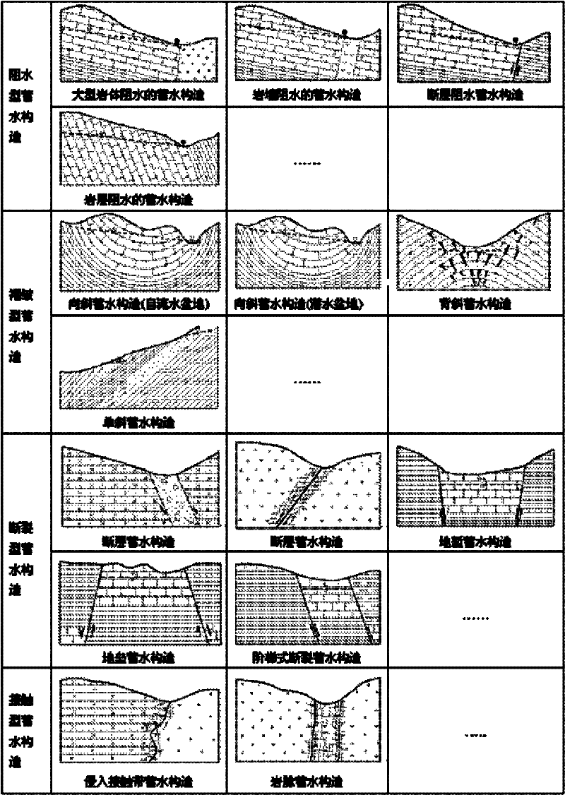
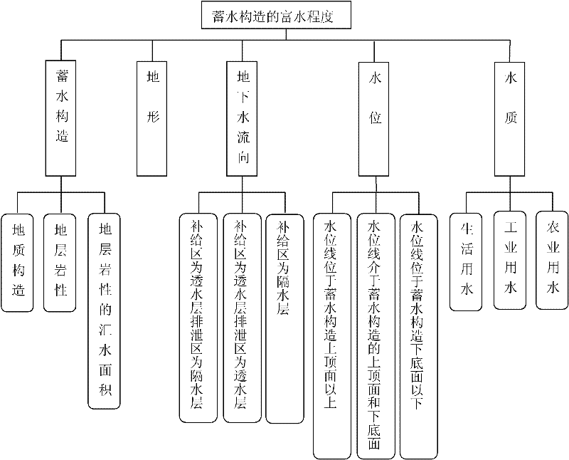
[0023] The implementation of the present invention is based on a geographic information system (GIS). Taking the Ningzhen Mountains as an example, the data sources include topographic information, hydrogeological drilling and hydrogeological maps, and groundwater dynamic monitoring data. Topographic information includes DEM and Tin; hydrogeological drilling and hydrogeological maps include hydrogeological drilling, hydrogeological maps and hydrogeological profiles; groundwater dynamic monitoring data are groundwater level monitoring points. Among them, DEM and Tin are interpolated by 1:50000 basic geographic information elevation data, DEM resolution is 50m; hydrogeological drilling data is hydrogeological drilling; hydrogeological map is integrated with hydrogeological map space data of 1:50000 bedrock geological map Attributes are obtained;...
PUM
 Abstract
Description
Claims
Application Information