

System and method for GPS mobile law enforcement supervision of land and resources
A technology of mobile law enforcement and land resources, which is applied in the field of land data surveying and mapping, can solve the problems of difficult editing and editing, prolonging the operation cycle, and the inability to make absolute positioning, so as to improve the efficiency and quality of law enforcement, reduce labor intensity, and curb illegal activities.
- Summary
- Abstract
- Description
- Claims
- Application Information
AI Technical Summary
Problems solved by technology
Method used
Image

Examples
Embodiment Construction
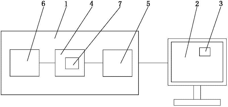
[0035] Such as Figure 1-3 As shown in one of the above, the system for GPS mobile law enforcement monitoring of land and resources of the present invention includes a GPS handheld all-in-one machine 1 and a background computer 2, and the outdoor GPS all-in-one machine 1 performs data collection by receiving satellite signals, and the GPS hand-held all-in-one machine 1 Connect with background computer 2 by USB interface, thereby carry out data synchronization, background computer 2 is provided with mobile law enforcement monitoring data processing module 3; Described GPS hand-held all-in-one machine 1 comprises operating system platform 4, camera 5 and GPS receiver 6, operates The system platform 4 is connected with the camera 5 and the GPS receiver 6 respectively, and the operating system platform 4 is provided with a memory 7, which stores a mobile law enforcement monitoring module.
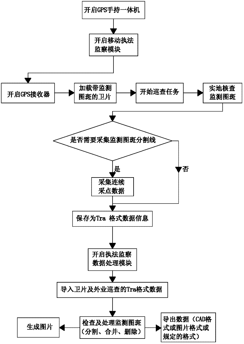
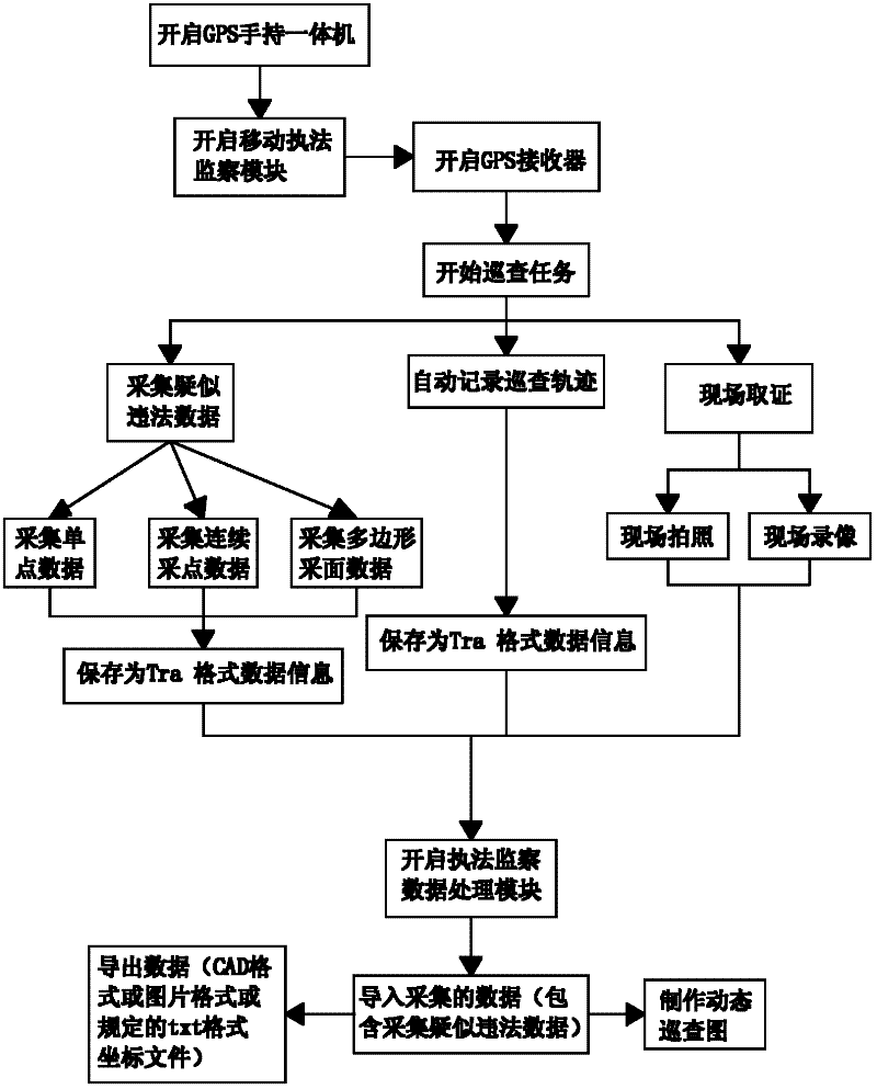
[0036] The method for GPS mobile law enforcement and monitoring of land and resources in th...
PUM
 Abstract
Description
Claims
Application Information