Method for selecting hyperspectral remote sensing image bands based on partial least squares
A partial least squares, hyperspectral remote sensing technology, applied in the field of remote sensing image processing, can solve the problem of time-consuming calculation, achieve fast calculation speed, and avoid the effect of feature subset search
- Summary
- Abstract
- Description
- Claims
- Application Information
AI Technical Summary
Problems solved by technology
Method used
Image
Examples
experiment example 1
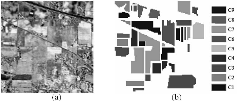
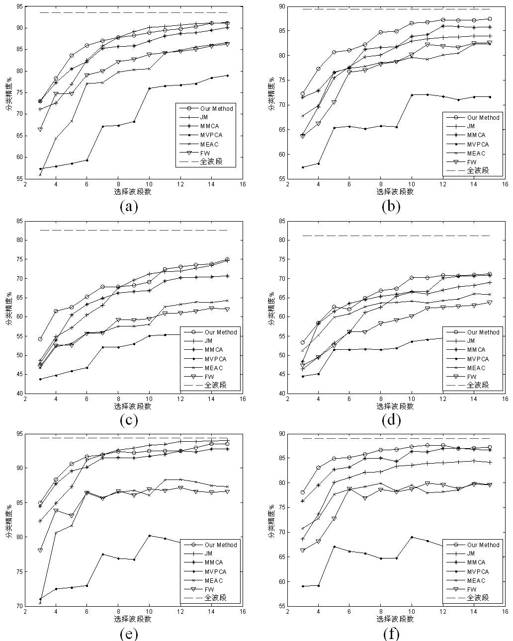
[0041] Experimental example 1. AVIRIS hyperspectral remote sensing data
[0042] category Corresponding features Number of Classified Samples C1 Corn-notill 1256 C2 Corn-min 726 C3 Grass / Pasture 431 C4 Grass / Tress 626 C5 Hay-windowed 443 C6 Soybeans-notil 828 C7 Soybeans-min 2284 C8 Soybeans-clean 503 C9 Woods 1198
[0043] The experiment uses the hyperspectral images collected by the Airborne Visible / Infrared Imaging Spectrometer (AVIRIS) in 1992 at the Pine test site in Indiana, USA (provided by https: / / engineering.purdue.edu / ~biehl / MultiSpec / free download of this data). The image block size is 145 × 145 pixels, with a total of 220 spectral bands. The wavelength range is from 0.4 to 2.5 μm, the spectral resolution is 10nm, and the spatial resolution is 17m. This data has been widely used in classification research of remote sensing images.
[0044] Bands 1-4, 103-113 and 148-166 were remov...
experiment example 2
[0049] Experimental example 2. HYDICE hyperspectral remote sensing data
[0050] The experiment uses Washington DC hyperspectral images collected by the (Hyperspectral Digital Imagery Collection Experiment, HYDICE) sensor. The image block size is 1280 × 307 pixels, with a total of 210 spectral bands. The ground resolution of this data is as high as 2.8 m, with few mixed pixels, and the differences of various ground objects are obvious.
[0051] Remove the noise and water absorption bands 103-106, 138-148, 207-210, leaving 191 spectral bands. Take the 53rd, 32nd, and 20th bands as R, G, and B components to synthesize pseudo-color images, such as figure 2 shown.
[0052] According to the ground object information in the literature [12], the seven types of ground objects, namely Water, Grass, Shadow, Street, Path, Trees, and Roof, are selected for classification, and the rest of the area is used as a blank area and is not used for classification. The number of selected samp...
PUM
 Abstract
Description
Claims
Application Information
 - R&D
- Intellectual Property
- Life Sciences
- Materials
- Tech Scout
- Unparalleled Data Quality
- Higher Quality Content
- 60% Fewer Hallucinations
Browse by: Latest US Patents, China's latest patents, Technical Efficacy Thesaurus, Application Domain, Technology Topic, Popular Technical Reports.
© 2025 PatSnap. All rights reserved.Legal|Privacy policy|Modern Slavery Act Transparency Statement|Sitemap|About US| Contact US: help@patsnap.com


