

Unmanned aerial vehicle scene matching auxiliary navigation method and system
A technology of scene matching and auxiliary navigation, which is applied in the field of navigation to achieve the effect of high real-time, high precision, efficient and accurate image matching
- Summary
- Abstract
- Description
- Claims
- Application Information
AI Technical Summary
Problems solved by technology
Method used
Image

Examples
Embodiment Construction
[0068] The technical scheme of the present invention is described in detail below in conjunction with accompanying drawing:
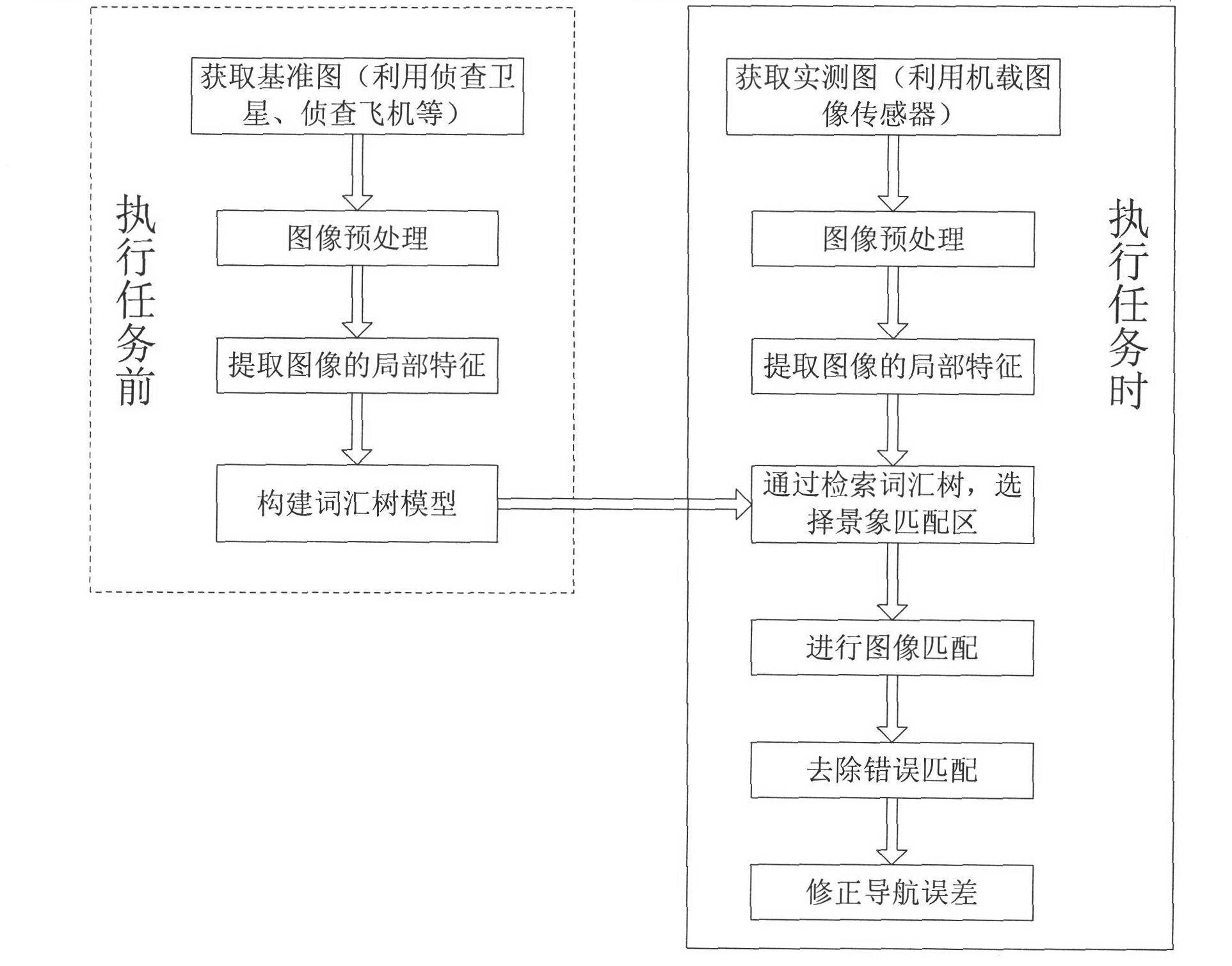
[0069] Such as figure 1 with Image 6 Shown are the flow charts of the method and system modules of the present invention respectively. In the method and the module, it includes correspondingly, an image preprocessing module for acquiring and preprocessing a reference image, an image feature extraction module for extracting image features, a reference image vocabulary tree building module for establishing a reference image vocabulary tree, and A scene matching area selection module for selecting a scene matching area, a scene matching module for realizing scene matching, a wrong matching removal module for removing wrong matching points, and a navigation error correction module for correcting navigation errors. The processing methods of the modules in the system will be introduced respectively below.
[0070] 1. Get the image and preprocess it:
[0...
PUM
 Abstract
Description
Claims
Application Information