

Method for generating road design surface information by laser radar scan
A technology of laser radar and laser scanner, which is applied in calculation, cross-section drawing, special data processing application, etc., can solve the problems of poor precision and low efficiency of actual measurement, and achieve the effect of high precision, high efficiency and automatic acquisition
- Summary
- Abstract
- Description
- Claims
- Application Information
AI Technical Summary
Problems solved by technology
Method used
Image


Examples
Embodiment 1
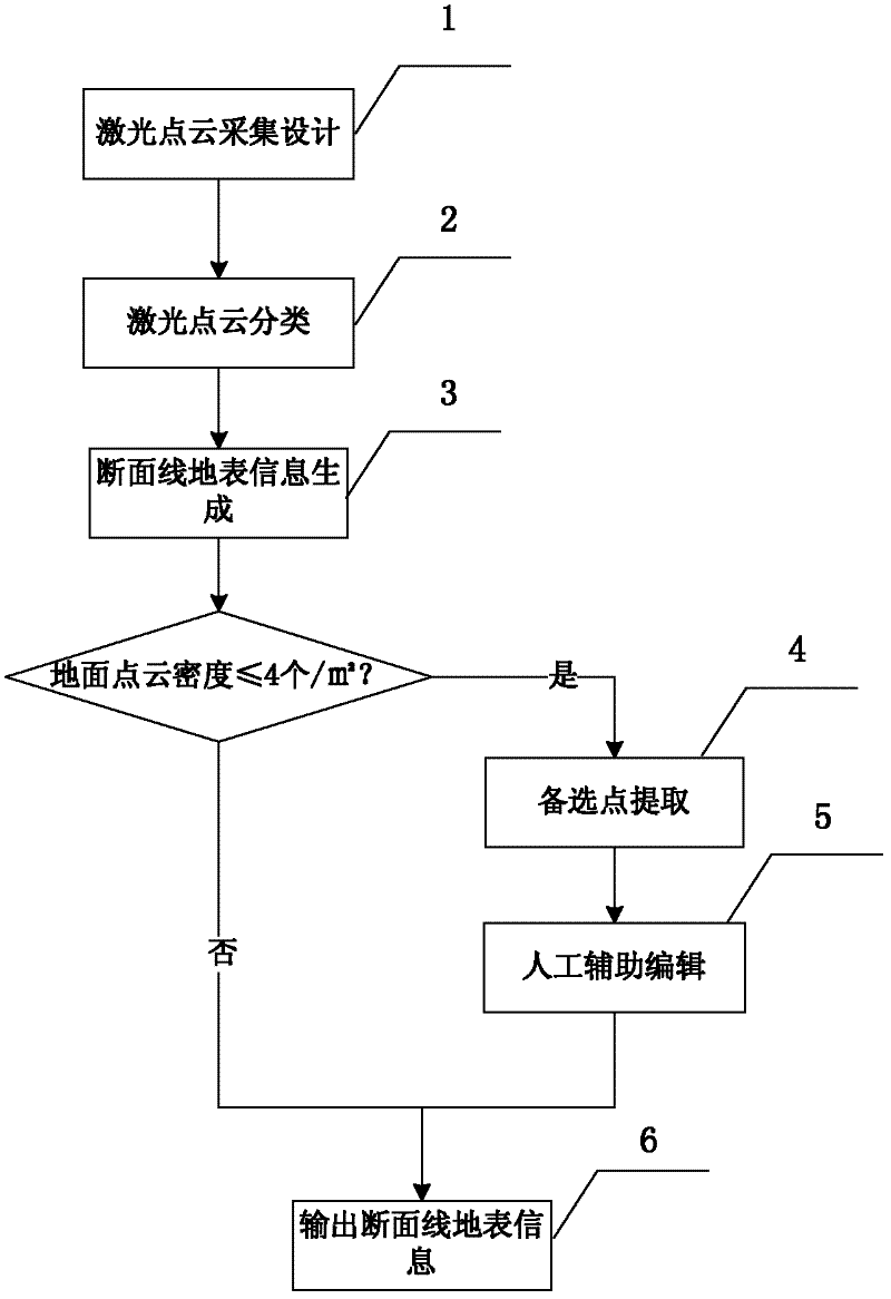
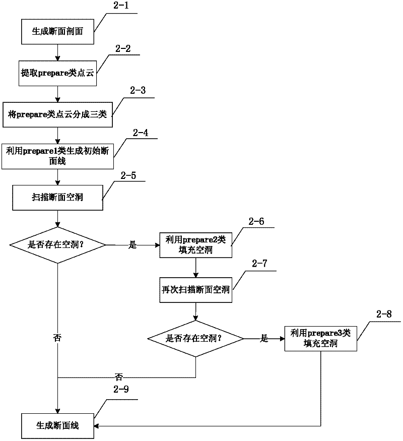
[0034] Describe the embodiment of the present invention below with the aid of accompanying drawing, specific working process is as follows figure 1 As shown, the description is as follows.
[0035] The first step, laser point cloud acquisition design 1;
[0036] For new highway projects, aircrafts are used as platforms to carry laser scanners for data collection. For highway reconstruction and expansion projects, you can choose a helicopter or a car as a platform to carry a laser scanner for data collection. The specific implementation methods of collecting data on different platforms are as follows:
[0037] When using an aircraft as a platform for data collection, task design is required. The specific implementation method is as follows:
[0038] 1) Data accuracy and density requirements. For new highway projects, the plane accuracy of laser radar scanning data results is better than 0.15m, the elevation accuracy is better than 0.10m, and the laser point density is high...
PUM
 Abstract
Description
Claims
Application Information