

Distributed algorithm for quickly establishing massive remote sensing image pyramid
A pyramid algorithm and remote sensing image technology, which is applied in the intersection of geographic information and information technology, can solve the problems of image block files crossing grids and "black borders"
- Summary
- Abstract
- Description
- Claims
- Application Information
AI Technical Summary
Problems solved by technology
Method used
Image

Examples
Embodiment 1
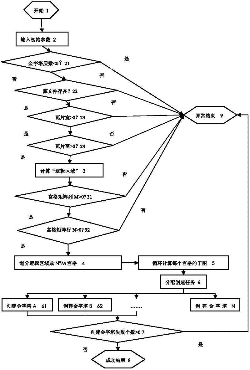
[0217] An algorithm for quickly building a pyramid based on distributed massive remote sensing images proposed by the present invention is implemented in a "massive image data management system". Embodiment 1 is written in C# language, relying on the read and write operations of GeoTIFF and other file formats provided by the open source geographic data abstraction library (Geospatial Data Abstraction Library, GDAL). Among them, the communication between the control node and the computing node and the remote procedure call adopt the windows communication protocol (Windows Communication Foundation, WCF) mechanism provided by the .net framework. The instance runs in a cluster environment consisting of a control node and 5 computing nodes connected by Gigabit Ethernet. The hardware configuration of the node is shown in Table 1 below:
[0218]
[0219] Table 1
PUM
 Abstract
Description
Claims
Application Information