Combined vehicle position measurement method

A measurement method and combined technology, applied in the fields of inertial navigation, satellite navigation and mobile measurement, can solve the problems of high device requirements, difficult implementation, and position error.

Inactive Publication Date: 2012-07-25
北京星网宇达科技股份有限公司
View PDF5 Cites 15 Cited by
  • Summary
  • Abstract
  • Description
  • Claims
  • Application Information

AI Technical Summary

Problems solved by technology

Currently the most commonly used means of position measurement is the GPS positioning system, such as car navigators, etc., but relying solely on the GPS system for position measurement often has the following problems: (1) GPS signals are easily blocked and interrupted: in bridges, tunnels, trees, cities, etc. In environments such as canyons, GPS cannot provide continuous and accurate location information
(2) GPS signals are vulnerable to multi-path interference and cause positioning errors. At this time, the position given by GPS will have a large error
But the inertial / GPS position measurement system also has an inevitable problem: when the GPS is invalid for a long time, the position error of the inertial navigation system will increase rapidly with time, especially if the low-cost MEMS inertial navigation system is selected, if the GPS signal is lost for 10 Seconds, the position error of the inertial navigation system will exceed 10m, which cannot meet the requirements of high-precision position measurement
[0004] In order to overcome the above problems, some units have begun to use the combined position measurement scheme of inertial navigation, GPS, and odometer, but according to literature reports, the information currently used is to integrate the information of inertial navigation, GPS, and odometer In-depth combination scheme, this kind of scheme often has higher requirements on the resolution of the odometer. In the case of low resolution of the odometer, the output position error after system combination is relatively large. In addition, this method uses a The filter algorithm for deep fusion of three sensor information is relatively complex and difficult to implement. When the resolution of the odometer changes or when the error characteristics of inertial navigation and GPS change, the parameters of the filter must be carefully adjusted. In order to ensure the accuracy of the output position, if the parameters of the filter are not adjusted accordingly, the position accuracy of the system output will be greatly reduced
In short, although the existing combined algorithms of inertial navigation, GPS, and odometer can solve the problem of high-precision and continuous position measurement, there are inevitably complex algorithms, high requirements for devices, and poor adaptability to different devices. Weaknesses such as weak points, there are certain difficulties in wide-scale promotion and use

Method used


Image

  • Combined vehicle position measurement method
  • Combined vehicle position measurement method
  • Combined vehicle position measurement method

Examples


Embodiment Construction

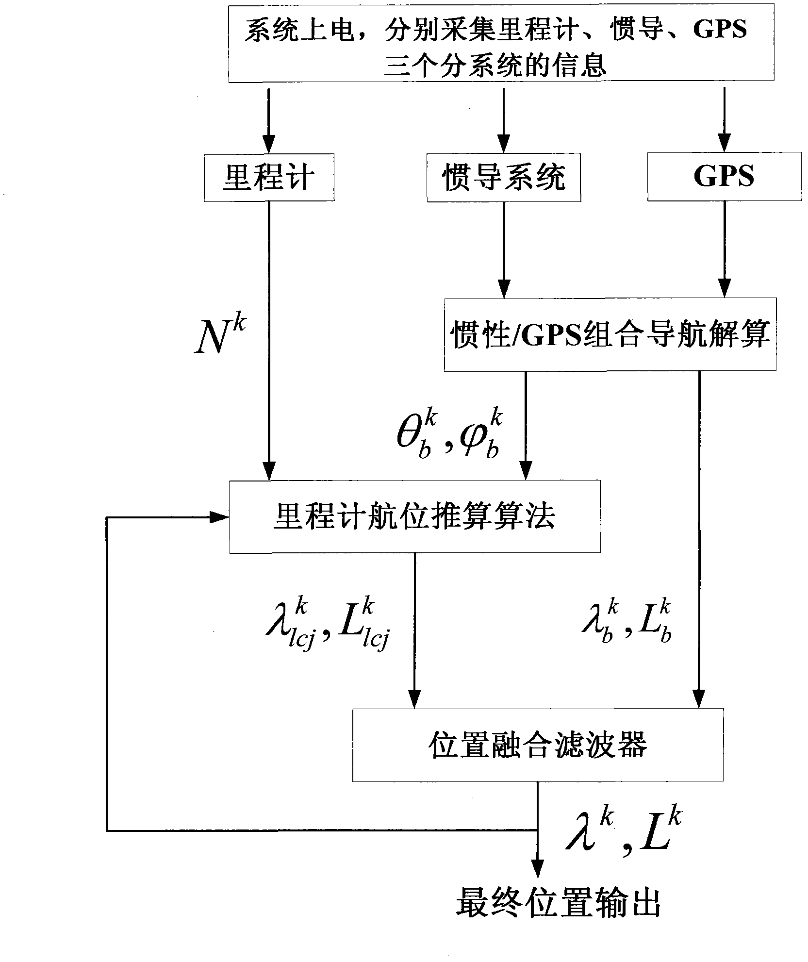
[0025] This embodiment demonstrates the feasibility of the algorithm described in this application through a set of actual sports car experimental data.

[0026] The inertial navigation system selected in this embodiment is a MEMS inertial navigation system, wherein the gyroscope selects the STIM202 type MEMS gyroscope of Sensonor Company for use, and its comprehensive drift is about 30 ° / h, and the accelerometer selects the MS9010 type MEMS accelerometer of Swiss Colibry Company for use, and its comprehensive The zero offset is about 1 mg; the GPS uses OEMV-2 dual-frequency dual-satellite GPS from Canadian Novtel, and its single-point positioning accuracy is about 2m without any interference; the odometer uses a magnetic induction Hall sensor, and the wheel turns out 1 pulse.

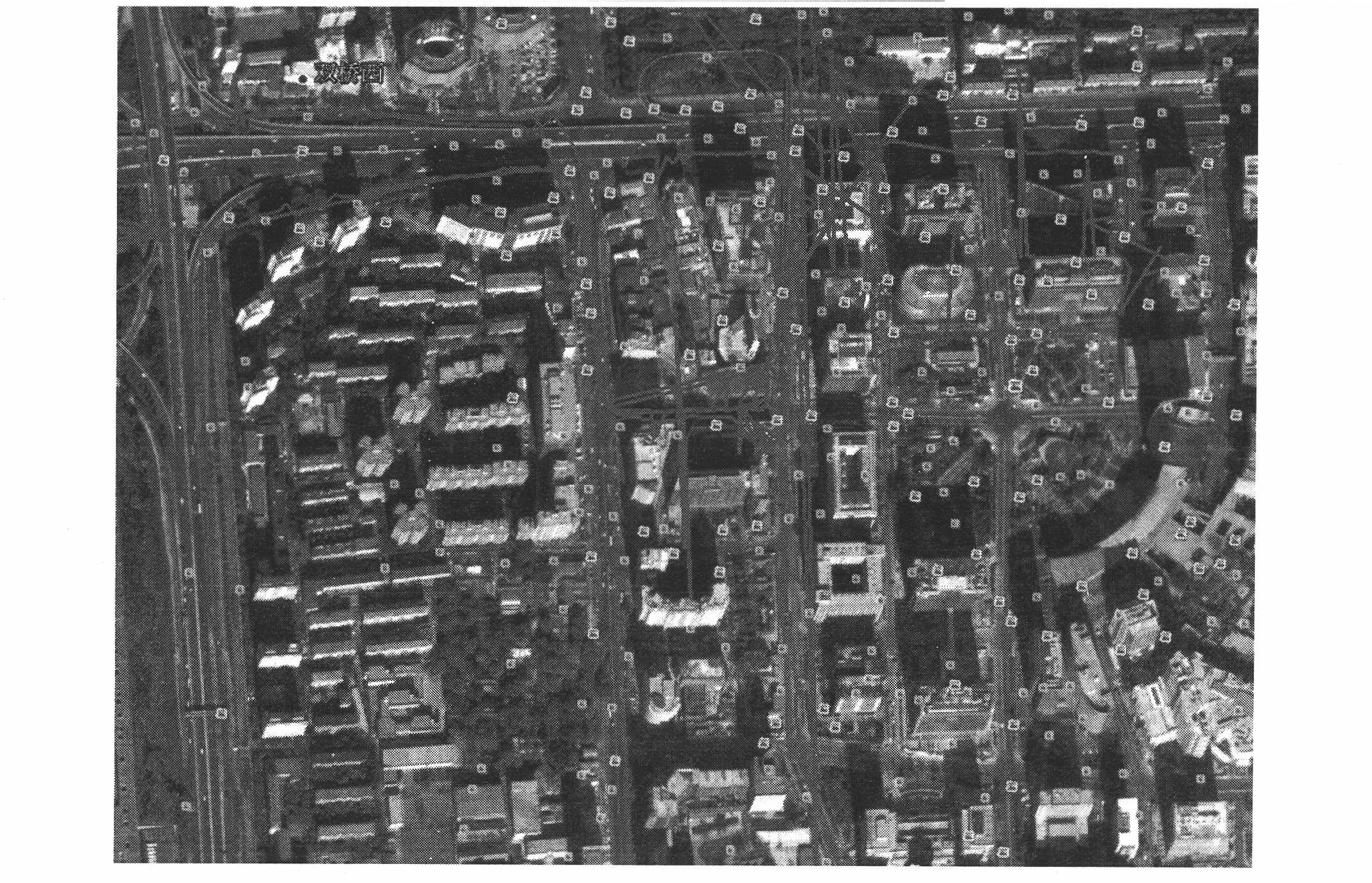
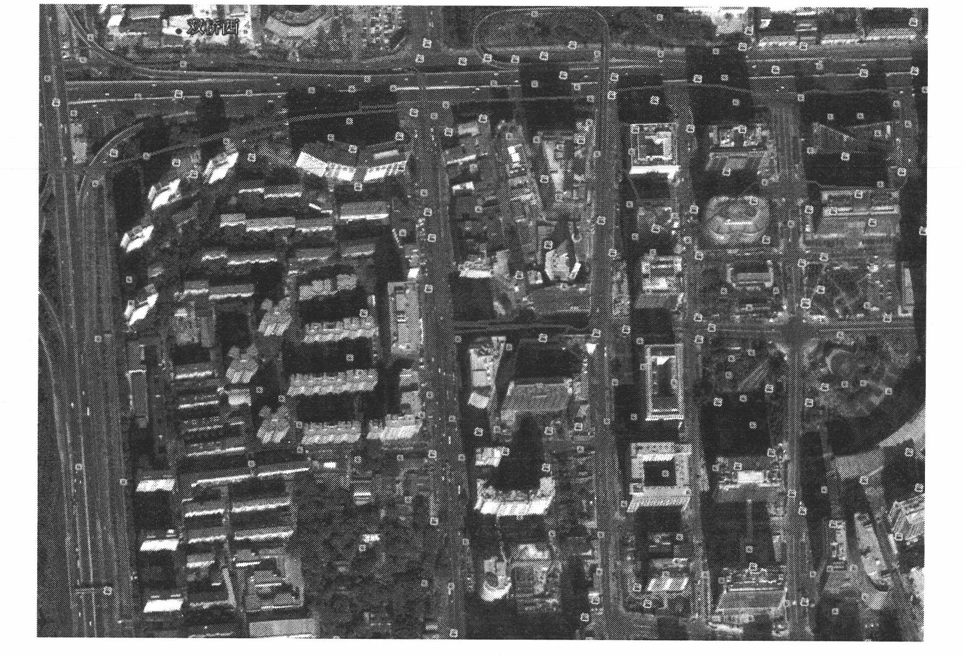
[0027] The experimental site of this embodiment is selected near Zhongguancun, Haidian District, Beijing, where vehicles need to pass through the high-rise area of ​​Zhongguancun, where GPS will be ser...


PUM


Abstract

The invention provides a simple and reliable inertia/GPS (global positioning system)/milemeter combined algorithm for solving the precision positioning problem of vehicles in complex environments, such as bridges, trees, tunnel barriers, urban canyons and the like. The method comprises the following steps of: respectively independently calculating position information of a carrier through an inertia/GPS combined navigation algorithm and a milemeter dead reckoning algorithm, further fusing the position information obtained by calculation through the two different algorithms through an output correction filter with simple design, and finally giving out high-precision vehicle position information. Compared with a traditional single-filter deep combined algorithm, the method has the advantages of stronger environmental adaptability, no sensitivity to error models of GPS, inertial navigation and a milemeter, high reliability, high output precision, easiness in implementation and the like, and can well solve the precision positioning problem of the vehicles in the complex environments.

Description

technical field [0001] The application relates to a method for measuring a dynamic position of a vehicle, and relates to the fields of inertial navigation, satellite navigation and mobile measurement. The method described in this application can be widely applied to high-precision, high-dynamic, real-time position measurement of various vehicles. Background technique [0002] Vehicle position measurement is a key technical problem that must be solved in application fields such as vehicle navigation, road mapping, and electronic transportation. Currently the most commonly used means of position measurement is the GPS positioning system, such as car navigators, etc., but relying solely on the GPS system for position measurement often has the following problems: (1) GPS signals are easily blocked and interrupted: in bridges, tunnels, trees, cities, etc. In environments such as canyons, GPS cannot provide continuous and accurate location information. (2) GPS signals are suscep...

Claims


Application Information

Patent Timeline
Patent Type & Authority Applications(China)
IPC IPC(8): G01S19/49
Inventor 徐烨烽薛宏滨杨宦春
Owner 北京星网宇达科技股份有限公司
Why Eureka
Try Eureka