Correction method for aerial surveying and mapping images

An image correction and aerial photography technology, applied in the field of aerial photography surveying and mapping, can solve the problems of ground altitude error, unable to obtain ground altitude data, etc., and achieve the effect of reducing accuracy requirements, easy implementation, and strong operability

Active Publication Date: 2012-10-03
天津建岩岩土工程有限公司
View PDF4 Cites 8 Cited by
  • Summary
  • Abstract
  • Description
  • Claims
  • Application Information

AI Technical Summary

Problems solved by technology

However, due to the fact that the height of the aerial photography of the aircraft cannot always be maintained at the preset reference altitude in the existing technology, it may be higher or lower than the preset reference altitude in a certain section of the flight, so the measured There is also a certain error in the ground altitude, and it is impossible to get accurate ground altitude data

Method used


Image

  • Correction method for aerial surveying and mapping images
  • Correction method for aerial surveying and mapping images
  • Correction method for aerial surveying and mapping images

Examples


Embodiment 1

[0040] A method for correcting the proportion of an aerial surveying and mapping image of the present invention comprises the following steps:

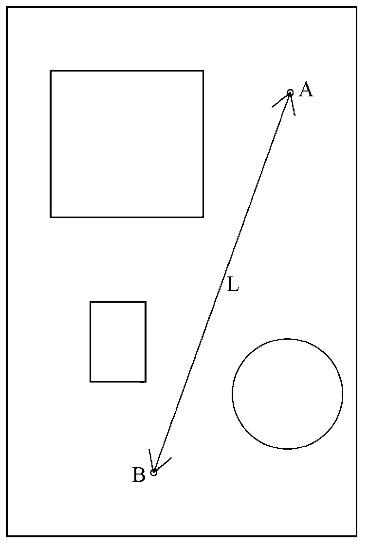
[0041] 1) Set two reference points in the measured area, which can be clearly identified in the image map obtained by aerial photography; figure 1 It is a schematic diagram of the measured area in this embodiment, such as figure 1 As shown, in the measured area, two identification points A and B are set respectively, and the identification points are light sources, so that they can be clearly identified in the aerial image map;

[0042]2) Measure the horizontal distance L between the two reference points A and B; the reference points are respectively equipped with GPS positioning devices, so that the latitude and longitude information of each reference point can be obtained through the GPS positioning device, and according to the latitude and longitude of each reference point The information calculates the horizontal distance L betwe...

Embodiment 2

[0049] A method for correcting aerial photography surveying and mapping images, comprising the following steps:

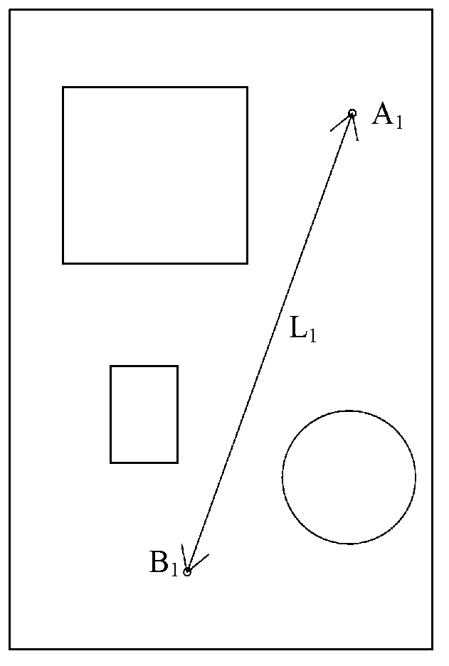
[0050] 1) Set at least two reference points in the measured area, the reference points are located at the start of the aerial photography of the measured area, and the reference points can be captured in the first picture of the aerial photography at the same time;

[0051] 2) Measure the horizontal distance between any two reference points;

[0052] 3) According to the target scale and the horizontal distance between the two reference points measured in step 2), calculate the expected distance between the two final image points in the final image map corresponding to the target scale, where the final The image point is the image corresponding to the reference point in the final image map;

[0053] 4) Take aerial photography of the measured area;

[0054] 5) Measure the actual distance between the two reference points in step 2) and the two original image points ...

Embodiment 3

[0060] A method for correcting an aerial surveying and mapping image, comprising the steps described in Embodiment 1 or Embodiment 2, and further comprising the step of correcting the altitude of the aerial surveying and mapping image of the measured area, including:

[0061] 1) Obtain the altitude x of two adjacent reference points C and D through the GPS positioning device set at each reference point 1 、x 2 ;

[0062] 2) Set any point E on the ground between C and D that needs to be corrected for altitude. When the aircraft flies to the two reference points C, D and point E, the positions are c, d, e. Collect The distance h between the aircraft and the ground measured by the aircraft flying to c, d, e 1 、h 2 、h 3 ,Right now image 3 The distances from point c to point C, point d to point D, and point e to point E are respectively h 1 、h 2 、h 3 ;

[0063] 3) According to the altitude x of the two reference points C and D obtained in step 1) 1 、x 2 and the distance ...


PUM


Abstract

The invention discloses a correction method for aerial surveying and mapping images, which comprises the following steps: setting two reference points in a to-be-measured area, and measuring the horizontal distance between the two points; measuring idealistic distance between two final image points in a final image corresponding to a target scale according to the target scale and the obtained horizontal distance; carrying out aerial photography for to-be-measured area, butting the obtained images so as to obtain an integral original image of the to-be-measured area, and measuring the actual distance between two original image points; and calculating the ratio of the idealistic distance to the actual distance to scale the original image according to the ratio, so as to obtain the final image. Due to the adoption of the method provided by the invention, the image of the target scale can be obtained without conforming to the accurate aerial photography height, accordingly, the precision requirement for the aerial photography height is reduced, and the operation is simpler.

Description

technical field [0001] The invention relates to the field of aerial photography surveying and mapping, in particular to an aerial photography surveying and mapping image ratio correction method suitable for use by unmanned aerial vehicles and manned aircraft. Background technique [0002] Aerial photography, also known as aerial photography or aerial photography, refers to taking pictures of the earth's landforms from the air to obtain a top view. At this stage, aerial photography technology has been widely used in various fields. For different fields, the required effects of shooting are also different. Such as large-scale group activities, TV, movies, and urban security inspections, usually require clear and stable real-time video images, and fixed-point shooting is required when shooting, so it is more suitable to use helicopter aerial photography; for land monitoring, forest fire prevention, power line inspection, etc., it is also a requirement Clear and stable real-tim...

Claims


Application Information

Patent Timeline
Patent Type & Authority Applications(China)
IPC IPC(8): G01C11/08G01C5/00
Inventor 林威
Owner 天津建岩岩土工程有限公司
Why Eureka
Try Eureka