
Pseudolite system based on aircraft group dynamic networking

A technology of satellite navigation system and aircraft, applied in the field of navigation

Inactive Publication Date: 2013-01-16
NANJING UNIV OF AERONAUTICS & ASTRONAUTICS
View PDF1 Cites 19 Cited by
  • Summary
  • Abstract
  • Description
  • Claims
  • Application Information

AI Technical Summary

Problems solved by technology

[0004] The technical problem to be solved by the present invention is to overcome the deficiencies of the existing pseudolite system and provide a pseudolite system based on dynamic networking of aircraft groups, which has stronger battlefield survivability and availability of navigation services

Method used


Image

  • Pseudolite system based on aircraft group dynamic networking
  • Pseudolite system based on aircraft group dynamic networking
  • Pseudolite system based on aircraft group dynamic networking

Examples


Embodiment Construction

[0032] The technical scheme of the present invention is described in detail below in conjunction with accompanying drawing:

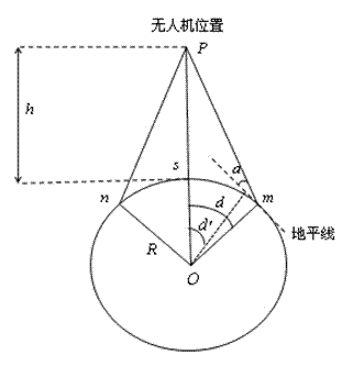
[0033] In order to solve the deficiency that the existing pseudolite system adopts static networking, the present invention proposes a pseudolite system based on the dynamic networking of aircraft groups, in which multiple pseudolites are located on relatively moving aircraft for dynamic networking; Each pseudolite uses the inertial navigation system, satellite navigation system, and star sensor of the carrier aircraft to perform multi-information fusion to achieve its own precise positioning. Adopting such a technical solution can overcome the disadvantages of inflexible setting and poor battlefield survivability of the existing static networked pseudolite system, and realize the aircraft positioning method using the multi-information fusion of various inertial navigation / satellite / star sensors. Pseudo-satellite self-positioning.

[0034] As we all kn...


PUM


Abstract

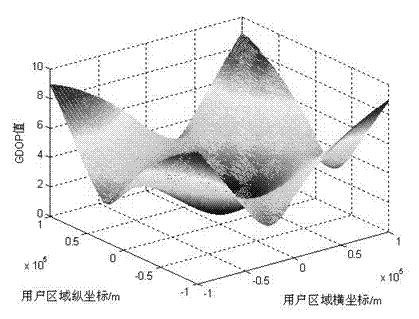
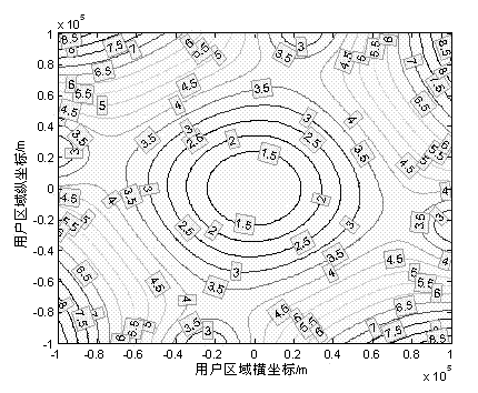
The invention discloses a pseudolite system based on an aircraft group dynamic networking. The pseudolite system comprises a plurality of pseudolites which are all arranged on a plurality of aircrafts and used for broadcasting navigation signals. Each aircraft is provided with an inertial navigation system, a satellite navigation system and a star sensor, and the plurality of aircrafts do relative movement. Through output information of the inertial navigation system, the satellite navigation system and the star sensor is mixed by each pseudolite, so that the pseudolite is accurately self-positioned. Furthermore, each of the plurality of aircrafts is provided with a wireless distance measuring device for measuring the distance of the aircraft. The distance measured by the wireless distance measuring device between every two aircrafts is used as an observed quantity by each pseudolite so as to mix the output information of inertial navigation system, the satellite navigation system and the star sensor, so that the pseudolite is accurately self-positioned. Within the user area, the value of geometric dilution of precision (GDOP) is smaller than 6, and the accuracy of self-positioning of the pseudolite is 1.20m, so that the pseudolite system has the advantages of flexible deployment and higher navigation accuracy.

Description

technical field [0001] The invention relates to a pseudo-satellite (Pseudo-Satellite, PL for short) system, in particular to a pseudo-satellite system based on dynamic networking of aircraft groups, which belongs to the field of navigation technology. Background technique [0002] Satellite navigation has the advantages of all-weather, high precision, and wide coverage, and has become the main development direction of navigation technology. However, there are also a series of inherent disadvantages: because the satellite is far away from the user, the level reaching the user is low, resulting in the signal being easily interfered or shielded and interrupting the service; due to the wide coverage of the satellite signal, it is important to provide wide-area services. At the same time, the satellite itself is in constant motion, so it lacks the ability to adapt to complex terrain and continuous coverage, making it difficult to receive signals under certain terrain conditions; ...

Claims


Application Information

Patent Timeline
IPC IPC(8): G01S19/48G01S19/49
Inventor 谭龙玉康国华张玉纯夏青袁超戴卫恒郁丰华冰
Owner NANJING UNIV OF AERONAUTICS & ASTRONAUTICS
Learn More