Automatic Generation Method of Intersection Network Based on GPS Information for Panoramic Sequence Images

A technology for automatic generation of sequential images, applied in special data processing applications, instruments, electrical digital data processing, etc., can solve problems such as not achieving 360° all-round correlation, and achieve the effect of automation

Inactive Publication Date: 2016-06-15
SUZHOU SHENGJING SPACE INFORMATION TECH
View PDF4 Cites 0 Cited by
  • Summary
  • Abstract
  • Description
  • Claims
  • Application Information

AI Technical Summary

Problems solved by technology

The traditional street view is generally a single panorama switching between points or connecting back and forth according to the shooting route, without 360° all-round connection

Method used


Image

  • Automatic Generation Method of Intersection Network Based on GPS Information for Panoramic Sequence Images
  • Automatic Generation Method of Intersection Network Based on GPS Information for Panoramic Sequence Images
  • Automatic Generation Method of Intersection Network Based on GPS Information for Panoramic Sequence Images

Examples


Embodiment Construction

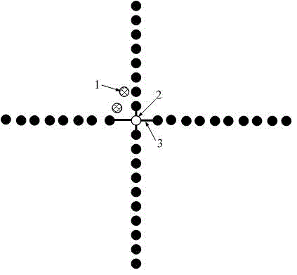
[0023] The present invention uses the road grid to establish the relationship between each image, the relationship between multiple images at each intersection, and saves the relationship of the current point to *.xml, that is, the front, back, and The file positions of the points associated with the left and right are stored in *.xml. All points on the huge road network are organized together reasonably to reduce the cost of manual operation.

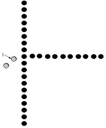
[0024] Such as figure 1 As shown, the specific detailed process is as follows:

[0025] 1) Add each associated point of the intersection to the road network library;

[0026] (S101) At first the GPS shooting point is entered in the database, and according to the coordinates of the center point on the road center line provided, the panoramic point that is most suitable as the center point in a certain area can be quickly matched; if not found or the coordinates have been If it exists in the road network library, read the coordinates ...


PUM


Abstract

The invention relates to an automatic intersection network generating method for a panorama sequence image based on GPS (Global Position System) information, comprising the steps of recording a GPS shot spot into a database, and quickly matching the shot spot into a certain area which is most suitable for serving as the central-point panorama point according to central-point coordinates on a provided road central line; searching the roads around the panorama point which is most suitable for serving as a road point, computing a point closest to the road point on the same road, computing the angle between the two points, and obtaining the east-west direction or the north-south direction of the road; computing the road points corresponding to other roads around the point by taking the obtained road direction as the reference; for the road section with more points, deleting points with closer distances according to practical distances, and if the closest distances of the rest points exceed a certain range, regarding the road section as invalid and searching the next road section; building a panorama image index file, and building the relation between the images by utilizing the intersection network; and reasonably organizing the points on the huge intersection network together.

Description

technical field [0001] The invention relates to an automatic generation method of a panoramic sequence image intersection network based on GPS information. Background technique [0002] Panorama (English name is Panorama) is to splice one or more groups of photos taken by the camera ring 360 degrees into a panoramic image. Panoramic virtual reality (also called real scene virtual reality) is a real scene virtual reality technology based on panoramic images. Realize a full range of interactive viewing of the restoration display of the real scene. With the support of the playback plug-in, use the mouse to control the direction of looking around, which can be left, right, near or far, so that the audience feels that they are in the live environment, as if browsing the beautiful scenery outside in a window. The virtual panorama technology based on static images is a primary virtual reality technology that can be realized on a microcomputer platform, which changes the ordinary c...

Claims


Application Information

Patent Timeline
Patent Type & Authority Patents(China)
IPC IPC(8): G06F17/30
Inventor 胡伏原毛惠琴汪小东鲁雪松
Owner SUZHOU SHENGJING SPACE INFORMATION TECH
Why Eureka
Try Eureka