Dynamic compensation method for attitude angle errors of optical remote sensing satellite based on ground navigation

A satellite attitude and optical remote sensing technology, applied in the field of optical remote sensing satellite data processing, can solve the problems of attitude angle error, excessive control point selection range, difficult decoupling, etc., and achieve the effect of improving geometric positioning accuracy

CN103129752BActive Publication Date: 2015-07-08CHINA CENT FOR RESOURCES SATELLITE DATA & APPL
2 Cites 0 Cited by

Patent Information

Authority / Receiving Office
CN · China
Patent Type
Patents(China)
Current Assignee / Owner
Publication Date
2015-07-08

Smart Images

  • Figure 1
    Figure 1
  • Figure 2
    Figure 2
  • Figure 3
    Figure 3
Patent Text Reader

Abstract

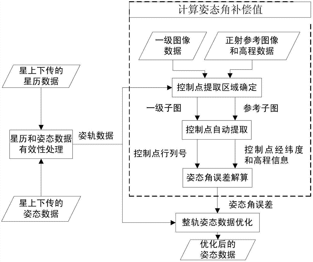
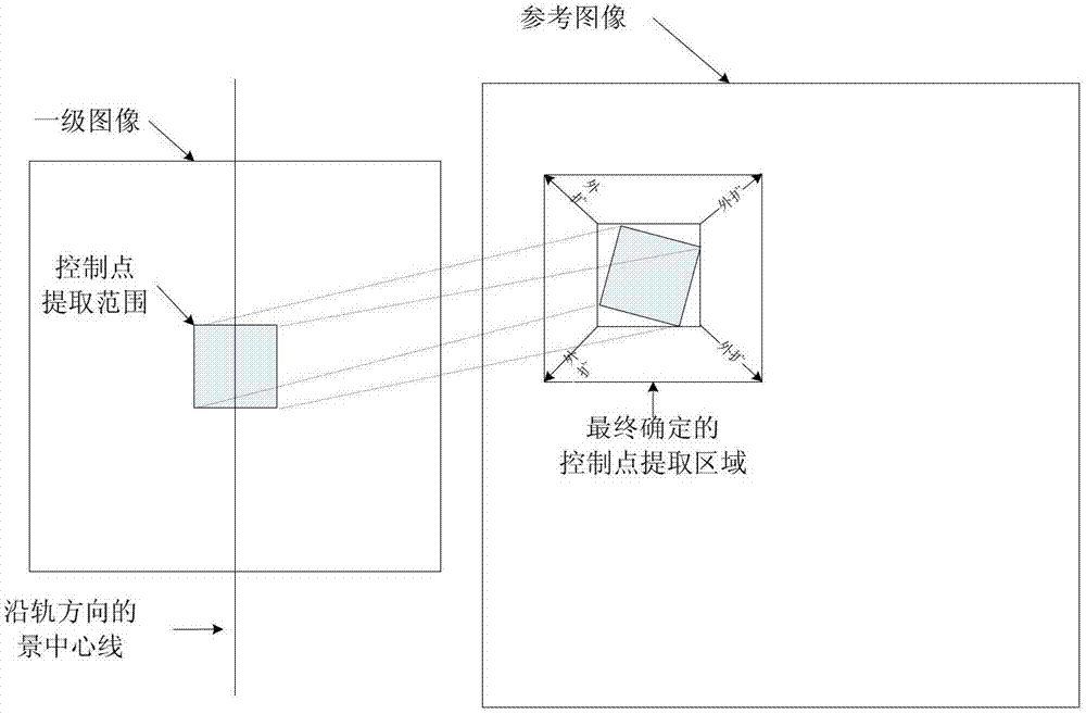
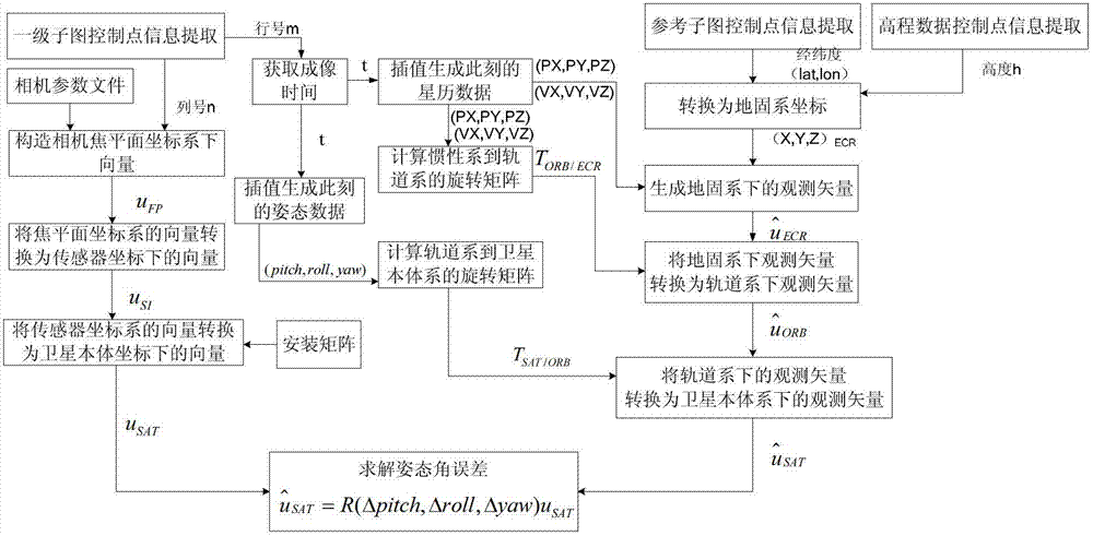
The invention discloses a dynamic compensation method for attitude angle errors of an optical remote sensing satellite based on ground navigation. The dynamic compensation method includes the following steps: (1) performing effectiveness processing on ephemeris data and attitude data downloaded from the satellite, namely eliminating outliers points in the data and re-determining the values of the points; (2) determining an extracting range of control points on a first level image which is an image corrected by radiation, determining an extracting range of control points on a reference image according to the extracting range on the first level image and data after processing in the step (1), intercepting the extracting ranges on the first level image and the reference image respectively, and generating one sub-image of the first level image which is an image subjected to radiometric correction and one sub-image of the reference image which is an orthoimage; (3) performing automatic pairing of the control points by adopting intercepted the sub-images of the first level image and the reference image, and eliminating mispairing points; (4) selecting at least 3 pairs of homonymy control points with different sequence orders and smallest Euclidean distances apart from a scenario center from the sub-images of the first level image and the reference image, and calculating attitude angle errors; and (5) performing compensation on an attitude angle of the optical remote sensing satellite by adopting determined attitude angle errors.
Need to check novelty before this filing date? Find Prior Art

Description

technical field

[0001] The invention belongs to the field of optical remote sensing satellite data processing and is suitable for optical remote sensing cameras. Background technique

[0002] With the improvement of spatial resolution of domestic remote sensing satellites, the geometric positioning accuracy of remote sensing images has become an important inspection index. The positioning accuracy of remote sensing images is mainly affected by the accuracy of orbit data, attitude data, and on-board time synchronization. Using today's orbit determination technology, such as dual-frequency differential GPS orbit determination accuracy can reach the meter level or even higher; the current satellite time synchronization accuracy can reach the microsecond level, such as the satellite time synchronization accuracy is 1ms, and the satellite speed is 7.6 km / s, the satellite position deviation caused by time asynchrony is 0.44m; however, it is difficult to measure the attitude of th...

Examples

Embodiment Construction

[0074] The main factors affecting the positioning accuracy of high-resolution optical remote sensing satellites include attitude data accuracy, orbit data accuracy and on-board time synchronization accuracy. Using today's orbit determination technology, such as dual-frequency differential GPS orbit determination accuracy can reach the meter level or even higher; the current satellite time synchronization accuracy can reach the microsecond level, such as the satellite time synchronization accuracy is 1ms, and the satellite speed is 7.6 km / s, the satellite position deviation caused by time asynchrony is 0.44m; however, it is difficult to measure the attitude of the satellite, and the systematic error, long-period error and random error in the attitude angle have a great influence on the geometric positioning accuracy. Automatic, Real-time and accurate calibration of attitude data errors and compensation can greatly improve the geometric positioning accuracy of images.

[0075] 1...