

Site selection method for measuring and calculating city super high-rise building viewing point based on atmospheric visibility
A technology for atmospheric visibility and high-rise buildings, applied in computing, special data processing applications, instruments, etc., can solve problems such as lack, and achieve the effect of strong variability and easy data
- Summary
- Abstract
- Description
- Claims
- Application Information
AI Technical Summary
Problems solved by technology
Method used
Image

Examples
Embodiment Construction
[0025] The present invention will be further explained below in conjunction with the accompanying drawings and specific embodiments. It should be understood that these embodiments are only used to illustrate the present invention and are not intended to limit the scope of the present invention. After reading the present invention, those skilled in the art all fall into the appended claims of the present application to the amendments of various equivalent forms of the present invention limited range.
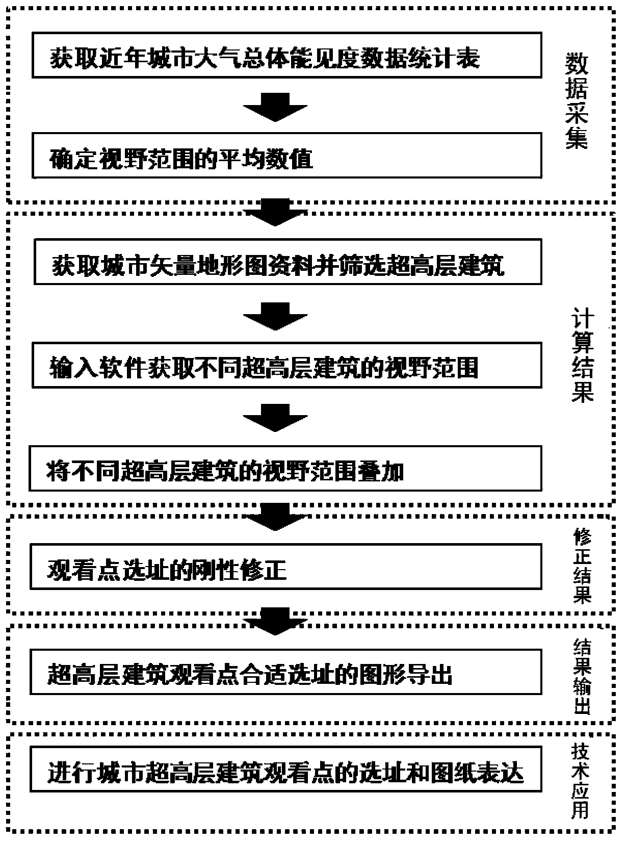
[0026] The present invention’s site selection method for urban super high-rise building viewing points based on atmospheric visibility measurement uses atmospheric visibility data that affects the field of view as a rational selection basis, superimposes the field of view of different super high-rise buildings based on ARCGIS software, and passes actual conditions The rigid revision of the method determines the recommended site selection of viewing points for super high-rise buil...
PUM
 Abstract
Description
Claims
Application Information