A Digital Aerial Photogrammetry Method of Ultra-High Magnification Mapping
An aerial photography and measurement method technology, applied in the field of aerial photogrammetry, can solve problems such as the inability to meet the requirements of large-scale mapping, and achieve the effect of strict technical design route, convenient implementation, and shortening of the mapping cycle.
- Summary
- Abstract
- Description
- Claims
- Application Information
AI Technical Summary
Problems solved by technology
Method used
Image
Examples
Embodiment Construction
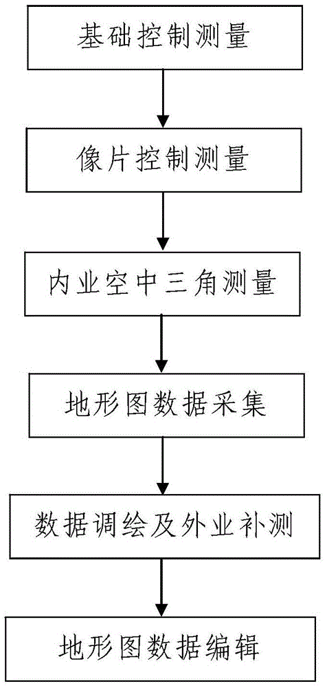
[0036] Such as figure 1 A digital aerial photogrammetry method with ultra-high magnification magnification is shown. The aerial photographic image obtained after aerial photogrammetry of the survey area is an aerial image, and before the digital aerial photogrammetry with ultra-high magnification magnification, Carry out aerial photogrammetry on the survey area and obtain the aerial photographic image of the survey area, the aerial photographic image is a small-scale image; when actually performing digital aerial photogrammetry with ultra-high magnification and magnification, the following steps are included:
[0037] Step 1. Basic control survey: lay out multiple basic control points in the survey area, and establish a survey control network.
[0038] In this embodiment, when the basic control measurement is performed in step 1, the established measurement control network needs to conduct joint measurement with multiple high-level national control points near the measurement ...
PUM
 Abstract
Description
Claims
Application Information
 - R&D
- Intellectual Property
- Life Sciences
- Materials
- Tech Scout
- Unparalleled Data Quality
- Higher Quality Content
- 60% Fewer Hallucinations
Browse by: Latest US Patents, China's latest patents, Technical Efficacy Thesaurus, Application Domain, Technology Topic, Popular Technical Reports.
© 2025 PatSnap. All rights reserved.Legal|Privacy policy|Modern Slavery Act Transparency Statement|Sitemap|About US| Contact US: help@patsnap.com


