

GPS, GLONASS and BDS unified solution positioning method
A positioning method and solution technology, applied in the positioning field of GPS, GLONASS and BDS joint solution, can solve the problem of less combination research and so on
- Summary
- Abstract
- Description
- Claims
- Application Information
AI Technical Summary
Problems solved by technology
Method used
Image

Examples
Embodiment Construction
[0089] In order to describe the technical content of the present invention more clearly, further description will be given below in conjunction with specific embodiments.
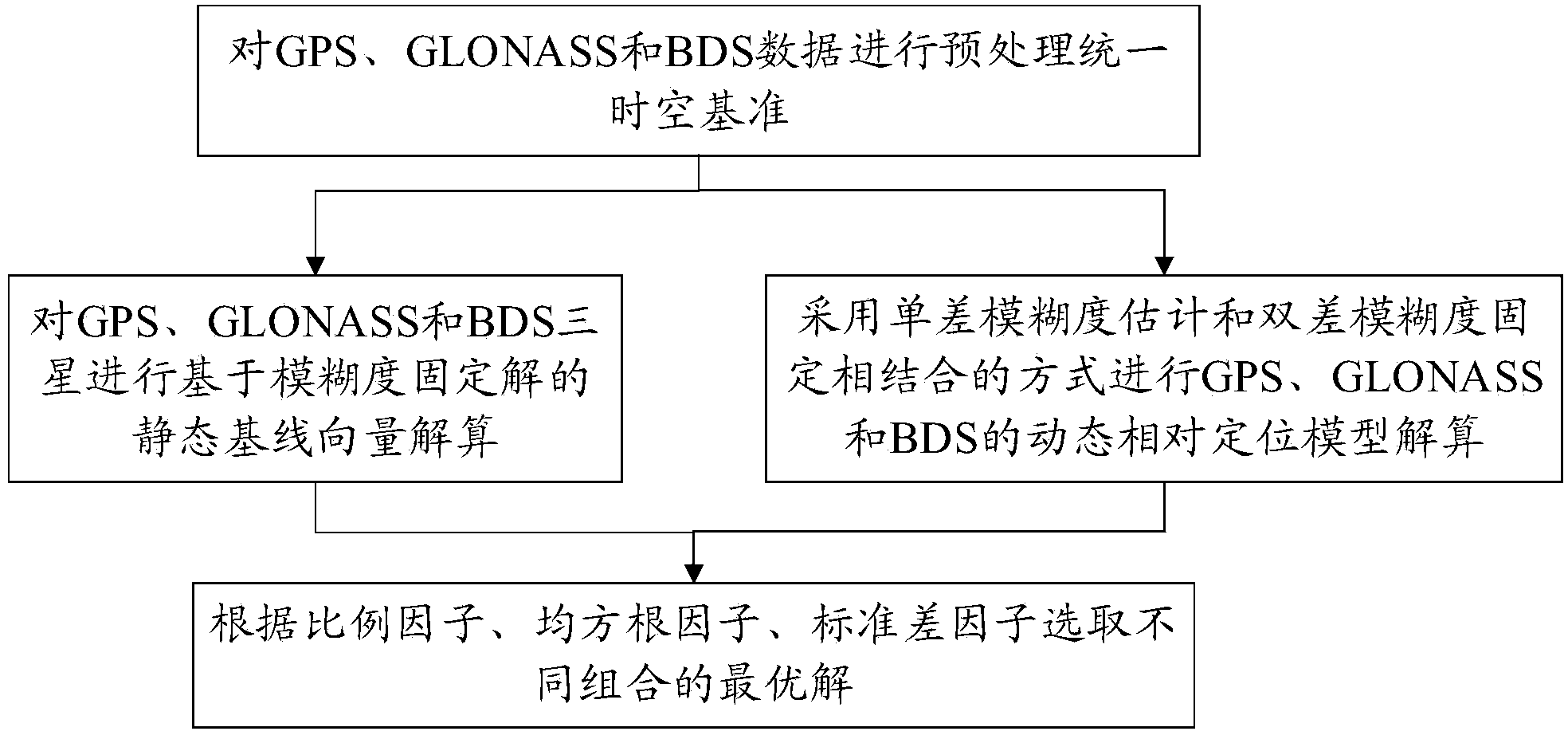
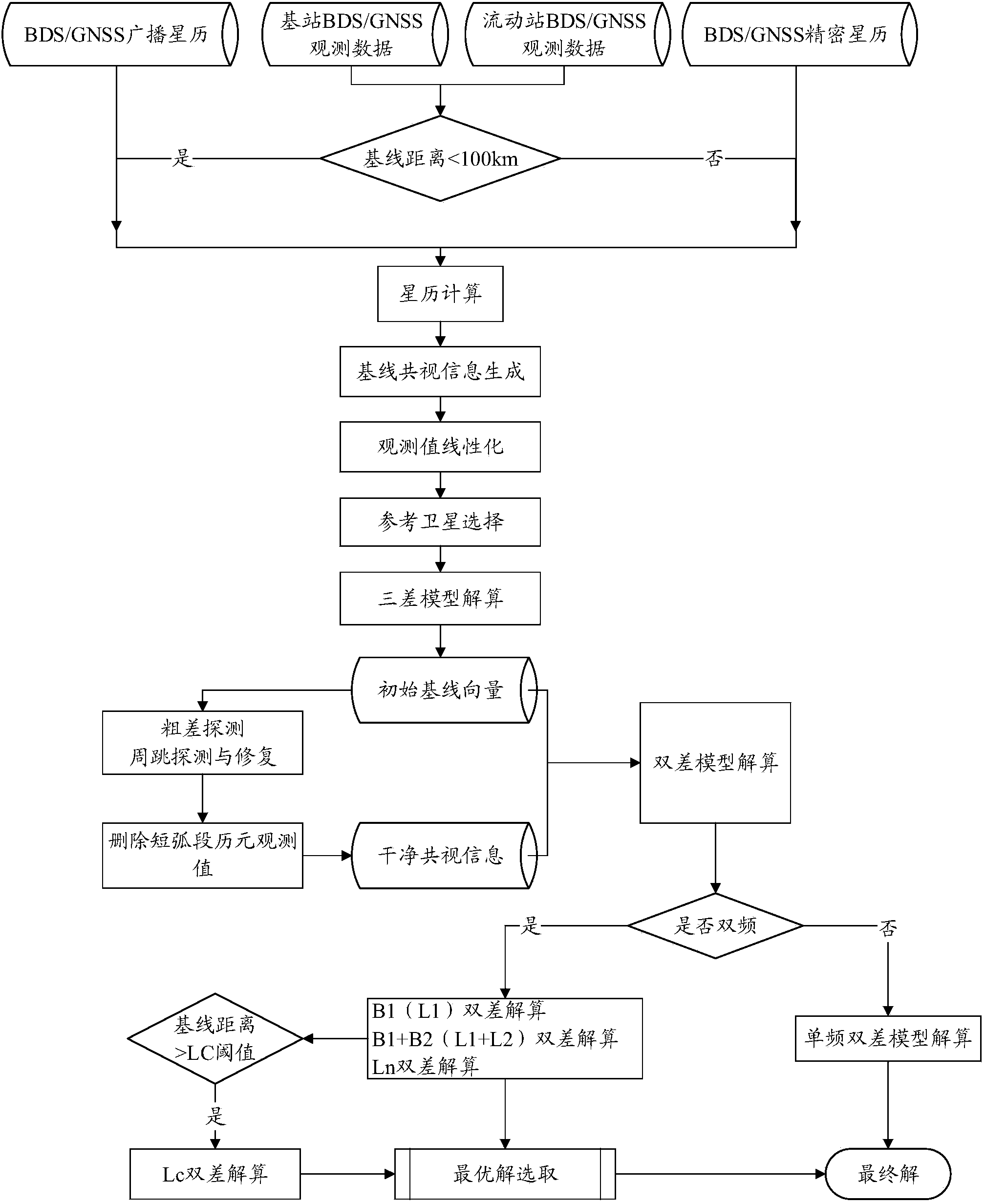
[0090] Static relative positioning method of GPS / GLONASS / BDS Samsung joint solution, such as figure 1 As shown, the specific steps are as follows:
[0091] The first step is to perform GPS / GLONASS / BDS data preprocessing, which may specifically include the following sub-steps:
[0092] Step 1.1: Unify the GNSS space-time reference and unify it as the GPS space-time reference;
[0093] Step 1.2: Observation linearization and error model correction, mainly including station coordinate tidal correction, antenna phase center deviation correction, satellite clock error correction, earth rotation error correction, satellite-ground geometric distance calculation, and tropospheric delay correction; among them, ionospheric delay And the tropospheric delay is the main error source, the correction method is as follow...
PUM
 Abstract
Description
Claims
Application Information