A Navigation Positioning Method Based on Integral Doppler Smoothed Pseudorange
A navigation positioning and smoothing pseudo technology, applied in the field of satellite navigation, can solve the problems of signal loss of lock phase, signal interference, affecting navigation accuracy, etc., to achieve the effect of satisfying fast and high-precision positioning, improving accuracy and smoothness, and meeting the needs of navigation
Active Publication Date: 2016-09-21
NANJING UNIV OF SCI & TECH
View PDF4 Cites 0 Cited by
- Summary
- Abstract
- Description
- Claims
- Application Information
AI Technical Summary
Problems solved by technology
[0002] Global Navigation Satellite Systems (GNSS) can continuously provide high-precision navigation information for multiple users all-weather and all-day around the world. It has achieved great success in military and civilian fields such as aerospace, surveying and mapping, and transportation. It is easily affected by factors such as high maneuverability of the carrier, obstacle occlusion, signal interference, etc., which largely limits its application range. With the continuous improvement of the navigation performance requirements of many military and civilian navigation products, how to achieve high Precision positioning navigation has become a research focus
[0003] When the carrier is in a complex environment such as high dynamic maneuvering, obstacle occlusion, signal interference, multipath, etc., the carrier tracking loop of the GNSS receiver is prone to signal loss of lock and phase loss of cycle, resulting in large changes in the carrier phase observation value. Phase-smoothed pseudoranges will seriously affect navigation accuracy
Method used
View moreImage
Smart ImageViewing Examples
Examples
Embodiment 1
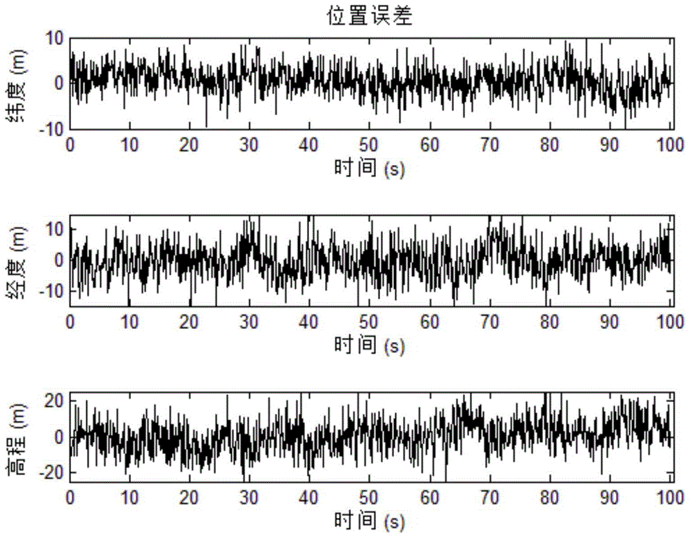
[0059] In order to illustrate the method of the present invention, it is fully demonstrated that the method has better dynamic adaptability and navigation stability, and the static and dynamic test experiments of navigation and positioning based on integral Doppler smoothed pseudorange are completed, as follows:
[0060] (1) Initial conditions and parameter settings of static experiments
Login to View More PUM
 Abstract
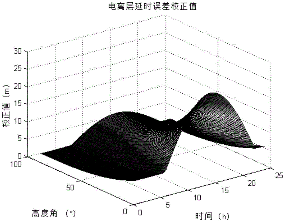
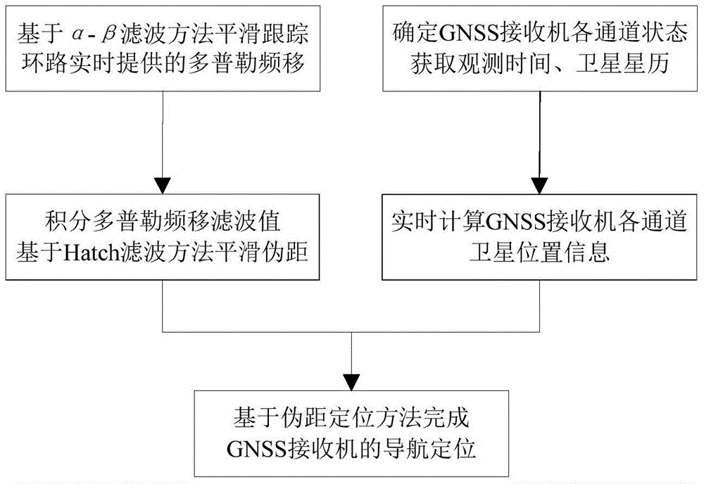
The invention discloses a navigation and positioning method for smoothing pseudorange based on integral Doppler. The method includes the steps that according to Doppler frequency shift observed values provided by all channel tracking loops of a GNSS, Doppler frequency shift is smoothed based on the an alpha-beta filtering method to eliminate delay error of an ionized layer; the pseudorange is smoothed through integral Doppler frequency shift, average processing is performed on pseudorange smoothing initial values, and the pseudorange smoothing precision is improved; the states of all channels of a GNSS receiver are determined, position information of all channel satellites of the GNSS is calculated at the observation moments in real time according to information such as observation time and satellite ephemeris, and navigation and positioning of the GNSS receiver are completed based on the pseudorange positioning method. Through the method, the influence of ionized layer delay and phase jump on pseudorange smoothing is eliminated, the pseudorange smoothing precision and the smoothness are improved, the dynamic adaptability and the navigation stability of the GNSS receiver are improved, and the application prospects are wide.
Description
technical field [0001] The invention relates to the field of satellite navigation, in particular to a navigation positioning method based on integral Doppler smoothing pseudorange. Background technique [0002] Global Navigation Satellite Systems (GNSS) can continuously provide high-precision navigation information for multiple users all-weather and all-day around the world. It has achieved great success in military and civilian fields such as aerospace, surveying and mapping, and transportation. It is easily affected by factors such as high maneuverability of the carrier, obstacle occlusion, signal interference, etc., which largely limits its application range. With the continuous improvement of the navigation performance requirements of many military and civilian navigation products, how to achieve high Precision positioning navigation has become a research focus. [0003] When the carrier is in a complex environment such as high dynamic maneuvering, obstacle occlusion, s...
Claims
Login to View More Application Information
Patent Timeline
 Patent Type & Authority Patents(China)
IPC IPC(8): G01S19/42
CPCG01S19/29G01S19/43
Inventor 陈帅金磊丁翠玲刘亚玲徐芹丽赵鹏常耀伟钟润伍王磊杰余威
Owner NANJING UNIV OF SCI & TECH
Features
- R&D
- Intellectual Property
- Life Sciences
- Materials
- Tech Scout
- Unparalleled Data Quality
- Higher Quality Content
- 60% Fewer Hallucinations
Learn More Browse by: Latest US Patents, China's latest patents, Technical Efficacy Thesaurus, Application Domain, Technology Topic, Popular Technical Reports.
© 2025 PatSnap. All rights reserved.Legal|Privacy policy|Modern Slavery Act Transparency Statement|Sitemap|About US| Contact US: help@patsnap.com


