Urban road marker automatic sorting method based on vehicle-mounted laser scanning point cloud

A vehicle-mounted laser scanning and road marking technology is applied in the field of automatic classification of urban road markings based on vehicle-mounted laser scanning point clouds to achieve the effects of improving quality, improving classification accuracy and ensuring safety.

Active Publication Date: 2014-12-10
XIAMEN UNIV
View PDF5 Cites 67 Cited by
  • Summary
  • Abstract
  • Description
  • Claims
  • Application Information

AI Technical Summary

Problems solved by technology

[0005] However, how to automatically extract terrain and feature features from high-density, high-precision mass vehicle-mounted laser scanning point cloud data is a challenge for the development of point cloud post-processing technology.

Method used


Image

  • Urban road marker automatic sorting method based on vehicle-mounted laser scanning point cloud
  • Urban road marker automatic sorting method based on vehicle-mounted laser scanning point cloud
  • Urban road marker automatic sorting method based on vehicle-mounted laser scanning point cloud

Examples


Embodiment

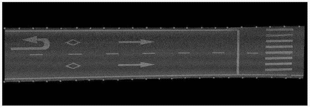
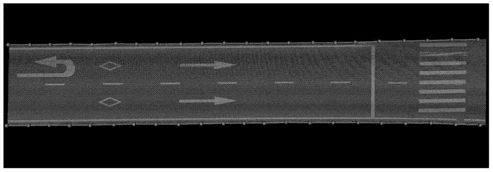
[0056] see figure 1 , the invention discloses a method for automatically classifying urban road markings based on vehicle-mounted laser scanning point clouds, which includes the following steps:

[0057] S1. Road surface point cloud data segmentation

[0058] Based on the driving trajectory data, the original point cloud data is segmented into the road surface to obtain the road surface point cloud data. The driving trajectory data mentioned here is collected through the inertial navigation system integrated on the vehicle laser scanning system. This step is specifically implemented through the following steps:

[0059] S11. Evenly divide the original point cloud data into a group of point cloud blocks along the direction of the driving track. In this embodiment, the segmentation interval of the point cloud blocks is 3m.

[0060] S12, for each point cloud block, cut out a point cloud slice along the direction perpendicular to the driving track, and extract roadside points fr...


PUM


Abstract

The invention discloses an urban road marker automatic sorting method based on vehicle-mounted laser scanning point cloud. The method includes: S1) a step of subjecting original point cloud data to road surface segmentation based on wheel path data to obtain road surface point cloud data; S2) a step of subjecting the obtained road surface point cloud data to binarization processing and extracting road marker points; S3) a step of clustering the road marker points and separating independent road marker targets; S4) a step of sorting large road markers and small road markers according to the dimensions of the obtained road marker targets; S5) a step of subjecting the large road markers to sorting processing based on wheel paths and road edge lines; and S6) a step of subjecting the small road markers to sorting processing based on deep learning and principal component analysis. The method rapidly and accurately extracts and sorts urban road markers, largely reduces the time and labor cost for data processing, and effectively guarantees traffic safety and intelligent drive reliability.

Description

technical field [0001] The invention relates to the fields of intelligent transportation systems and smart city construction, in particular to an automatic classification method for urban road markings based on vehicle-mounted laser scanning point clouds. Background technique [0002] As an important component of the traffic supervision system, urban road markings play an irreplaceable role in many urban infrastructures. On the one hand, it can regulate and control the behavior of vehicles and pedestrians, effectively reducing the occurrence of traffic accidents and providing protection for the safety of vehicles and pedestrians; Important input that helps improve the reliability of intelligent driving. Therefore, traffic control departments and intelligent transportation systems urgently need a fast and real-time system for extracting and classifying road markings in urban areas, so as to ensure traffic safety and reliability of intelligent driving. [0003] At present, t...

Claims


Application Information

Patent Timeline
Patent Type & Authority Applications(China)
IPC IPC(8): G01C11/00G06K9/62
CPCG01C11/00G06F18/24137
Inventor 于永涛李军管海燕王程
Owner XIAMEN UNIV
Why Eureka
Try Eureka