Method for generating traffic safety road characteristic graphs on basis of point-cloud
A traffic safety and feature map technology, applied in the field of traffic surveying and mapping, can solve the problems of difficult data sources, heavy workload, low reliability, etc., and achieve the effect of high map quality and reducing traffic congestion.
- Summary
- Abstract
- Description
- Claims
- Application Information
AI Technical Summary
Problems solved by technology
Method used
Image
Examples
Embodiment
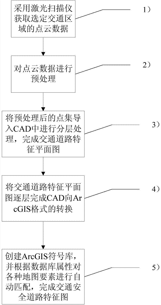
[0047] Such as figure 1 As shown, a point cloud-based traffic safety road feature map mapping method includes the following steps:
[0048] 1) Use a laser scanner to obtain point cloud data of multiple images in the selected traffic area, including position data and color data;
[0049] 2) Preprocessing the point cloud data, including the following steps:
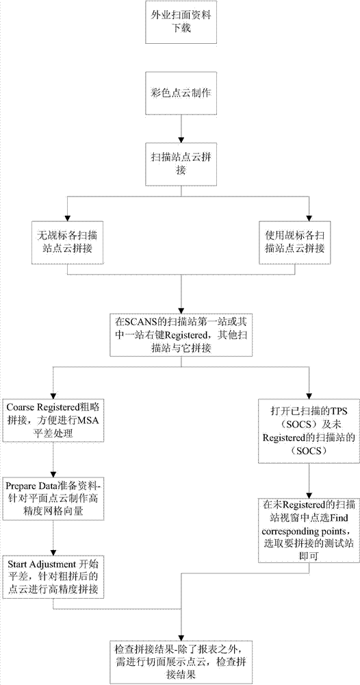
[0050] 21) If figure 2 As shown in , perform color stitching on the acquired point clouds of multiple images;
[0051] 22) Elevation filtering is performed on the spliced point cloud data, and the road surface and the interference points on the ground are separated. The method of separating the road surface and the interference points on the ground is:
[0052] Set a road surface threshold h, according to the point's three-dimensional coordinate information (x, y, z), if its z>h, it indicates that the point is an interference point on the road surface; otherwise, it is a point on the road surface . The contrast eff...
PUM
 Abstract
Description
Claims
Application Information
 - R&D
- Intellectual Property
- Life Sciences
- Materials
- Tech Scout
- Unparalleled Data Quality
- Higher Quality Content
- 60% Fewer Hallucinations
Browse by: Latest US Patents, China's latest patents, Technical Efficacy Thesaurus, Application Domain, Technology Topic, Popular Technical Reports.
© 2025 PatSnap. All rights reserved.Legal|Privacy policy|Modern Slavery Act Transparency Statement|Sitemap|About US| Contact US: help@patsnap.com


