
Precise landing automatic control method for traffic information collecting unmanned aerial vehicle

A technology of traffic information collection and unmanned aerial vehicles, which is applied in the field of transportation, can solve the problems of difficult to achieve precise landing and fixed-point landing of unmanned aerial vehicles, and achieve the effect of fast information interaction, low cost and strong robustness

Inactive Publication Date: 2015-02-18
WUHAN UNIV OF TECH
View PDF6 Cites 34 Cited by
  • Summary
  • Abstract
  • Description
  • Claims
  • Application Information

AI Technical Summary

Problems solved by technology

However, the fixed-point landing of drones has always been a problem, and it is difficult to achieve the purpose of precise landing

Method used


Image

  • Precise landing automatic control method for traffic information collecting unmanned aerial vehicle
  • Precise landing automatic control method for traffic information collecting unmanned aerial vehicle
  • Precise landing automatic control method for traffic information collecting unmanned aerial vehicle

Examples


Embodiment Construction

[0023] The present invention will be further described below in conjunction with the accompanying drawings and specific examples.

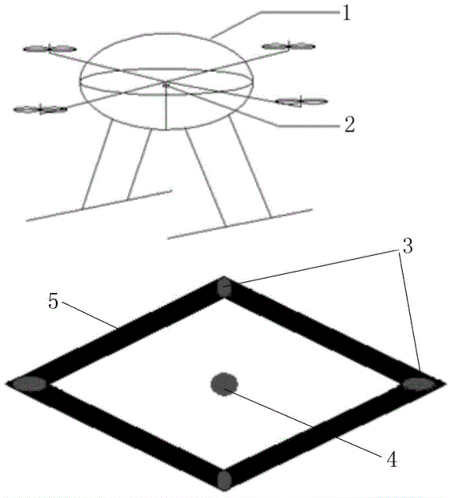
[0024] Such as figure 1 As shown, a kind of precise landing automatic control method for the traffic information collection unmanned aerial vehicle provided by the present invention comprises the following steps:

[0025] S1. First-level positioning: UAV 1 flies to the first-level target position according to GPS, including longitude, latitude and height information. The selection principle of the first-level target position is: the local area wireless network of the ground control station can cover.

[0026] S2. The UAV 1 establishes a local area wireless network connection with the ground control station.

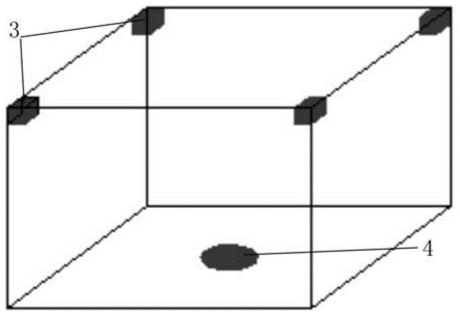
[0027] S3. Secondary positioning: UAV 1 sends a secondary positioning request to the ground control station, and at the same time starts video positioning (acquires the light source image through the camera 2 on the drone 1); the ground cont...


PUM


Abstract

The invention provides a precise landing automatic control method for a traffic information collecting unmanned aerial vehicle. The method comprises the following steps that S1, the unmanned aerial vehicle flies to a primary target position according to a GPS; S2, the unmanned aerial vehicle and a ground control station are in local area wireless network connection; S3, the unmanned aerial vehicle sends a secondary locating request to the ground control station, meanwhile, video locating is started, a first locating light source is started after the ground control station receives the secondary locating request, the unmanned aerial vehicle captures the position of the first locating light source through video, the position information of the first locating light source is obtained through an image processing method, and the unmanned aerial vehicle flies to a secondary target position; S4, the unmanned aerial vehicle sends a third-stage locating request to the ground control station, a second locating light source is started after the ground control station receives the three-stage locating request, the unmanned aerial vehicle captures the position of the second locating light source through video, the position information of the second locating light source is obtained through the image processing method, and the unmanned aerial vehicle lands on the ground station. According to the method, landing of the unmanned aerial vehicle can be precisely and automatically controlled.

Description

technical field [0001] The invention relates to the field of transportation and navigation technology, in particular to an automatic control method for accurate landing of a UAV used for collecting traffic information. Background technique [0002] Unmanned aerial vehicle (UAV) is an aerial flight platform used to observe ground targets or drop small objects, and is widely used in military intelligence and reconnaissance. Because of its characteristics of flexible deployment, simple equipment, and low cost, it is widely used to collect micro-traffic information such as vehicle trajectories, and has broad application prospects. However, the fixed-point landing of drones has always been a problem, and it is difficult to achieve the purpose of precise landing. Contents of the invention [0003] The technical problem to be solved by the present invention is to provide an automatic control method for accurate landing of UAVs for traffic information collection, which can automa...

Claims


Application Information

Patent Timeline
IPC IPC(8): G08G5/02
CPCG08G5/0069G08G5/025
Inventor 高嵩祁玉茜严利鑫吴超仲
Owner WUHAN UNIV OF TECH
Learn More