High-definition aerial remote sensing data automatic road extraction method

An aerial remote sensing and high-resolution technology, applied in image data processing, image analysis, instruments, etc., to achieve strong robustness, complete theory, and fast calculation

Inactive Publication Date: 2015-04-08
NANJING UNIV
View PDF7 Cites 20 Cited by
  • Summary
  • Abstract
  • Description
  • Claims
  • Application Information

AI Technical Summary

Problems solved by technology

This is not an ideal solution if you consider that you will also detect the edge of the house and so on

Method used


Image

  • High-definition aerial remote sensing data automatic road extraction method
  • High-definition aerial remote sensing data automatic road extraction method
  • High-definition aerial remote sensing data automatic road extraction method

Examples


Embodiment Construction

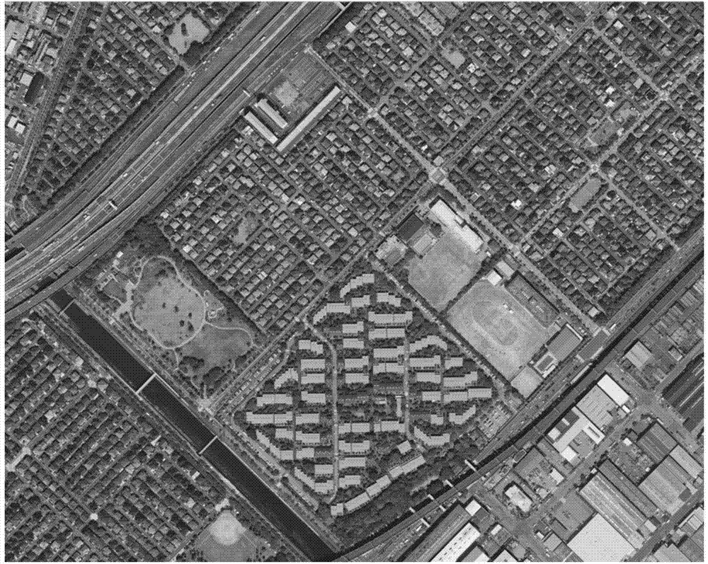
[0035] This example takes a residential area in Tokyo, Japan as an example to extract the road network. The aerial images of this area are shown in figure 1 , the data source is the 0.5m resolution DSM data (digital surface model data) obtained by the interactive photogrammetry method, and the DSM data is obtained from the aerial image.

[0036] In this embodiment, an automatic road extraction method for high-resolution aerial remote sensing data based on cross-verification of road elements includes the following steps:

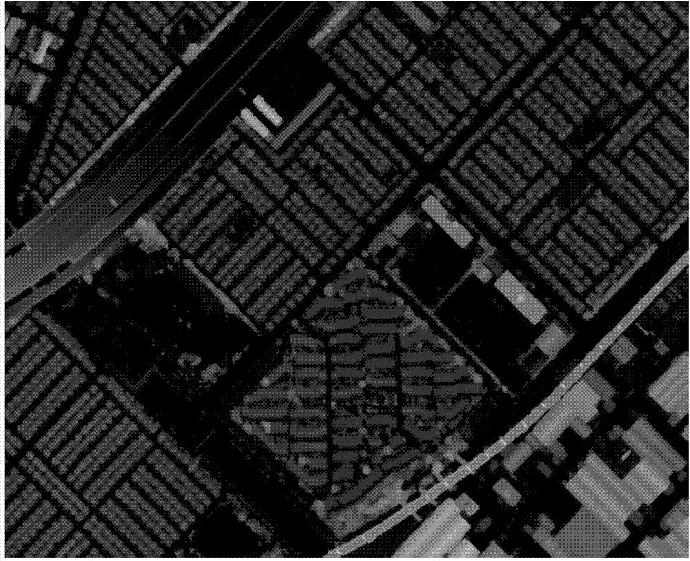
[0037]Step 1. Generating NDSM data - performing morphological filtering on the digital surface model data to obtain NDSM data (normalized digital surface model data).

[0038] In this step, the digital surface model data is filtered with the morphological filter of the disk structure element with a radius of 100 pixels to obtain the NDSM (results in figure 2 ). Morphological operations are usually applied to binary images, where the target only has region ...


PUM


Abstract

The invention relates to a high-definition aerial remote sensing data automatic road extraction method; the method employs an aerial remote sensing image and DSM data of a corresponding researched area for extracting ground and overground areas, constitutes streets and extracts central lines of roads via a series of morphological conversions, including open and close operation, convex set shell, concave set shell, range conversion, watershed segmentation, and the like. The central lines and border lines of roads obtained by the disclosed method are continuous curves. Comparing to the method of the prior art, the algorithms and theories are complete, the road lines are prices, the calculations are quick, and the algorithms are good in adaptability; indicated after experiments that the disclosed method is very strong in robustness with respect to road extraction.

Description

technical field [0001] The invention relates to a road extraction method, in particular to a road extraction method based on cross-validation of road elements, and belongs to the technical field of computer pattern recognition. Background technique [0002] Automatic road extraction and modeling from remote sensing data is a new and open problem. The way of thinking to solve this kind of problem depends heavily on the resolution and source of remote sensing data. On a medium-resolution satellite image, the road is only one pixel wide, and the shape presented approximates a line. Therefore, our principles and methods should focus on the features of line elements, such as edge detection based on certain technologies. On the high-resolution satellite image or DSM, the road is much wider, showing not only line features, but also surface features along the direction. Therefore, our research method should consider both edge features and surface features. [0003] The choice of...

Claims


Application Information

Patent Timeline
Patent Type & Authority Applications(China)
IPC IPC(8): G06T7/00
CPCG06T2207/10032G06T2207/30256
Inventor 李艳吴剑亮刘元亮
Owner NANJING UNIV
Why Eureka
Try Eureka