

Space-borne synthetic aperture radar ground range resolution representation and parameter design method
A technology of synthetic aperture radar and parameter design, which is applied in the direction of radio wave reflection/re-radiation, re-radiation, and measurement devices, which can solve the uneven distribution of ground resolution and the inability to fully represent the ground-range resolution of spaceborne SAR issues such as capacity
- Summary
- Abstract
- Description
- Claims
- Application Information
AI Technical Summary
Problems solved by technology
Method used
Image

Examples
Embodiment 1
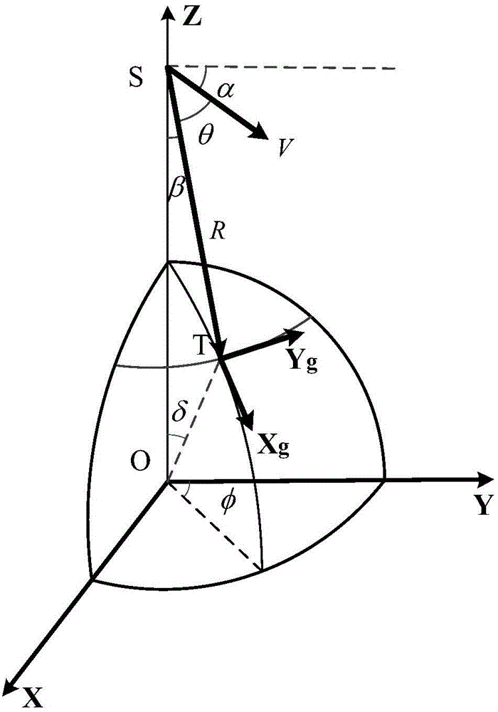
[0092] Embodiment one: the satellite moves on the elliptical orbit, and each parameter of the orbit is specifically as follows:
[0093] Earth radius: 6371.004km
[0094] Orbit semi-major axis: 42164km
[0095] Orbit inclination: 50°
[0096] Orbit eccentricity: 0.1
[0097] Argument of perigee: 90°
[0098] The beam pointing parameters are as follows
[0099] Downward viewing angle: 4.5°
[0100] Azimuth: 15 degrees, 30 degrees, 45 degrees, 60 degrees, 75 degrees, 90 degrees Resolution related parameters are as follows
[0101] Transmission signal bandwidth: 15MHz
[0102] Synthetic Aperture Time: 75s
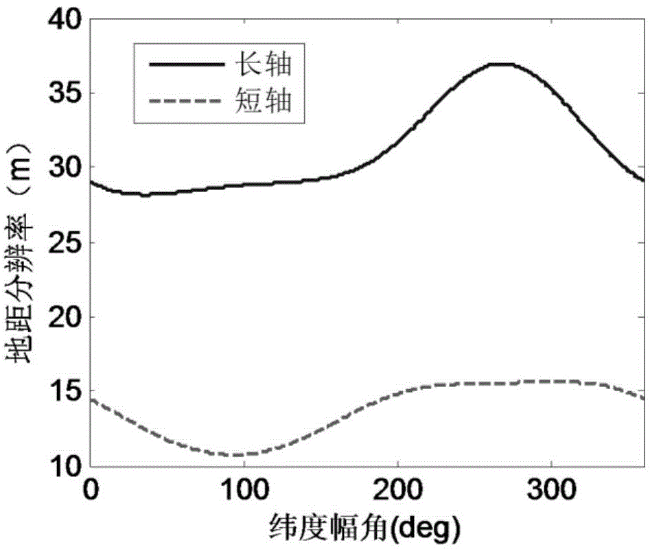
[0103] Echoes from point targets are simulated and imaged using backprojection algorithms. The long-axis and short-axis ground distance resolutions of the imaging results were evaluated, and compared with the calculation results, as shown in Table 1. The calculation results are consistent with the evaluation results, and the error is small.
[0104] Table 1 Compariso...
Embodiment 2
[0106] Embodiment 2, the satellite operates on an elliptical orbit, and each parameter of the orbit is specifically as follows:
[0107] Earth radius: 6371.004km
[0108] Orbit semi-major axis: 10000km
[0109] Orbit inclination: 50°
[0110] Orbit eccentricity: 0.1
[0111] Argument of perigee: 90°
[0112] The beam pointing parameters are as follows
[0113] Downward viewing angle: 20°
[0114] Azimuth: 45°
[0115] The antenna radiation parameters are as follows:
[0116] Antenna size: 10mx10m
[0117] Signal wavelength: 0.1m
[0118] Receiver noise figure: 3dB
[0119] System loss: 5dB
[0120] Antenna Efficiency: 60%
[0121] Equivalent backscatter coefficient: -20dB
[0122] 1. Ground distance resolution
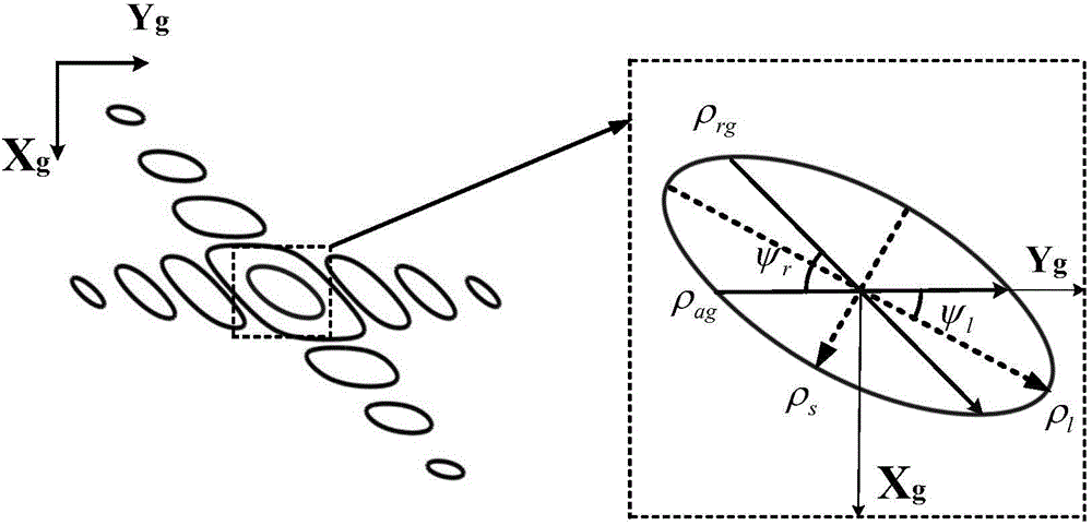
[0123] If the transmitted signal bandwidth is 30MHz and the synthetic aperture time is 30s, the major axis and minor axis of the achievable ellipse resolution area are as follows: image 3 shown. Long axis and Y g The included angle of direction is as ...
PUM
 Abstract
Description
Claims
Application Information