A location-based information interaction system

A technology of information interaction and picture information, applied in the field of location-based information interaction system, can solve the problems of incomplete functions, inability to realize monitoring, inconvenient use, etc., and achieve strong practicability, which is conducive to privacy protection and data storage and use convenient effect

Active Publication Date: 2019-02-22
陈红红
View PDF3 Cites 0 Cited by
  • Summary
  • Abstract
  • Description
  • Claims
  • Application Information

AI Technical Summary

Problems solved by technology

[0005] The purpose of the present invention is to provide a location-based information interaction system and its usage method that is convenient to use, fully functional, and applicable to diversification, so as to solve the problem that the existing location-based information interaction system and its method cannot be realized when the driver leaves the car. Monitoring of the vehicle body and its surrounding conditions, incomplete functions, inconvenient use and other technical problems

Method used


Image

  • A location-based information interaction system
  • A location-based information interaction system
  • A location-based information interaction system

Examples


Embodiment 1

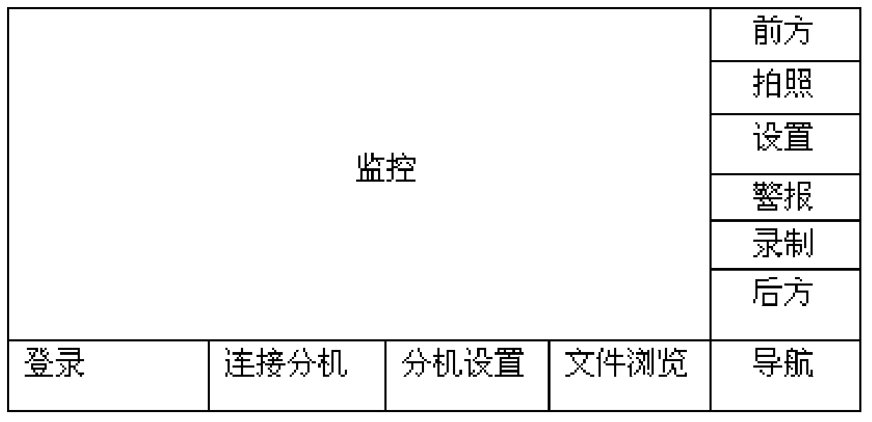
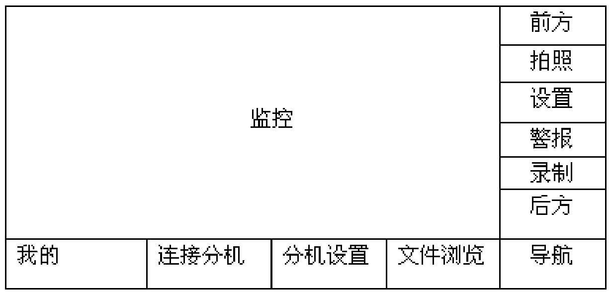
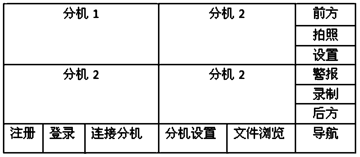
[0053] A location-based information interaction system, including a video acquisition module, a processing module, and a client; the video acquisition module, the processing module, and the client transmit information through wireless signals; the video acquisition module is used for video or picture information collection and its transmission; the processing module is used to receive and process the information sent by the client and the video capture module, send information to the video capture module and the client, and manage the The location information of the client and the video acquisition module; the client is used to send current location data to the processing module, plan a route, and realize searching for a location within a certain range around a specified location by interacting with the processing module information The other clients and the video capture module send video transmission requests to the other clients and the video capture module, process the othe...

Embodiment 2

[0064] like Figure 4 Shown is a flow chart of the method for using the location-based information interaction system provided in Embodiment 1 of the present invention; a method for using the location-based information interaction system is used to understand the real-time road conditions of the planned route, and is characterized in that, The method includes the following steps: 1) using the client to plan a driving route; 2) searching and viewing other video acquisition modules and the client that can perform real-time video or picture information interaction around a specified location in the driving route 3) Send a request for real-time transmission of video or picture information to the video capture module and the client; 4) The video capture module transmits video through WebRTC technology, or transmits video through WebRTC technology after the client responds. The video or picture information described in the above method can also be text information, but it is prefera...

Embodiment 3

[0066] A method for using the location-based information interaction system for monitoring the dynamics of a specified environment, characterized in that after connecting the video acquisition module to the processing module through a wireless signal and logging in, binding the corresponding The above-mentioned client can perform information collection and interaction, and can use the above-mentioned functions to set up according to different needs; the above-mentioned usage method provided by this embodiment is used to monitor the dynamics of the specified environment, and can not only be used to monitor the above-mentioned vehicle-mounted video collection The environment of the vehicle itself can also monitor other environments that need to be monitored, such as the user's own house, warehouse and other places. The operation is simple, intelligent and convenient.


PUM


Abstract

The invention discloses an information interactive system based on a position. The system comprises a video acquisition module, a processing module and a client side. Every two of the video acquisition module, processing module and client side transmit information through a wireless signal manner. The video acquisition module is used for collecting and transmitting video or image information. The processing module is used for receiving and processing information sent by the client side and the video acquisition module, sending information to the video acquisition module and the client side, and managing position information of the client side and the video acquisition module. The information interactive system based on the position adopts a manner of providing the video or image, so that the information is more authentic and accurate, and scientific, reasonable, smooth and convenient planed drive routes can be provided. Road condition videos or images of the planed routes can be transmitted dynamically in real time according to the demand of clients, so that the information interactive system based on the position is convenient to use, and has diversified applications and very strong practicability.

Description

technical field [0001] The invention relates to the technical field of network mobile communication, in particular to a location-based information interaction system. Background technique [0002] "Internet +" is currently a very popular development model. Indeed, with the rapid development and popularization of mobile communications and network technology, various convenient technologies based on the Internet are spewing out, and the exchange of information between people Through many methods, such as WeChat, Weibo and QQ chat software, text, voice or video communication can be carried out between people who know or follow each other. [0003] Regarding real-time understanding of road conditions, Baidu Maps and Altitude Navigation can provide prompt information about road conditions, but drivers cannot see real-time traffic video through their systems. Major intersections in every city are equipped with traffic intersection video monitoring systems, but these road condition...

Claims


Application Information

Patent Timeline
Patent Type & Authority Patents(China)
IPC IPC(8): H04N7/18H04L29/08
Inventor 陈红红
Owner 陈红红
Why Eureka
Try Eureka