

Riverbank ecological buffering band and construction method for same
A buffer zone and ecological technology, applied in the field of environmental governance, can solve problems such as breaking the balance of microbial communities, destroying the structure of microbial communities, and destroying riverbank ecosystems, so as to improve the creation of waterfront landscapes, increase species diversity, and reduce salinity.
- Summary
- Abstract
- Description
- Claims
- Application Information
AI Technical Summary
Problems solved by technology
Method used
Image

Examples
Embodiment 1
[0031] Follow the steps below to construct a riparian ecological buffer zone:
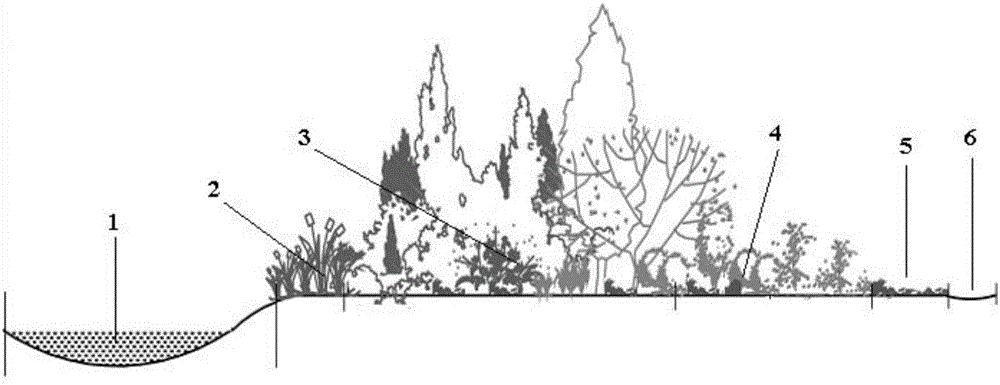
[0032] (1) Delineate the construction area: select the river bank land area within 15 meters from the extension of the highest water level of the river as the construction area of the river bank ecological buffer zone;
[0033] (2) Adjust the surface slope of the construction area to 7-8 degrees without changing the internal environment of the soil layer in the construction area;
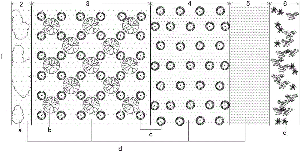
[0034] (3) Determine the community construction scheme: in the construction area, a reed-grass belt with a width of 1.2 meters, a tree-shrub-grass belt with a width of 7 meters, and a shrub-grass belt with a width of 5 meters are arranged successively from near to far from the river. On the edge of the area far away from the river, dig a catchment ditch with a width of 1m at the bottom of the ditch, a width of 2m at the top of the ditch, and a depth of 1m along the direction of the river, and the rest is grassland;
...
Embodiment 2
[0044] Follow the steps below to construct a riparian ecological buffer zone:
[0045] (1) Designate the construction area: select the river bank land area within 20 meters from the extension of the highest water level of the river as the construction area of the river bank ecological buffer zone;
[0046] (2) Adjusting the surface slope of the construction area to 5-6 degrees without changing the internal environment of the soil layer in the construction area;
[0047] (3) Determine the community construction scheme: in the construction area, a reed-grass belt with a width of 2 meters, a tree-shrub-grass belt with a width of 8 meters, and a shrub-grass belt with a width of 5 meters are set in sequence from near to far from the river. On the edge of one side of the river along the direction of the river, a catchment ditch with a width of 0.5m at the bottom of the ditch, a width of 1.5m at the top of the ditch and a depth of 0.5m is set up, and the rest is a grassland area; ...
Embodiment 3
[0056] Follow the steps below to construct a riparian ecological buffer zone:
[0057] (1) Delineate the construction area: select the land area of the river bank within 50 meters from the extension of the highest water level of the river as the construction area of the ecological buffer zone of the river bank;
[0058] (2) Adjusting the surface slope of the construction area to be 9-10 degrees without changing the internal environment of the soil layer in the construction area;
[0059] (3) Determine the community construction scheme: in the construction area, a reed-grass belt with a width of 2.5 meters, a tree-shrub-grass belt with a width of 25 meters, and a shrub-grass belt with a width of 17.5 meters are set in sequence from near to far from the river. On the edge of one side of the river along the direction of the river, a catchment ditch with a width of 1.5m at the bottom, a width of 2.5m at the top and a depth of 1.5m is set up, and the rest is grassland;
[0060...
PUM
 Abstract
Description
Claims
Application Information