

In-situ visualization method for trajectory data based on stream data cube
A trajectory data and cube technology, applied in the field of data visualization, can solve the problems that the data structure cannot be changed, and irregular space query is not supported.
- Summary
- Abstract
- Description
- Claims
- Application Information
AI Technical Summary
Problems solved by technology
Method used
Image

Examples
Embodiment Construction
[0053] The present invention will be further described below in conjunction with the accompanying drawings and specific embodiments.
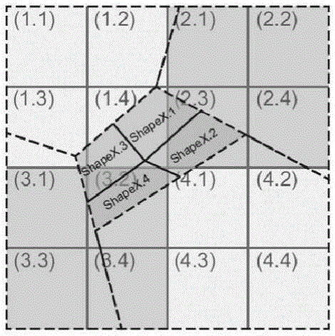
[0054] Such as Figure 11 The illustrated embodiment is an in-situ visualization method for trajectory data based on a flow data cube. The map range involved in this embodiment is 120.4387 east longitude - 120.8953 east longitude, 27.8676 north latitude - 28.131 north latitude.
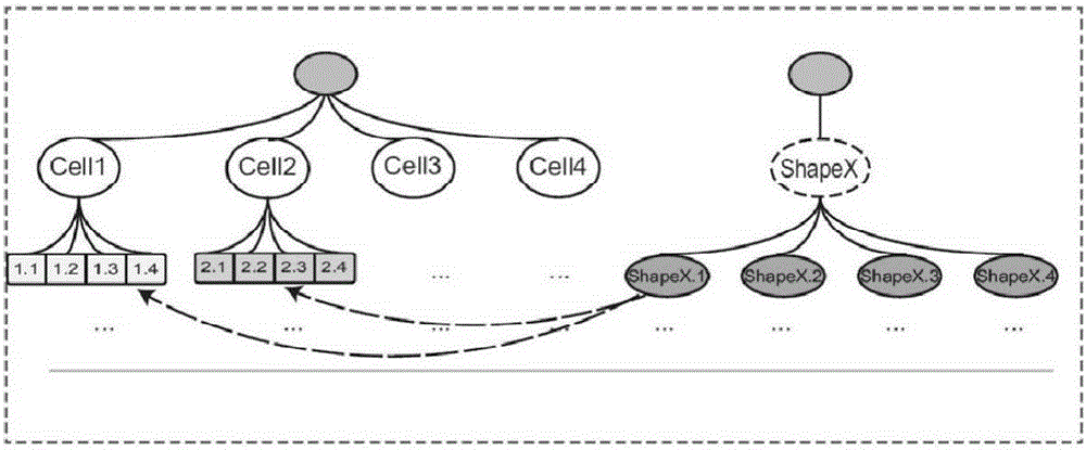
[0055] Step 100, obtain the hybrid map structure
[0056] Step 110, the computer uses the quadtree to establish on the map such as figure 2 The space tree (quadtree) with a depth of 10 shown in the figure has a total of 816*450=367200 nodes on the 10th layer. For the minimum granularity grid (cell), the longitude interval lon=(120.8953-120.4387) of each cell can be obtained ) / 816, latitude interval lat=(28.131-27.8676) / 450, give each cell a unique number as the cell identifier cellID, and use the coordinates of the upper left corner of the cell as the location infor...
PUM
 Abstract
Description
Claims
Application Information